Snow Forecast Noreaster 01222017
Snow Forecast Noreaster 01232017
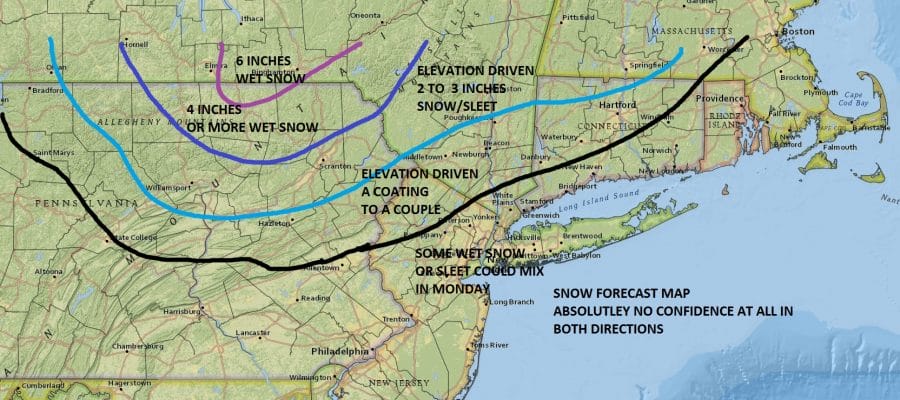
SNOW FORECAST FOR MONDAY 01232017 CONFIDENCE IS NON EXISTENT

After looking at everything this morning I decided to do a snow forecast map and I want to make it clear that I have no confidence in this in either direction. We have an absolutely minimal amount of cold air and while the mid levels of the atmosphere may be cold enough for snow and sleet it is just barely. Fight on the other side of this is the nagging feeling of something really absurd happening where this becomes one of those heavy wet snow storms that you get every 20 or 30 years in mid fall. October 2011 comes to mind with this. Right now my forecast I think is something that i am comfortable with given the constructs of what we are dealing with here. We have a major storm to the south taking a track offshore with strong dynamics and borderline cold air. What happens from here is anyones’s guess. And by the way this could also wind up being more sleet than anything else. National Weather Service snow forecast maps are below where their latest predictions.


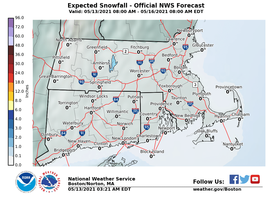
The maps below are the National Weather Service forecast snow maps with the most likely snowfall prediction.


Weather models this morning continue to trend colder overall. I guess the best approach is to just put it out there that something crazy could happen and leave it at that. Right now everything is elevation driven. I think along the coast some sleet and wet snow can mix in for a time. Best chances for anything accumulating would be above the 500-750 ft level and particularly above 1000 feet. Areas north and northwest of Route 84 probably are in the best position for this to happen at this point. We will keep you updated on this later today. In the end we may just have to wait for it to all get undeway and let it play out.