Snow Forecast Monday 01302017
Snow Forecast Monday 01302017
After looking at the afternoon model series it seems to me that models are trending back toward what it showed a few days ago with a clipper system dropping down from the Great Lakes and redeveloping along the New Jersey coast. Based on this trend here is my snow forecast map regarding clipper number 1.
JOE’S SNOW FORECAST FOR MONDAY MORNING
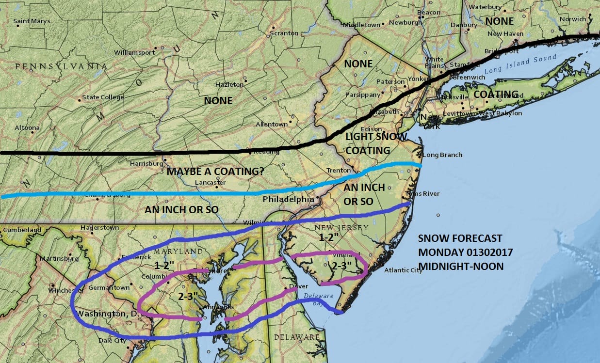
I decided to bring the northern edge of snow to about New York City and Long Island but in reality (at the moment at least) the accumulating snow will be in Central and Southern New Jersey, across Delaware into Maryland. Nothing should fall north of Route 78. Long Island is kind of in a tricky spot with this because the NAM does bulge snow to the South Shore but for now I’m going to go with this and adjust later if necessary. There will be a stripe of 2-3 inches across extreme Southern New Jersey through Central Delaware back to Washington DC/Baltimore with lesser amounts north and northwest. The National Weather Service forecast maps are below and they have also nudged up amounts a bit. Clipper systems are always torture.

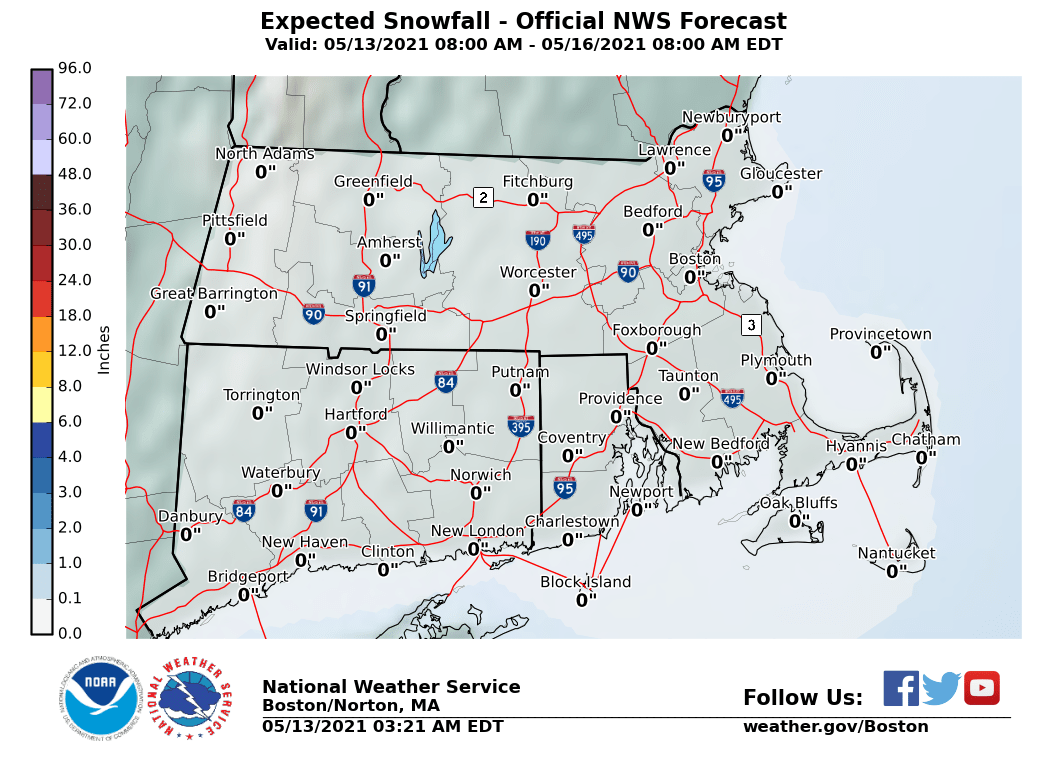
The maps below are the National Weather Service forecast snow maps with the most likely snowfall prediction.