Snow Forecast Early Call JOESTRADAMUS
Snow Forecast Early Call JOESTRADAMUS
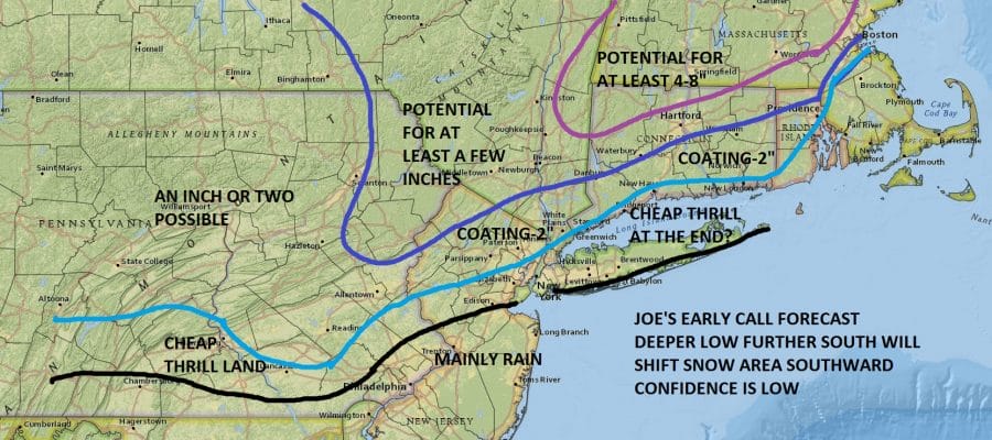
Let me make this clear for those of you who don’t understand what an early call map is. It is a forecast inside 72 hours. My confidence here is low and mainly because I have a suspicion that I may be too conservative especially inland north and east. Even along the coast I’m a little nervous as well. I don’t like trying to outguess a potentially explosive low that deepens by 30 mb in less than 24 hours.
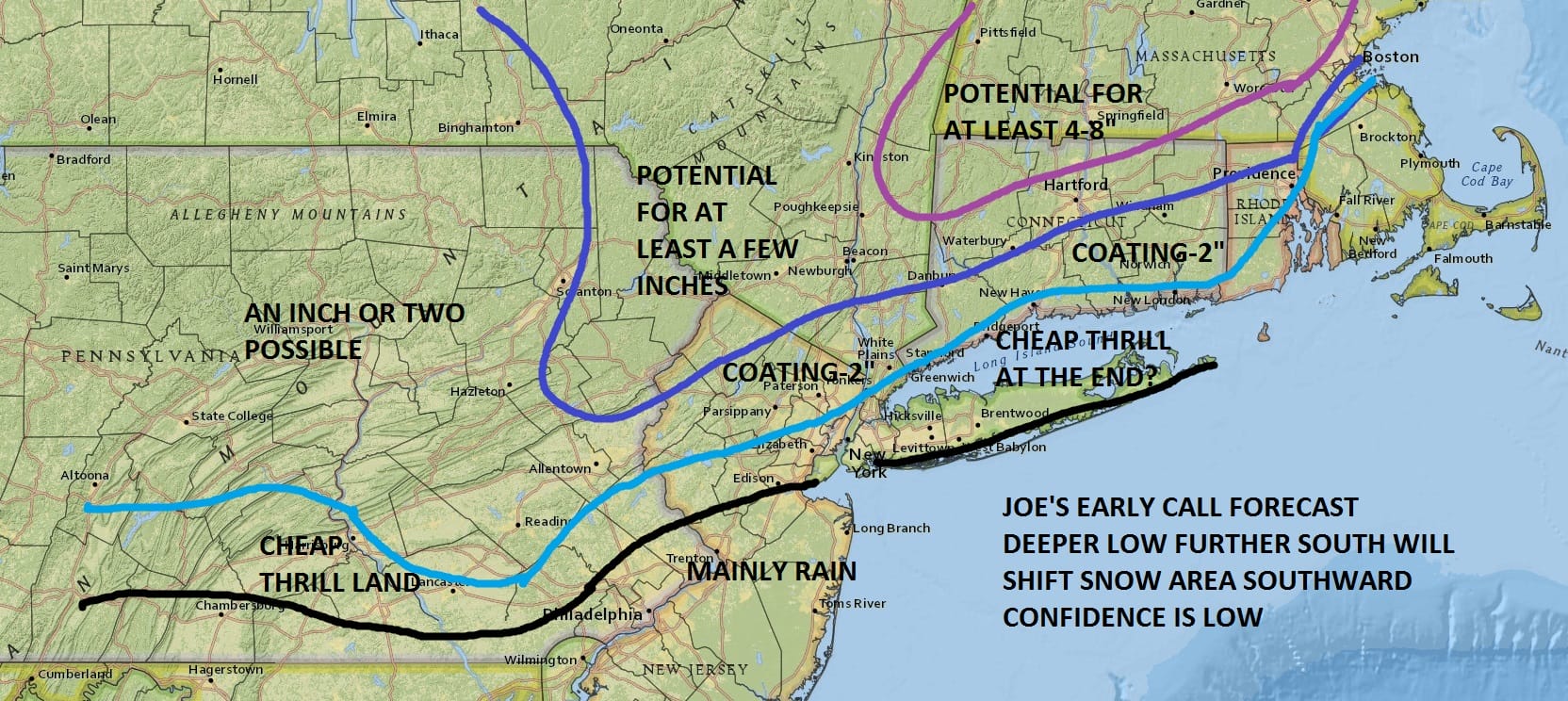
I also am uncomfortable with the fact that the atmosphere aloft is not that warm especially inland. Upper air temperatures are borderline but they have been trending colder on the last three NAM model runs. So for now I am going with this idea for now and be advised that this is going to be subject to change.

The maps below are the National Weather Service forecast snow maps with the most likely snowfall prediction.


National Weather Service snowfall forecast maps are up. Please note that the map put out by the Philadelphia forecast office goes through 7pm Thursday and there could be additional snows in the Northwestern part of the state for a few hours afterwards. The map from the National Weather Service in Upton which covers NYC Northeast NJ, Long Island, Hudson Valley to Putnam County and Southern Connecticut goes through 1am Friday. Additional Northeast snowfall forecast maps are available here and update automatically.