Friday March 20, 2015
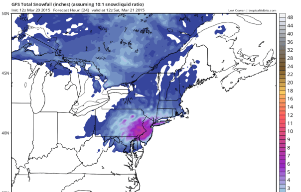
If you have been following this all along we know the issues. But now that the snow is underway I continue to hold to the idea that most areas from Eastern Pennsylvania, New Jersey, New York City Long Island, the lower Hudson Valley and Coastal Connecticut will be in the 2 to 5 inch snow band that I have been emphasizing. The new GFS model supports this if I go with the idea that we should take the amounts regarding snow and cut them by at least 1/3 and possibly 1/2.
The GFS snow map above is a literal transaltion of precip at a 10 to 1 ratio which is what we have here with temperatures close to freezing. So whether the forecast busts too low will depend on what happens this afternoon. We will just watch the radar and obs for clues and update as required.
I just want to say thank you for those of you who have hit the tip jar. It really helps me expand the bandwitdth and provide a better website experience for you. And if you have an I-PHONE you can subscribe to me on the MY WEATHER CONCIERGE app for just 99 cents a month. That dollar goes a long way to keep this all going. It will soon be also available for android users.Thank you very much for your support this winter as we carry it into the new spring months.