Snow Cold Long Range?

Snow Cold Long Range?
Weather Models Grow More Bullish On Colder Pattern
The question mark (?) here is important. There is always that sort of nagging feeling that models will change their outlook along the way. What has been rather remarkable here is that for the last 4 plus days weather models have been signalling a change to a colder pattern beginning in about 8 days. They have not waivered at all and it seems like we are going to see a switch to a colder (and POSSIBLY) a more stormy pattern for the very end of January and the start of February. What I am not sure of at this point is whether this is something that lasts a short time (a week or so) or is this something that will carry us through much of February and into March. NO ONE KNOWS THE ANSWER TO THAT QUESTION AT THIS POINT. I can say the signs seem to suggest this will hang a round for awhile. However the winter so far has been marked by volatility so if it winds up being a short flip, don’t be shocked.
GFS WEATHER MODEL NEXT SATURDAY JANUARY 21, 2017
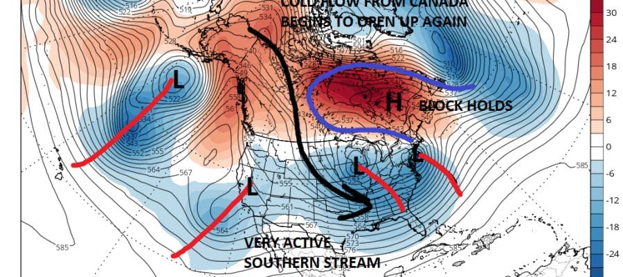
I’m bypassing the work week and jumping right to next Saturday because here is where the seeds of the pattern change really begin to produce fruit. There are two important developments. The first is an upper low near Nova Scotia and the second is a big blocking high in Southeast Canada over Hudson Bay. This I believe will allow cold air to drain southward from New England and Eastern Canada next weekend. The North Atlantic Oscillation index is going negative this week. While other indicators are not in a good position this week, the NAO going negative (more blocking) would suggest that any warm days should be limited. This is not to say temperatures won’t be above normal this week because they will. But the developing block tempers this to some degree by next weekend.
GFS MODEL SUNDAY THROUGH TUESDAY JANUARY 22-24 2017 CLICK TO ANIMATE
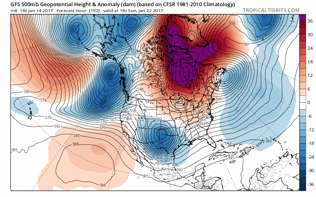
Click on the map to animate it. You can see what the blocking high does. It forces the jet stream well south of normal in the United States with several short wave troughs (areas of energy) to move along in that southern jet. This suggests a stormier view going forward. The cold air needs separate reparing and at this point it would be limited to low levels and how much will be able to drain southward.
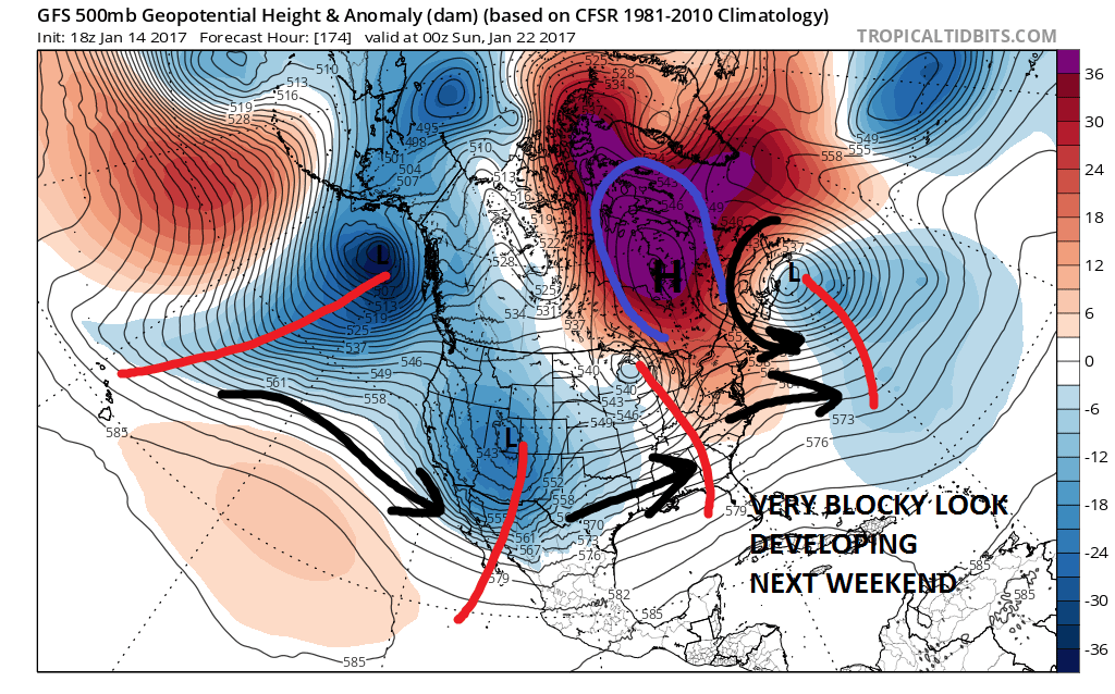
GFS WEATHER MODEL FRIDAY JANUARY 27, 2017

By the time we get to Friday 1/27/17 you can see the progress. The cold air pipeline from Canada reopens. At the same time the block continues to displace the southern jet stream which becomes increasingly more active over time. It would certainly suggest that colder air returns with the possibility of one or two storm threats. However I want to be cautious here at this point since in a weather puzzle where pieces are constantly change in size and intensitiy as well as position, we need all these things to come together. I think the cold part of the equation is going to be a bit easier than the stormy part because of the variable nature of the atmosphere. However the long range at the very least suggests next week’s thaw pattern won’t last too long as the atmosphere continues to realign. Perhaps this will all lead to a cold and active second half of the winter season.
MANY THANKS TO TROPICAL TIDBITS FOR THE WONDERFUL USE OF THE MAPS
SNOW REMOVAL COMPANIES FOR YOUR WINTER NEEDS
LONG ISLAND ROCKLAND COUNTY Connecticut

![]()

ROCKLAND COUNTY TRI STATE SNOW REMOVAL JOHNSTOWN PA


FiOS1 News Weather Forecast For Long Island
FiOS1 News Weather Forecast For New Jersey
FiOS1 News Weather Forecast For Hudson Valley
NATIONAL WEATHER SERVICE SNOW FORECASTS
LATEST JOESTRADAMUS ON THE LONG RANGE
Weather App

Don’t be without Meteorologist Joe Cioffi’s weather app. It is really a meteorologist app because you get my forecasts and my analysis and not some automated computer generated forecast based on the GFS model. This is why your app forecast changes every 6 hours. It is model driven with no human input at all. It gives you an icon, a temperature and no insight whatsoever.
It is a complete weather app to suit your forecast needs. All the weather information you need is right on your phone. Android or I-phone, use it to keep track of all the latest weather information and forecasts. This weather app is also free of advertising so you don’t have to worry about security issues with your device. An accurate forecast and no worries that your device is being compromised.
Use it in conjunction with my website and my facebook and twitter and you have complete weather coverage of all the latest weather and the long range outlook. The website has been redone and upgraded. Its easy to use and everything is archived so you can see how well Joe does or doesn’t do when it comes to forecasts and outlooks.
Just click on the google play button or the apple store button on the sidebar for my app which is on My Weather Concierge. Download the app for free. Subscribe to my forecasts on an ad free environment for just 99 cents a month.
Get my forecasts in the palm of your hand for less than the cost of a cup of Joe!
![]()
