
Snow is approaching from the west thanks to an upper air disturbance and cold front that are swinging toward the coast. This is going to be nothing more than a cheap thrill for some. Some areas could get into a solid burst of snow while others may see little or nothing. It all depends on how the radar lines up late this afternoon and evening. Its no big deal but for snow lovers it is something however small
Snow Accumulation Forecast
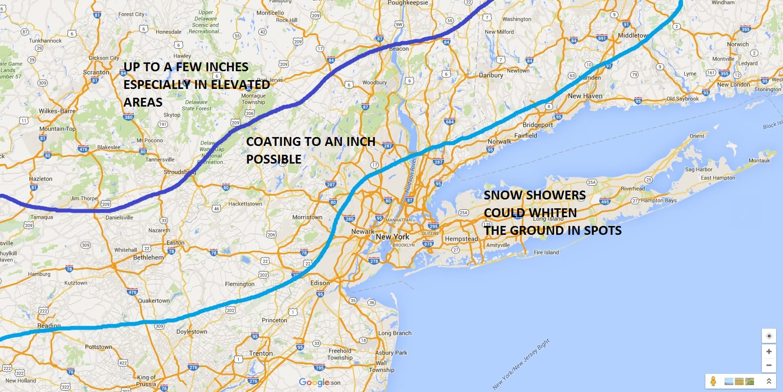
There is no change being made to my original forecast from yesterday. This should all be done this evening in Western areas of New Jersey and Eastern Pennsylvania and by midnight over Eastern Long Island.
The satellite loop shows a well defined twist in the upper air disturbance but when you look at the radar loop below it doesn’t translate into a large area of snow. You can see the bands that form and this is why some areas might see a quick heavy burst and other areas will see little.


Once this goes by the next 2 days will be cold but dry. Friday we will see sunshine giving way to arriving clouds as a noreaster looms for the weekend. Models having been trending further south and a little colder during the overnight runs and while this might not mean any difference for coastal areas it might might a difference for areas south of I-90 and North of Route 84, especially when the coastal takes over and intensifies. It might draw some cold air southward into those areas. I’m going to wait until the day run models are done to see what the new look is. The secondary low seems to want to form much further south so if it takes over fast enough it opens the door for cold air to drain southward on the backside. Again at this point I don’t think it makes much of a difference for the coastal areas, however I always have an open mind.
Last night’s GFS model analysis
NATIONAL WEATHER SERVICE SNOW FORECASTS
LATEST JOESTRADAMUS ON THE LONG RANGE
Weather App

Winter is here! Don’t be without Meteorologist Joe Cioffi’s weather app. It is a complete weather app to suit your forecast needs. All the weather information you need is right on your phone. Android or I-phone, use it to keep track of all the latest weather information and forecasts. This weather app is also free of advertising so you don’t have to worry about security issues with your device. An accurate forecast and no worries that your device is being compromised.
Use it in conjunction with my website and my facebook and twitterand you have complete weather coverage of all the latest weather and the long range outlook. The website has been redone and upgraded. Its easy to use and everything is archived so you can see how well Joe does or doesn’t do when it comes to forecasts and outlooks.
Just click on the google play button or the apple store button on the sidebar for my app which is onMy Weather Concierge. Download the app for free. Subscribe to my forecasts on an ad free environment for just 99 cents a month.
Get my forecasts in the palm of your hand for less than the cost of a cup of Joe!
![]()


