Snow 1-3 Inches Evening Rush Hour Weekend Outlook
SHOP THE JOESTRADAMUS STORE
Snow 1-3 Inches Evening Rush Hour Weekend Outlook
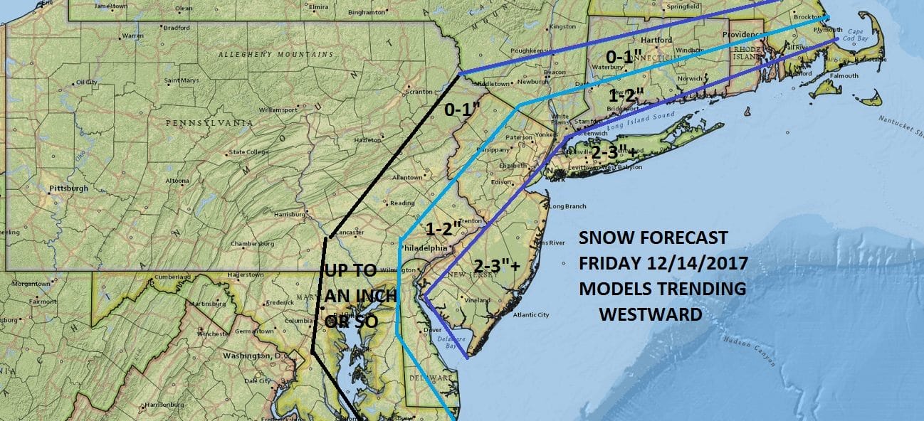
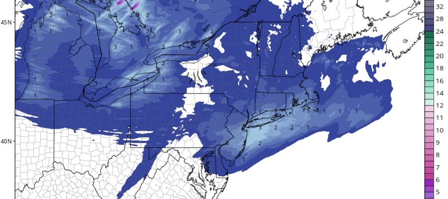
My forecast map for snow is above and i’m sticking with what I had last night which is for basically a 2 to 3 inch snow fall for Central & South Jersey mainly south and east of the NJ Turnpike and from NYC east to Long Island with lesser amounts north and northwest of there. This morning we don’t see anything other than clouds and it certainly is cold outside with temperatures that hit their bottom in the single digits and teens in most places.
SATELLITE LOOP

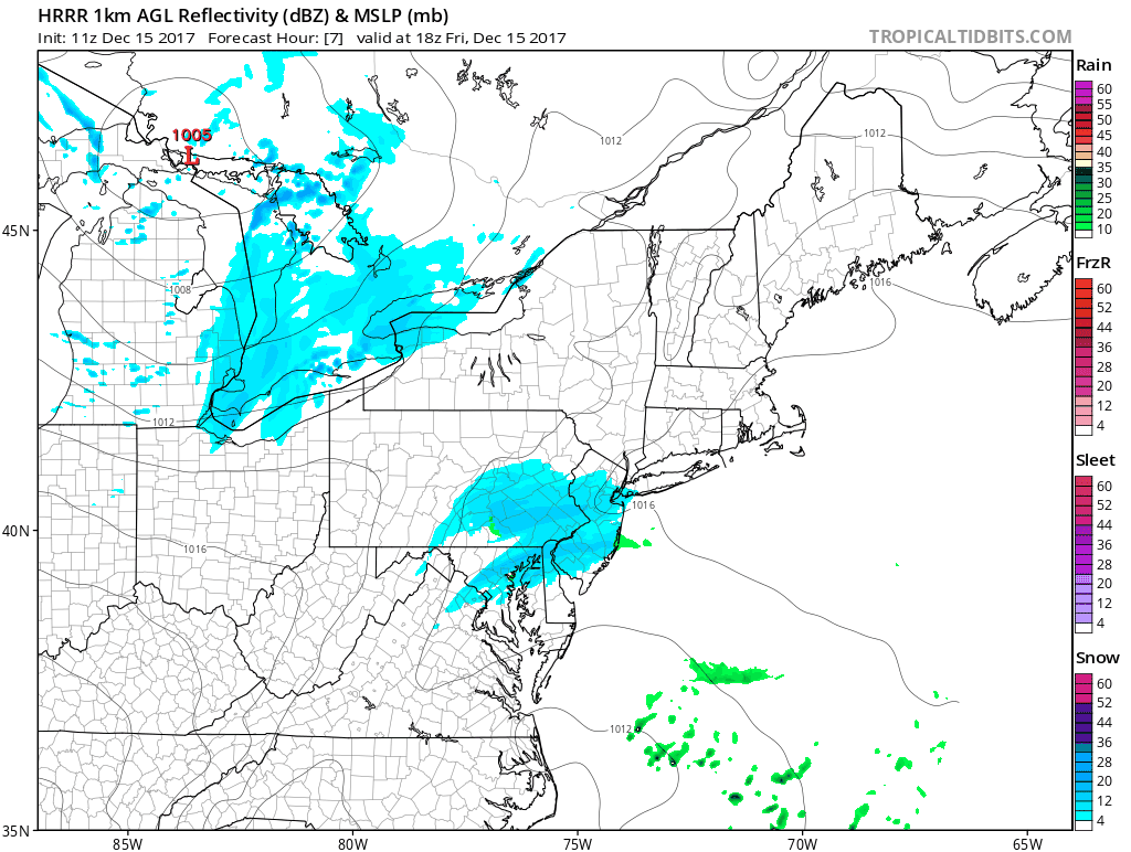
We are beginning to see the weather system causing all this swinging around the Great Lakes as an upper trough triggers a low to develop to the Southeast. There is a weak subtropical jet shooting clouds off the Middle Atlantic coast but this moisture doesn’t get directly involved. Our atmosphere is fairly moist and clouds are already here. Snow show break out this afternoon between 1pm & 3pm in most areas as this all forms right on top of us.
REGIONAL RADAR

Most of the models overnight were in fair agreement with the general idea of a 1 to 3 inch snowfall for most areas from NYC & Long Island south with less to the northwest. We didn’t see any significant shift in models overnight from the prior view so the northwest shift has stopped at least for now.
SNOW HRRR MODEL 1PM-7PM CLICK TO ANIMATE
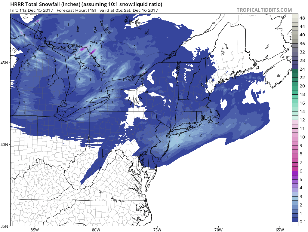
Weather models generate about two tenths of an inch of liquid on average and with temperatures in the 20s we are looking at a bit of fluff factor getting involved. The HRRR model snow map pretty well lays out the snowfall close to what the other models do. It is perhaps a bit further north with it’s maximum snow favoring Long Island more than New Jersey. Im not too uncomfortable with this idea.
HRRR SNOW FORECAST
All of this is done this evening from west to east and skies clear tonight with lows down in the teens to low 20s. The weekend is looking pretty good overall with clouds and some sunshine for both Saturday and Sunday. Highs Saturday will be in the mid to upper 30s in most places and Sunday we should see upper 30s to a few lower 40s which is pretty much where we should be for this time of year. Once this system passes it looks fairly quiet for next week as the upper air pattern does a little bit of reloading and rearranging. We don’t see any big storms on the horizon and temperatures will nudge up a bit Monday and Tuesday and then chill down a bit Wednesday and Thursday. There is the risk for a passing shower late Tuesday and again late Thursday as weak weather systems play through. Long range the pattern could get active again going into Christmas Eve and Christmas Day and we will examine this later today.
 GET JOE A CIGAR IF YOU LIKE

FiOS1 News Weather Forecast For Long Island
FiOS1 News Weather Forecast For New Jersey
FiOS1 News Weather Forecast For Hudson Valley


