Showers Thunderstorm Risk On And Off Through Wednesday Late Week Storm Offshore

Weather in 5/Joe & Joe Weather Show Latest Podcast
Showers Thunderstorm Risk On And Off Through Wednesday Late Week Storm Offshore
The first work week of the month of May is going to be a busy one with some weather swings. The beginning of the week will be the warmer more humid and showery part. The end of the week will be cooler with a coastal storm offshore of all things. We also have a touch of severe weather risk for Wednesday as a cold front passes. Today we see lots of clouds on the satellite view of the Eastern US and this will be the dominant feature today though some breaks of sun could be there this morning.
SATELLITE

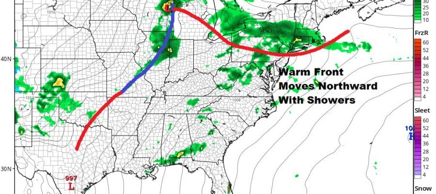
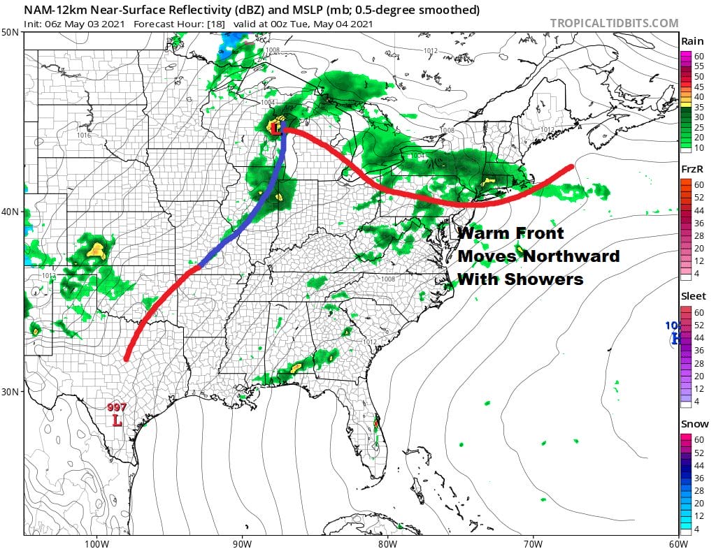
Showers and some scattered thunderstorms will be loading up on the radars and we will see those showers move through this afternoon and tonight. It won’t be continuous but there will be rounds of downpours to contend with. Temperatures today will be in the 70s for the most part except for 60s along south and east facing shorelines.
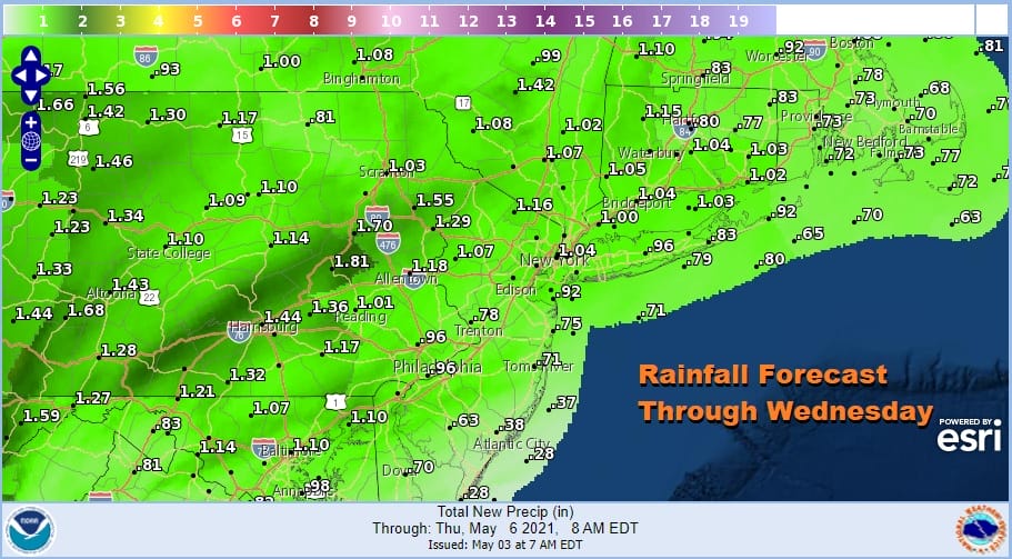
Trying to gauge rainfall amounts is always tough in a situation of showery rains due to the variability and the convective nature of it but between this system and the cold front for Wednesday, rainfall amounts should total between 3/4 inch and 1.25 inches. More of this comes from today and tonight and less from the cold front Wednesday.
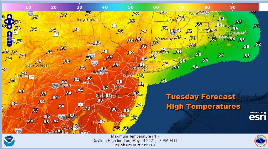
Once the warm front goes by showers end by Tuesday morning and it leaves us in a warm and rather humid air mass. Sunshine will return and that could boost temperatures into the 80s from NYC south and west with 70s to the east.
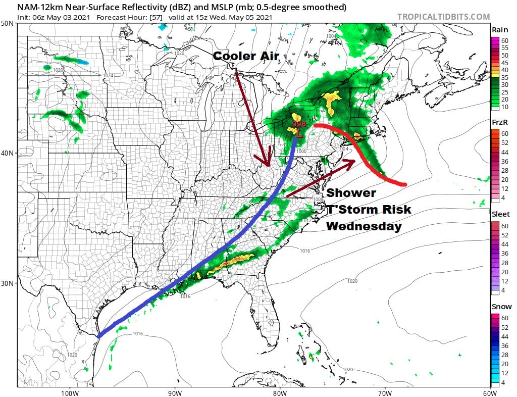
There is the outside chance for a shower or thunderstorm late Tuesday or Tuesday evening but I think there might be a higher chance on Wednesday as a cold front approaches and moves through. The upper feature here is robust so this brings severe weather risk to the table. The Storm Prediction Center has a marginal risk for severe weather indicated in its early outlook.
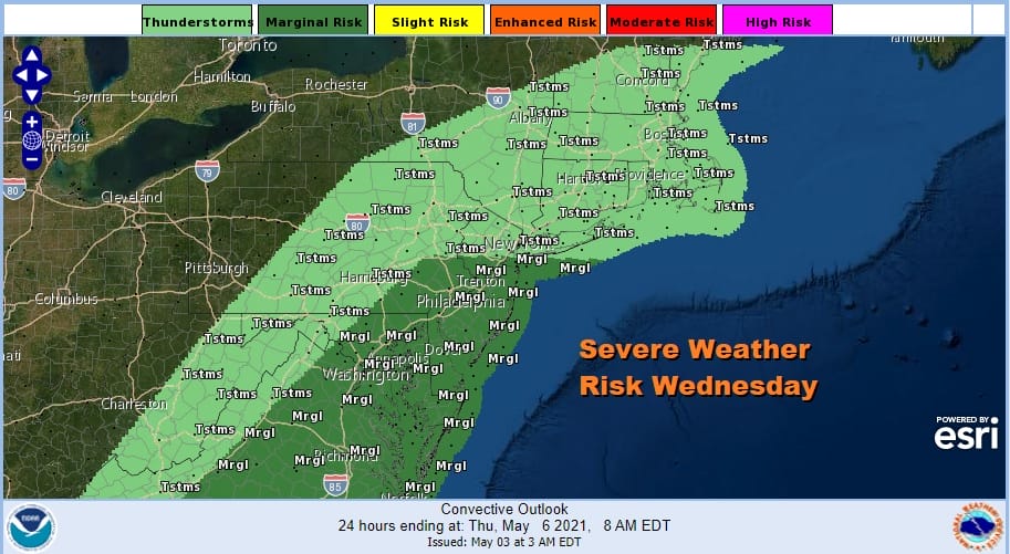
It is a little hard to see how this plays out Wednesday. The question of daytime heating is there along with the position of the warm front. Highs Wednesday will be in the 70s to near 80 before the cold front passes. No model is particularly bullish on the severe weather idea for Wednesday but weather models are not always good with severe weather issues in the longer range in terms of specifics. A better view should emerge Tuesday.
The second half of the week will no doubt be cooler with Thursday highs in the 60s. Models have been making some noise regarding the chance for an intensifying coastal storm for Friday moving up the coast and bringing wind and rain to many locations, in other words a noreaster. We have been rather dubious on the idea given that the GFS model up until last night was the only model showing a dynamic system for the end of the week.
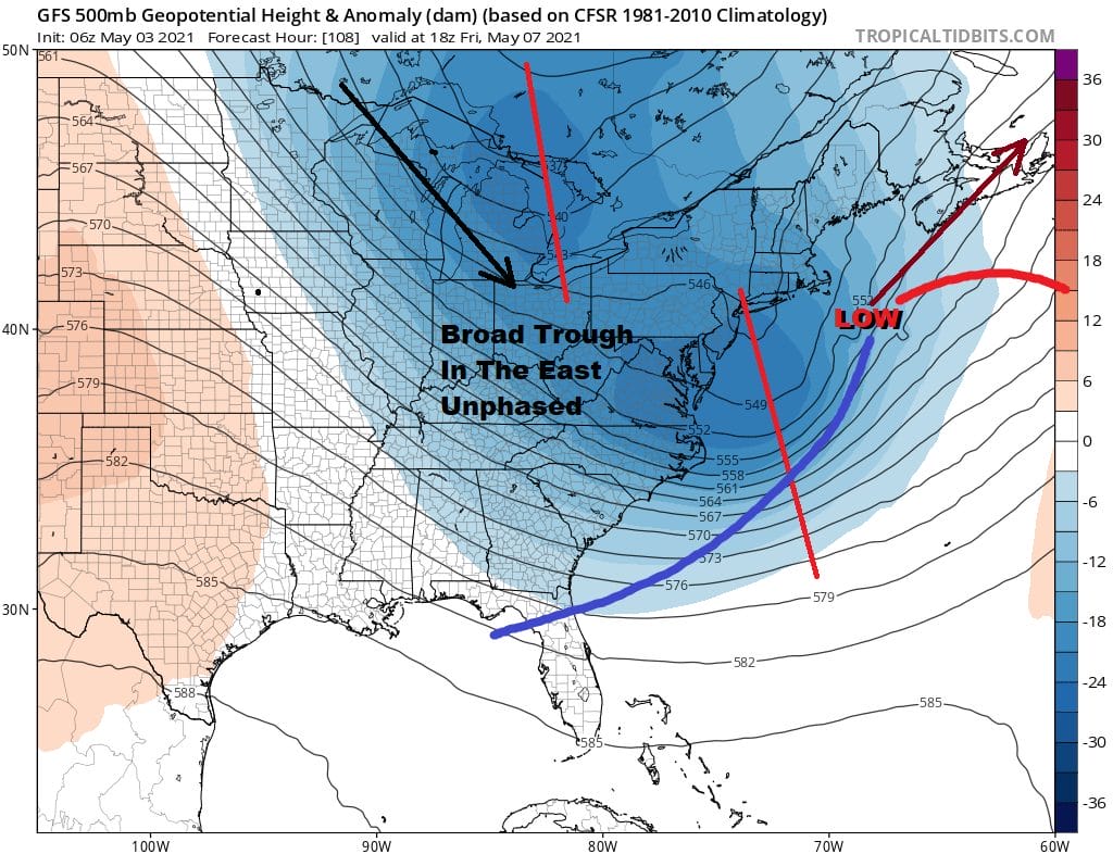
The upper air is dynamic enough but the orientation of the jet stream is too broad and the north and the south are “unphased” or in other words the two streams remain separate until the storm is well offshore. We still should keep an eye on this but for now I think the biggest risk will be some rain coming back to the immediate coast for a few hours on Friday IF the GFS is correct. Regardless of rain look for clouds and only a limited amount of sun with Friday highs in the upper 50s and lower 60s. Where rain is an issue along the coast it could be even cooler. There might be a few showers Friday night as the northern upper trough moves by. The weekend it seems will be a Saturday better than Sunday kind of weekend. Mother’s Day is not going to be a washout but there is the chance for showers later in the day at this early juncture.

BE SURE TO DOWNLOAD THE FREE METEOROLOGIST JOE CIOFFI WEATHER APP &
ANGRY BEN’S FREE WEATHER APP “THE ANGRY WEATHERMAN!
MANY THANKS TO TROPICAL TIDBITS FOR THE USE OF MAPS
Please note that with regards to any severe weather, tropical storms, or hurricanes, should a storm be threatening, please consult your local National Weather Service office or your local government officials about what action you should be taking to protect life and property.


