Severe Weather Weakening
Severe Weather Weakening
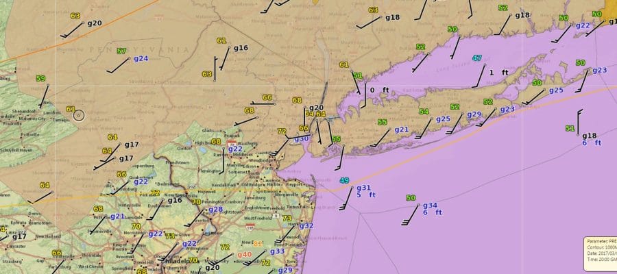
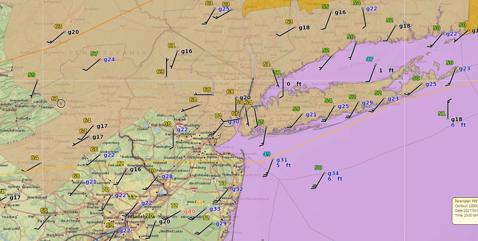
The marine layer is a formidable force and the fact that it never got out of the way until mid afternoon prevented daytime heating from cooking the atmosphere. Severe thunderstorm activity continues to diminsh and it is all over with except for the Southern Counties of New Jersey where some strong cells are still evident on the radars below.
SATELLITE LOOP

REGIONAL RADAR

LOCAL RADAR NEW YORK CITY

LOCAL RADAR PHILADELPHIA


Warnings remain confined to coastal Southern New Jersey and points south. Once we get through the next 2 hours or so weather conditions will improve. There might be one more round of showers later this evening or before midnight but they shouldn’t amount to much. Then we dry out into the weekend. Weather models have completely backed away from even a minor snow threat for Friday so it will be cold and dry into the weekend. Highs Thursday will be in the 40s with some sun and clouds. Friday’s highs will be in the 30s and we will be down in the teens Saturday morning. Saturday’s highs with some sunshine just into the 30s. We should be back to 40 or higher on Sunday. No precipitation is forecast through the weekend.
 GET JOE A CIGAR IF YOU LIKE

SNOW REMOVAL COMPANIES FOR YOUR WINTER NEEDS
LONG ISLAND ROCKLAND COUNTY Connecticut

![]()

ROCKLAND COUNTY TRI STATE SNOW REMOVAL JOHNSTOWN PA


FiOS1 News Weather Forecast For Long Island
FiOS1 News Weather Forecast For New Jersey
FiOS1 News Weather Forecast For Hudson Valley
NATIONAL WEATHER SERVICE SNOW FORECASTS
LATEST JOESTRADAMUS ON THE LONG RANGE
Weather App

Don’t be without Meteorologist Joe Cioffi’s weather app. It is really a meteorologist app because you get my forecasts and my analysis and not some automated computer generated forecast based on the GFS model. This is why your app forecast changes every 6 hours. It is model driven with no human input at all. It gives you an icon, a temperature and no insight whatsoever.
It is a complete weather app to suit your forecast needs. All the weather information you need is right on your phone. Android or I-phone, use it to keep track of all the latest weather information and forecasts. This weather app is also free of advertising so you don’t have to worry about security issues with your device. An accurate forecast and no worries that your device is being compromised.
Use it in conjunction with my website and my facebook and twitter and you have complete weather coverage of all the latest weather and the long range outlook. The website has been redone and upgraded. Its easy to use and everything is archived so you can see how well Joe does or doesn’t do when it comes to forecasts and outlooks.
Just click on the google play button or the apple store button on the sidebar for my app which is on My Weather Concierge. Download the app for free. Subscribe to my forecasts on an ad free environment for just 99 cents a month.
Get my forecasts in the palm of your hand for less than the cost of a cup of Joe!


