Severe Weather Threat Wednesday New Jersey Southward
Severe Weather Threat Wednesday New Jersey Southward

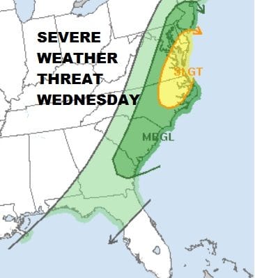
The Storm Prediction Center of the National Weather Service has increased the severe weather threat along the East Coast for Wednesday adding an area of slight risk from Southern New Jersey southward into Northeastern North Carolina. For tonight we have an extensive area of severe weather across the Ohio & Tennessee Valley as well as the Western & Central Gulf Coast. Tornado watches continue over a large area this evening across this area.

We have been dealing with a cold raw flow off the ocean and much of the rain from earlier today has moved to the northeast though there are still showers occurring across Southern New Jersey and areas to the south. Much of tonight we will see patchy light rain or drizzle as a warm front moves northward.


Wednesday warmer air on a strengthening south to southwest wind should take temperatures into the 50s and 60s. This sets the stage for thunderstorms during the afternoon. The upper dynamics are impressive enough that these thunderstorms could hold together as they move east to the coast. The main threat time will be from 1pm to 5pm in most areas. Once the front passes strong northwest winds take over and then it turns colder Wednesday night. Skies will clear out and at least Thursday looks dry and sunny but cold with highs just in the 40s in most places.

Friday brings the first of 3 weather systems that will threaten us with more precipitation. The bulk of Friday’s precipitation will pass to the north of the coast. It will be a cold rain from NYC & Long Island south with perhaps a bit of a mix at the start. Inland north and northeast it will be snow for awhile and a coating to a couple of slushy inches in elevated areas can’t be ruled out. A second storm approaches for Saturday which looks cold enough for mostly snow if it makes it far enough north as models are now suggesting.
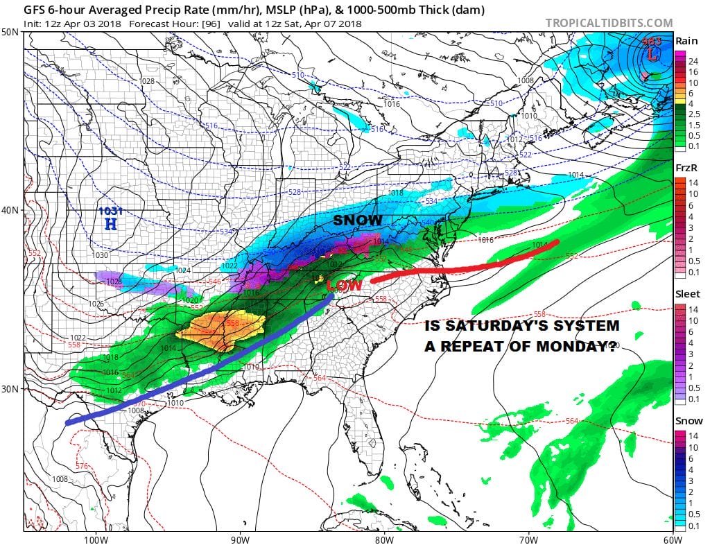
We are still unsure of the details here. Time of day and how far north are key. The most important factor will be intensity of precipitation. If snow is going to accumulate during the day this time of year it needs to snow at at least an inch an hour pace or higher. We aren’t sure of much at this point and we need to determine whether this system will have enough juice to pull that off.
Read more on these two systems and a third that follows in JOESTRADAMUS’S latest long range post.
FiOS1 News Weather Forecast For Long Island
FiOS1 News Weather Forecast For New Jersey
FiOS1 News Weather Forecast For Hudson Valley
NATIONAL WEATHER SERVICE SNOW FORECASTS
LATEST JOESTRADAMUS ON THE LONG RANGE


