COLD FRONT ARRIVES WITH LATE THUNDERSTORMS
CLOUDS INTO THE WEEKEND WITH ONSHORE WINDS
RAIN HANGS CLOSE BY NEXT SEVERAL DAYS
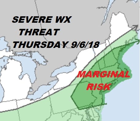
We are finally going to drive a stake in the heart of the current heat wave (there are other vampires out there. Dew points are in the off the wall 70s. We have clouds around this morning but we should also see skies go partly sunny. Temperatures will shoot up into the upper 80s and lower 90s. The cold front has some instability to work with and given the high dew points and some stronger winds aloft it looks we have the seeds for severe weather this evening.

Not much is happenning on the satellite and radar loops this morning but the approaching cold front is pretty obvious. There aren’t any showers anywhere close this morning. Nothing of consequence should happen until late afternoon and evening.
EASTERN SATELLITE

REGIONAL RADAR

The front is going to stall to our south eventually but it will still be close enough Friday for clouds and the chance for passing showers. Temperatures will be much cooler Friday with highs just in the 70s to near 80. A freshening wind from the northeast will take hold. This is going to keep things cool this weekend as high pressure builds down from Eastern Canada.
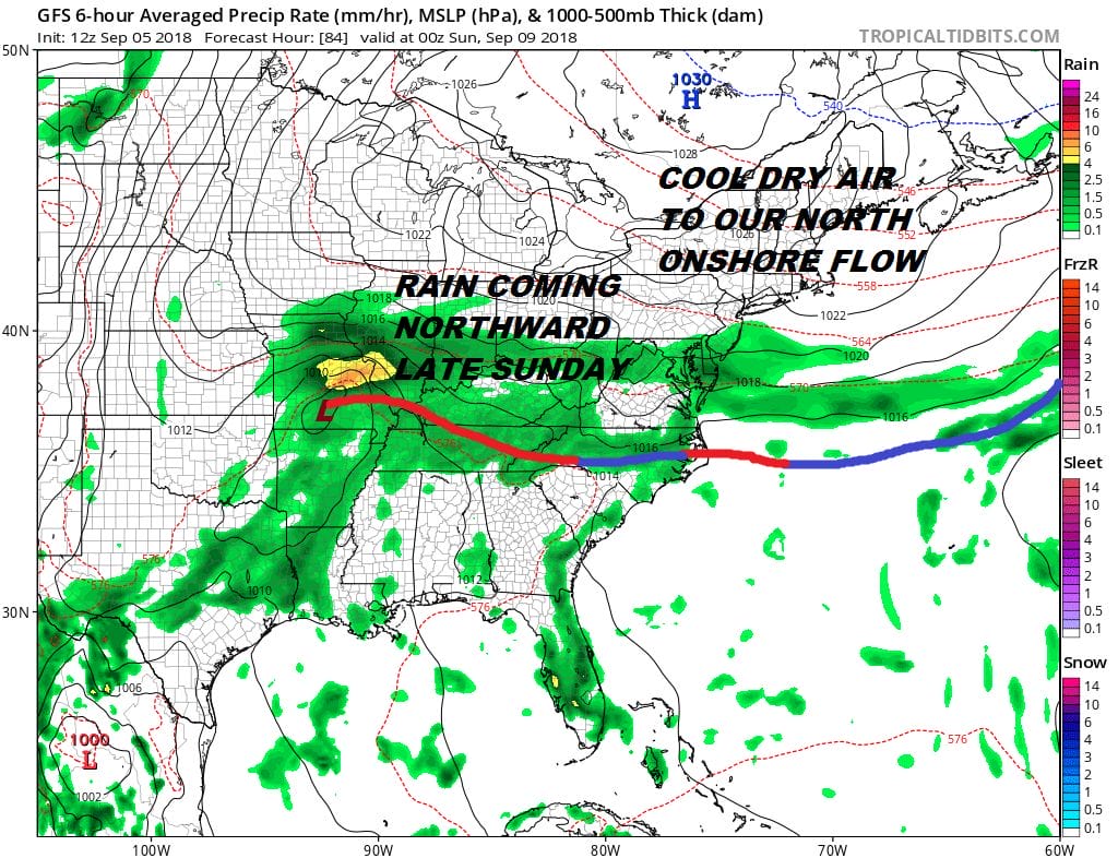
Friday night into Saturday afternoon it looks like there will be some rain or showers as a weak wave on the front moves through and forces the front further south. Temperatures will be in the low to mid 70s. Dry air could push down Saturday night into Sunday to keep it dry but there will be cloud issues Sunday. Highs just in the upper 60s to lower 70s. Considering the weekend it will feel amazingly cool this weekend. Then rain comes back on the scene overnight Sunday night and Monday as the warm front comes back and a warm front approaches. Monday’s highs will be back in the 70s.
HURRICANE FLORENCE
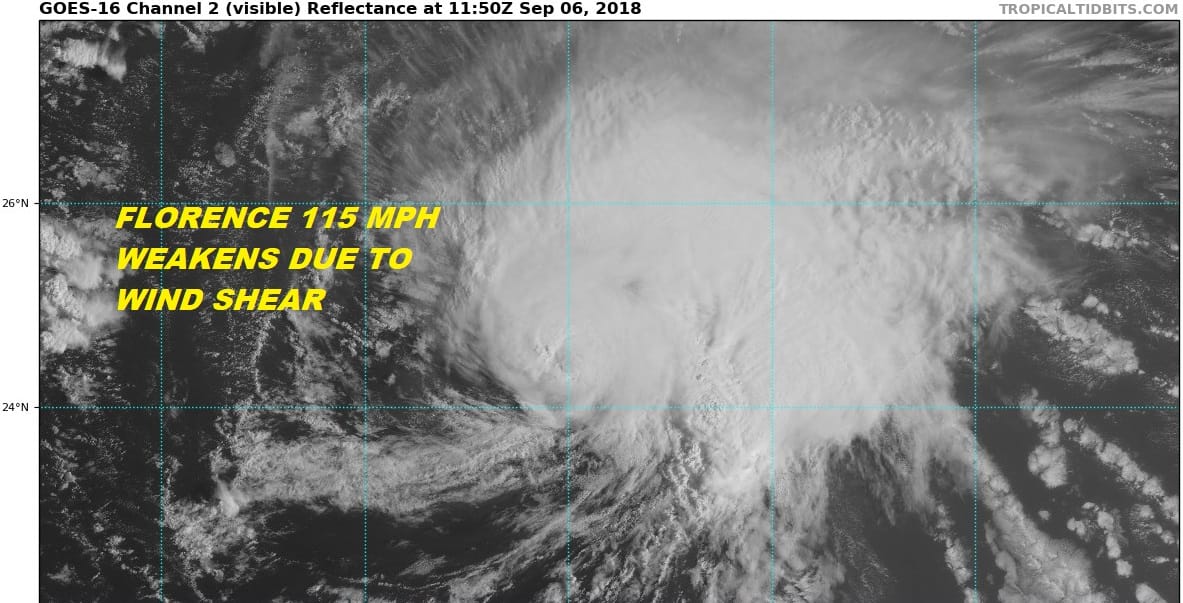
Overnight Hurricane Florence right on schedule has weakened somewhat thanks to increasing wind shear (stronger winds aloft). The hurricane is getting distorted southwest northeast due to this. The zone of shear will impact the hurricane for the next 48 hours. Once it gets west of 60 degrees west we will likely see the shear relax and strengthening should take place. There is a good chance Florence could get back to category 4 status once it is west of 60 degrees west. Weather models continue to bring the storm inside 70 degrees west. The European Canadian & UKMET show a serious threat to the East Coast, the GFS models overnight recurved it to the east and kept it offshore. None of this is a surprise really. We still have to work out the strength of the ridge in the East as it rebuilds as this is going to be the ultimate driver. Florence is still a week out so there is plenty of room for models to maneuver in both directions. We will examine Florence closely later today after the dayside models come out.
JOIN US ON PATREON
MANY THANKS TO TROPICAL TIDBITS FOR THE USE OF MAPS
Please note that with regards to any tropical storms or hurricanes, should a storm be threatening, please consult your local National Weather Service office or your local government officials about what action you should be taking to protect life and property.
LATEST JOESTRADAMUS ON THE LONG RANGE