Severe Weather Risks Tuesday Wednesday Hot Humid Weather On The Way

Weather in 5/Joe & Joe Weather Show Latest Podcast
Severe Weather Risks Tuesday Wednesday Hot Humid Weather On The Way
Day three of the holiday weekend is drawing to a close and it was a good one. Now it is on to heat humidity and severe weather risks for Tuesday and Wednesday. Skies are mainly cloud free over most of the Northeast and Mid Atlantic states and the radar is mostly silent. Temperatures won’t be going anywhere tonight as winds turn southwest and humidity levels continue to rise. Lows will be in the upper 60s to lower 70s in most places with warmer urban centers on the high end.
SATELLITE

Radars are going to be quiet (unless an isolated shower or thunderstorm pops up this evening) but they will get busy on Tuesday.
WEATHER RADAR


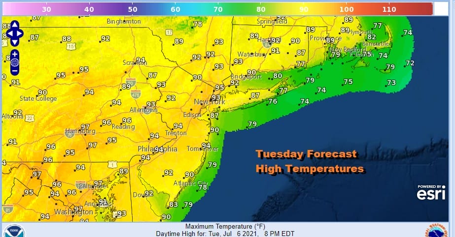
An upper trough is going to be moving through the Northeast tomorrow evening. Ahead of it we will have sunshine and it will be another one of those very hot and very humid days like the ones recently experienced. Highs will reach the mid to upper 90s except temperatures should be about 10 degrees lower at the beaches.
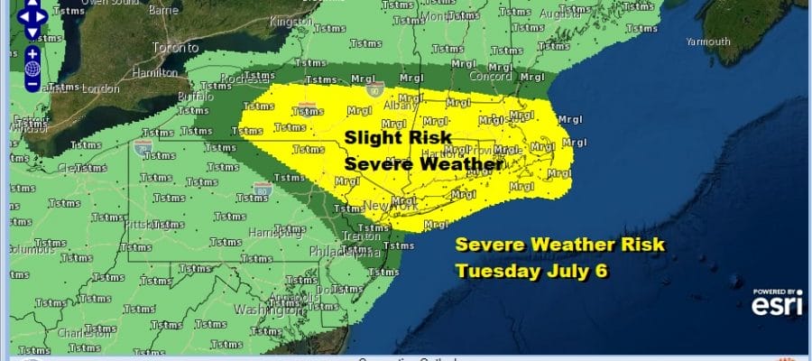
Strong daytime heating and dew points reaching into the 70s plus that upper trough will lead to severe weather risks and the Storm Prediction Center has upgraded the risk from marginal to slight for Tuesday for a large portion of Eastern Pennsylvania into Upstate NY and New England as well as Long Island and Northern and Central New Jersey.

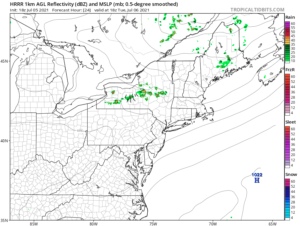
The latest HRRR model seems to have the most active view of all the short term models as it follows a line moving southeast from Upstate NY and reaching the coast sometime during Tuesday evening. This may be another one of those instances where the models underdo the coverage of thunderstorms.
On to Wednesday which will be another hot day with highs in the low to mid 90s and another round of severe weather is possible though for Wednesday the risk is inland north and northwest of the coast. All of this ahead of the next cold front that is likely to stall near the coast in almost repeat performance of late last week.

Two issues for late in the week is that Thursday probably sees the development of more numerous showers and thunderstorms. Riding along the frontal boundary will be Tropical Storm Elsa and todays European run above and the GFS run below both have the same idea of the low center riding up the coast. Normally the European would be inland and the GFS offshore but in this case we have the reverse. The European loop is courtesy of Pivotal Weather.
We mentioned last week that either the moisture from Elsa would enhance the front or we might see an identifiable feature move northeast up the coast and at least today we seem to have the latter. It will be interesting to see what the National Hurricane Center does with this in their updated forecast this evening. Either way this would be for later Thursday and Thursday night into early Friday followed by improving weather conditions going into the weekend.
BE SURE TO DOWNLOAD THE FREE METEOROLOGIST JOE CIOFFI WEATHER APP &
ANGRY BEN’S FREE WEATHER APP “THE ANGRY WEATHERMAN!

MANY THANKS TO TROPICAL TIDBITS & F5 WEATHER FOR THE USE OF MAPS
Please note that with regards to any severe weather, tropical storms, or hurricanes, should a storm be threatening, please consult your local National Weather Service office or your local government officials about what action you should be taking to protect life and property.


