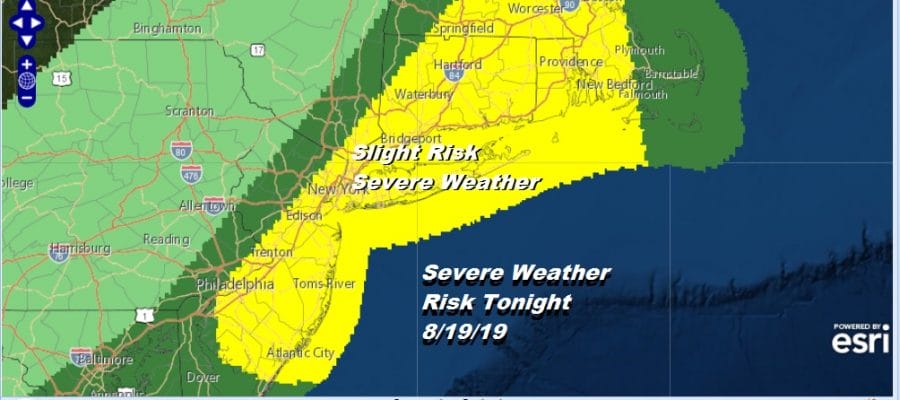
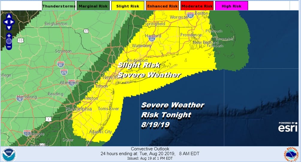
Severe Weather Risk This Evening Humidity Relief Coming Friday
So far we have seen some scattered thunderstorms devleop on the radar. It looks as if based on the timing of this upper air disturbance moving eastward at the moment in Eastern NY down to Eastern Pennsylvania that maximum development will be a little further east in Eastern New England. This is where the Storm Prediction Center has put up a Severe Thunderstorm Watch. We remain at a slight risk for severe weather this evening and that area extends southward into Delaware.
SATELLITE

We are seeing ample daytime heating. Most temperatures are in the upper 80s to lower 90s this afternoon and the humidity levels are very high with dew points into the 70s. We will watch the radars to see what fires up in the next few hours. Much like yesterday you may see thunderstorms fire up relatively quickly though the odds for thunderstorms grown stronger as you go east of NYC rather than west.
REGIONAL RADAR

We are beginning to see some widely scattered thunderstorms pop up in parts of New Jersey down into Delaware. Also some cells are popping up in interior New England. Thunderstorms are mostly moving to the east. The main threat time will be from 4pm to 8pm.
LOCAL RADAR NEW YORK CITY

LOCAL RADAR PHILADELPHIA 

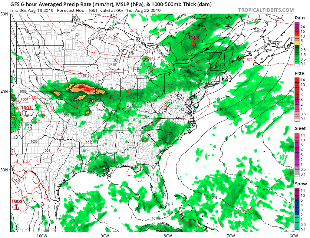
Once these storms are done it will be warm and humid overnight. Actually for some areas from NYC north and east there will be some very slight humidity relief overnight into Tuesday. For everyone else it is the same story. Lows tonight will be in the mid 60s to lower 70s and highs Tuesday will be in the mid 80s to near 90 in the hot spots. Some pop up thunderstorms are possible Tuesday but they will be widely scattered. There could be a few passing downpours Tuesday night as humidity returns everywhere on Wednesday. Then we wait for the first of two front with thunderstorms likely late in the day. There is the risk for severe weather late Wednesday. Highs will be in the upper 80s to lower 90s.
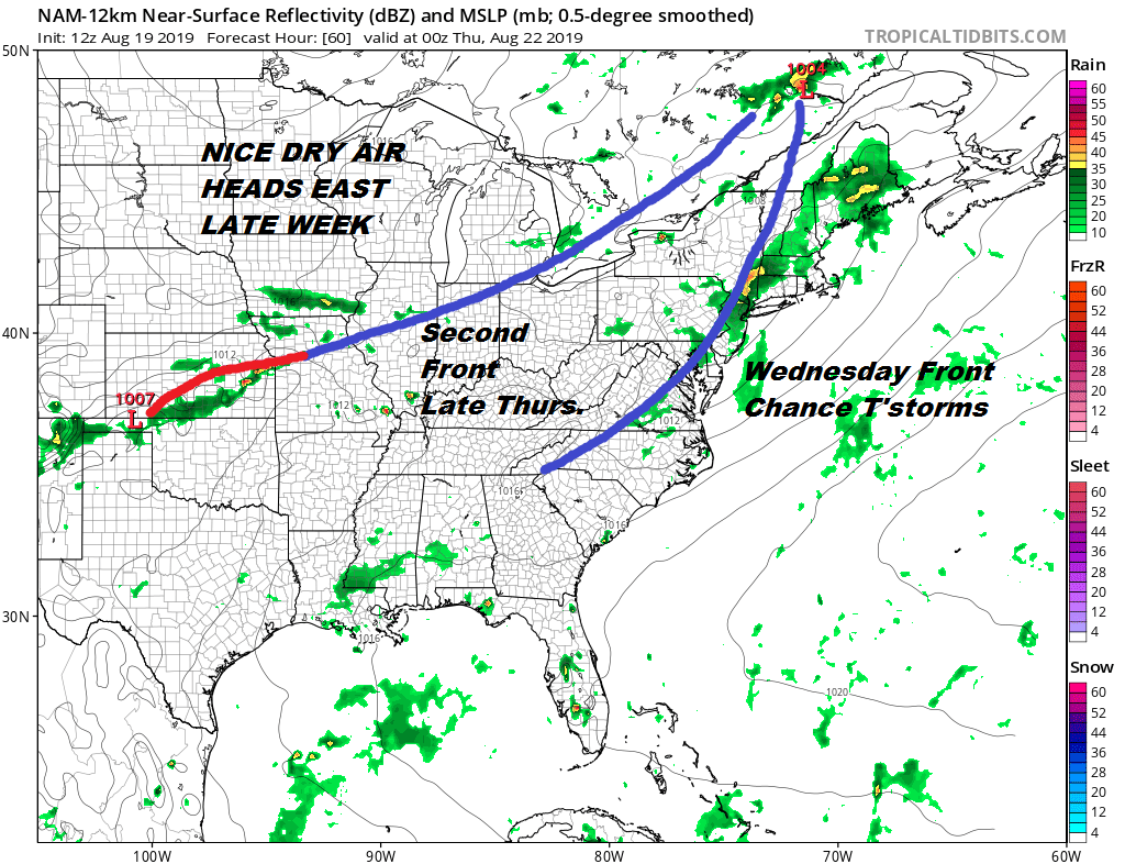
We have one more weather front to deal with and that is for late Thursday. This could mean another round of showers or thunderstorms depending on the timing. The more important thing about this front is that it ushers in nice dry air for Friday and the weekend.
If this plays out according to plan, Friday begins at least a 3 day stretch of great weather, low humidity, and sunshine. Highs Friday and Saturday will be in the 70s to near 80 with lows at night in the 50s in many areas. This could rival the beautiful weekend we had 2 weeks ago so keep your fingers crossed on this.
MANY THANKS TO TROPICAL TIDBITS FOR THE USE OF MAPS
Please note that with regards to any tropical storms or hurricanes, should a storm be threatening, please consult your local National Weather Service office or your local government officials about what action you should be taking to protect life and property.


