
Severe Weather Risk Saturday
[brid video=”57445″ player=”6390″ title=”thursday”]
Severe Weather Risk Saturday
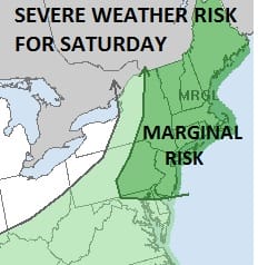
The Storm Prediction Center of the National Weather Service has indicated a marginal risk of severe weather for Saturday for all of the Northeast US from Eastern Pennsylvania and New Jersey northeastward. This is due for a cold front that will be approaching and moving through during Saturday. You can see the front moving into the Western Great Lakes on the satellite loop. Until it gets here we have another good day of weather ahead of us on Friday with sunshine and highs in the low to middle 80s. Humidity levels will still be comfortable.


Severe Weather Risk Saturday
The problem for Saturday is the timing of the front as weather models are showing different speeds here. Usually the NAM model is faster. The GFS has been trying to bring the front through in the early afternoon and this afternoons NAM 4KM model goes along now with this idea. The NAM 12 model however has it holding back until evening.
Severe Weather Risk Weather Models Saturday Afternoon
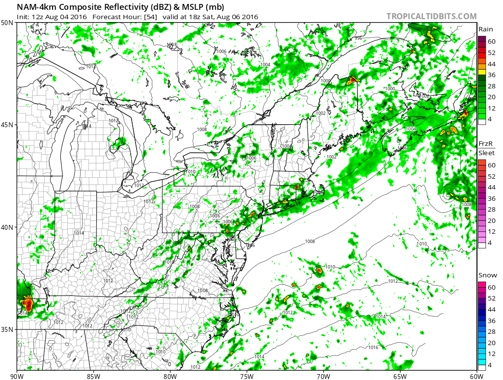
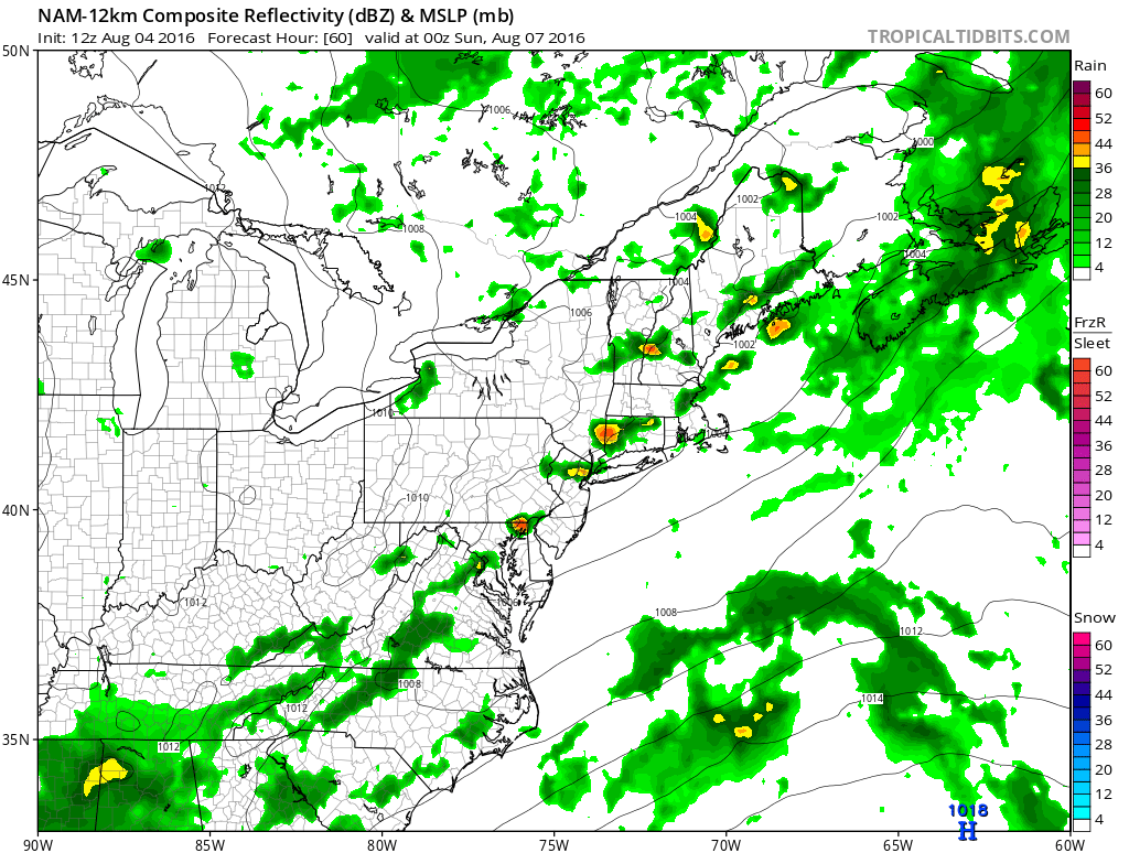
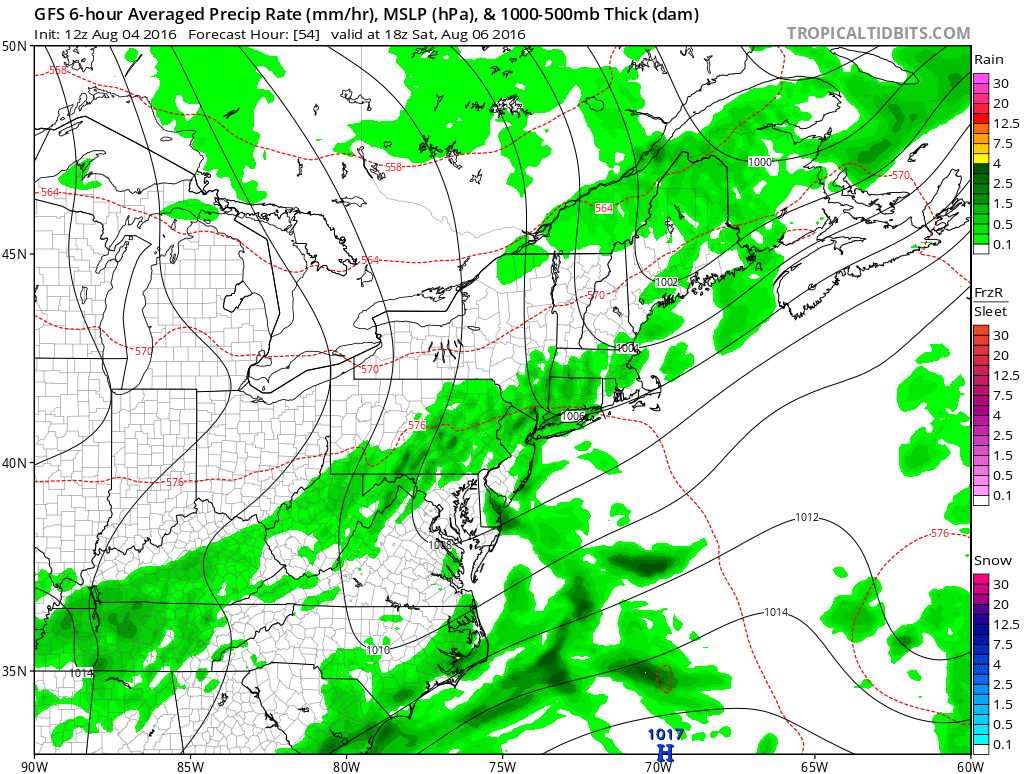
Since we have been seeing weather fronts mainly underperform over the summer (not all the time), I think right now the best approach from a forecast standpoint is the lean on the idea that the front may be a bit slower than forecast and come through mid to late afternoon. Should it come through earlier, it would probably mean storms would be a little less developed with the lack of daytime heating. Delay of thunderstorms means temperatures will reach the upper 80s to lower 90s Saturday. Behind the front dry and and lots of sunshine come in for Sunday.
LATEST YOU TUBE VIDEO ON HURRICANE EARL WEEKEND AND LONG RANGE
FiOS1 News Weather Forecast For Long Island
FiOS1 News Weather Forecast For New Jersey
FiOS1 News Weather Forecast For Hudson Valley
NATIONAL WEATHER SERVICE SNOW FORECASTS
LATEST JOESTRADAMUS ON THE LONG RANGE
Weather App

Don’t be without Meteorologist Joe Cioffi’s weather app. It is really a meteorologist app because you get my forecasts and my analysis and not some automated computer generated forecast based on the GFS model. This is why your app forecast changes every 6 hours. It is model driven with no human input at all. It gives you an icon, a temperature and no insight whatsoever.
It is a complete weather app to suit your forecast needs. All the weather information you need is right on your phone. Android or I-phone, use it to keep track of all the latest weather information and forecasts. This weather app is also free of advertising so you don’t have to worry about security issues with your device. An accurate forecast and no worries that your device is being compromised.
Use it in conjunction with my website and my facebook and twitter and you have complete weather coverage of all the latest weather and the long range outlook. The website has been redone and upgraded. Its easy to use and everything is archived so you can see how well Joe does or doesn’t do when it comes to forecasts and outlooks.
Just click on the google play button or the apple store button on the sidebar for my app which is on My Weather Concierge. Download the app for free. Subscribe to my forecasts on an ad free environment for just 99 cents a month.
Get my forecasts in the palm of your hand for less than the cost of a cup of Joe!

MENTION JOE CIOFFI AND GET A 5% DISCOUNT


