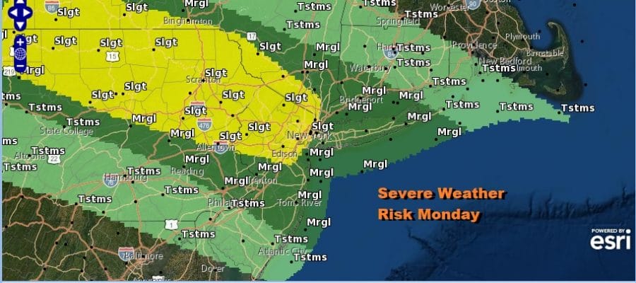
Severe Weather Risk Parts of Northeast Today Very Warm Humid Conditions Watching Southeast US Coast

Weather in 5/Joe & Joe Weather Show Latest Podcast
Severe Weather Risk Parts of Northeast Today Very Warm Humid Conditions Watching Southeast US Coast
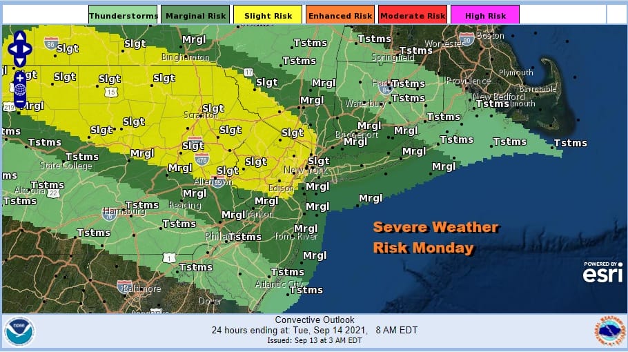
We though that this backdoor cold front moving southward from upstate NY would be a minimal issue but its seems this front has different ideas. It gets hung up further north and allows for plenty of daytime heating. Humidity levels are high as dew points run toward 70 or higher giving us a very unstable atmosphere. That means severe weather risk no extends down into Central New Jersey to Southern New England and Long Island with risk increasing as you move northwest into the Hudson Valley, Northern New Jersey and Northeast Pennsylvania. These storms are coming with a hail and high wind risk but tornado risk is less than 2 percent.
SATELLITE

In the meantime we see just some patchy clouds around and not much on the radar except of the coast of Eastern New England. Later today you can expect the radars to rev up with downpours and stronger thunderstorms.
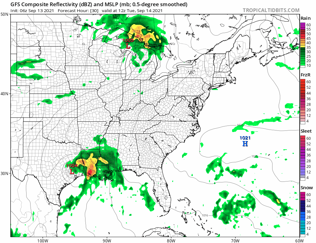
WEATHER RADAR

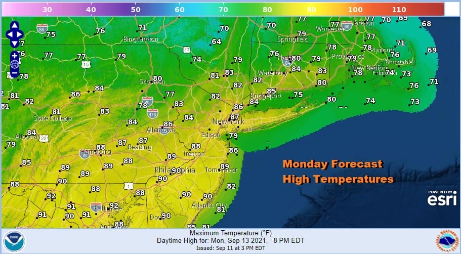
One of the more interesting aspects of this severe weather risk area today is the fact that none of the short range models show very much if anything at all with regards to thunderstorms late today into tonight. This was my original idea of today that we wouldn’t see much of anything at all. However I will defer to SPC since we have see often enough where reality outperforms the models when it comes to thunderstorms. Otherwise it will be a very warm to hot humid Monday with highs reaching the middle to upper 80s.
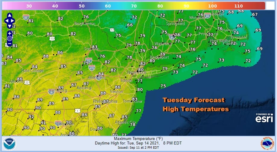
We will stay with the same ideas for Tuesday and Wednesday. The back door front stops close to NYC basically dissolves so look for partly sunny skies Tuesday with highs ranging from the 70s to near 80 north and east of the frontal boundary and upper 80s to near 90 to the south.
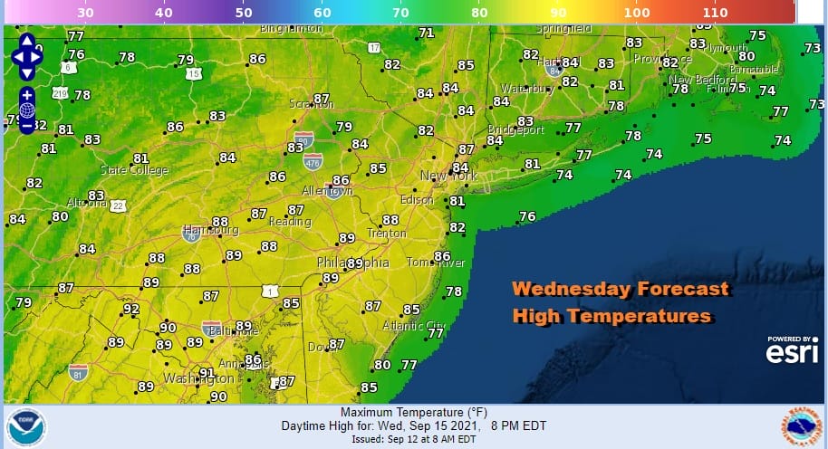
Wednesday brings another front and this one is going to be a stronger one as it heads southeast from upstate NY. This comes with severe weather risk and SPC had that risk up in its long range Sunday so this is one to pay attention to. This severe weather risk area sets up north and west of Philadelphia and NYC.

Ahead of the front it will be a very warm to hot and very humid day with sunshine taking highs to the 80s to near 90 degrees. Dew points will reach into the 70s. It would seem that while there is thunderstorm risk along the coast it probably holds off until after dark.
Now lets moving on to the second half of this week where the Wednesday front stalls nearby. High pressure builds across Southeastern Canada and New England. This creates lower than normal pressure off the Southeast US coast. Now lets throw in a tropical wave and a weakening upper trough and you have the ingredients for low pressure to develop and the chance that the low could be a tropical system.
Meanwhile Tropical Storm Nicholas in the Northwest Gulf is forecast to move inland. Weather models seem to take that moisture and shoot it northeastward while low pressure develops offshore with its own area of rain. The result is for some showery rains Thursday into Friday before the ocean low pulls away to the northeast in time for the weekend. Bear in mind there is a lot of unknowns here including whether the moisture from Tropical Storm Nicholas comes up this far north, the status of the developing ocean low, and whether that ocean low becomes a tropical cyclone or not. Obviously everyone is going to be thinking about heavy rain after our experience with the remnants of Hurricane Ida. This is a different set up here in the East this time around and it should lead to a manageable outcome but we need to see how all these puzzle pieces play out over the next several days. It is probably a good idea to pay a little extra attention to the weather over the next couple of days just in case.
BE SURE TO DOWNLOAD THE FREE METEOROLOGIST JOE CIOFFI WEATHER APP &
ANGRY BEN’S FREE WEATHER APP “THE ANGRY WEATHERMAN!

MANY THANKS TO TROPICAL TIDBITS & F5 WEATHER FOR THE USE OF MAPS
Please note that with regards to any severe weather, tropical storms, or hurricanes, should a storm be threatening, please consult your local National Weather Service office or your local government officials about what action you should be taking to protect life and property.


