Severe Weather Risk New Jersey Pennsylvania Next Cold Front Arrives
We wrap up another warm July day and now we look ahead to the next weather system that approaches for Thursday. This buys us one more day of no thunderstorms, some sunshine though temperatures will be edging higher into the 80s to near 90 and humidity levels will be coming up as well. The satellite picture tonight show what looks like some high clouds but this is actually a smokey condition coming from forest fires in Western Canada which has been an on again off again issues sky wise for us. Temperatures overnight will be in the 60s to near 70 with the humidity a bit higher and no risk for any showers.
SATELLITE

REGIONAL RADAR

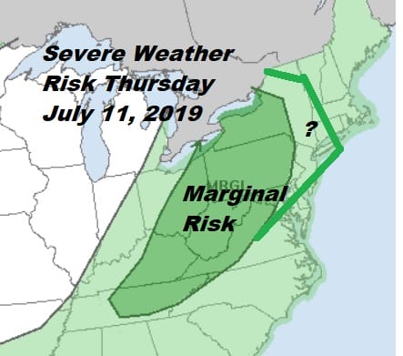
Wednesday is going to be a very warm to borderline hot and somewhat humid day with some sunshine as temperatures approach 90 degrees in many areas. I think we stay thunderstorm free until Thursday. Dynamics in the atmosphere Thursday look at least impressive enough to open up the possibility of severe weather. The Storm Prediction Center is going for a marginal risk for Pennsylvania but I think it could get extended eastward into New Jersey at least and possibly further north into the Hudson Valley.

Last Saturday’s severe weather outbreak was with a marginal risk outlook from the Storm Prediction Center. Dew points will be up into the low 70s. The cold front will create some unstable conditions across much of the interior Middle Atlantic and into the Northeast so we think additional risk is warranted here.
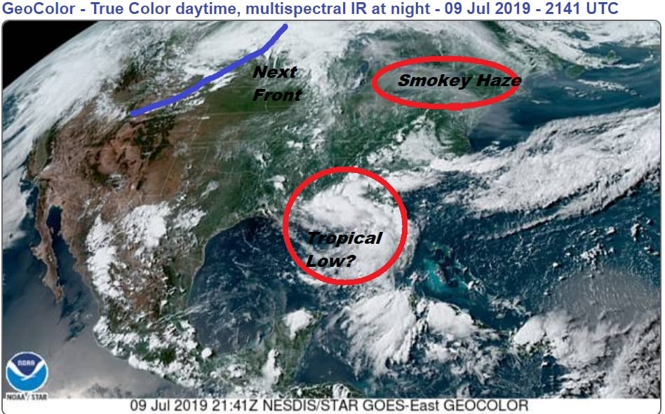
Meanwhile we have been watching energy dropping through the Southeast US and into the Gulf of Mexico. That process appears to be complete as low pressure has formed in the Northeast Gulf of Mexico. Conditions are favorable for tropical cyclone formation over the next few days and the National Hurricane Center has a plane scheduled for Wednesday if there are signs of organization. The issue is how far into the Gulf will the surface low develop. The further southeast, the greater the potential. If it stays closer to the Gulf coast it will be more of a rain issues from east to west. The track here from the upper flow will be from east to west thanks to an upper high across the Gulf States.
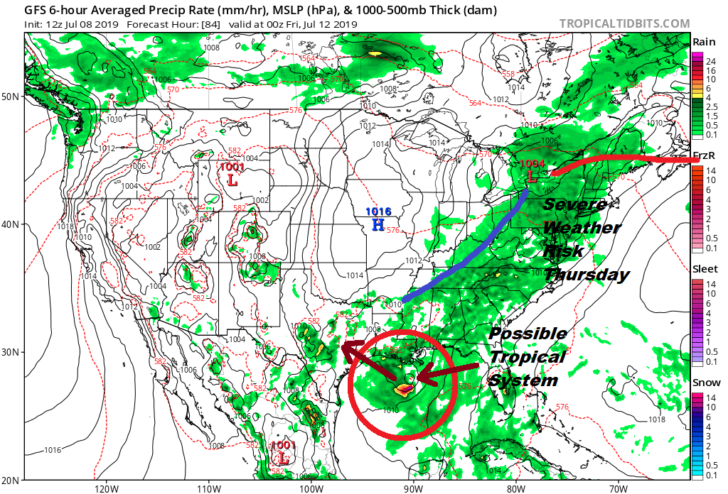
What we can say at this point is that the front in the East will move offshore Thursday night as as high pressure builds eastward, it will prevent this low from moving northeastward along the frontal boundary. We may be looking at hot and humid conditions setting up for later in the weekend and next week as an upper high builds off the East Coast and cold fronts get deflected or delayed for awhile.
MANY THANKS TO TROPICAL TIDBITS FOR THE USE OF MAPS
Please note that with regards to any tropical storms or hurricanes, should a storm be threatening, please consult your local National Weather Service office or your local government officials about what action you should be taking to protect life and property.


