Severe Weather Risk Late Today

Severe Weather Risk Late Today
Gusty Winds With Thunderstorms
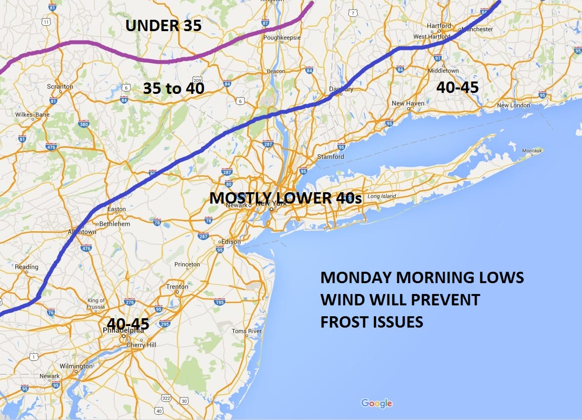
Very Chilly Sunday Into Monday
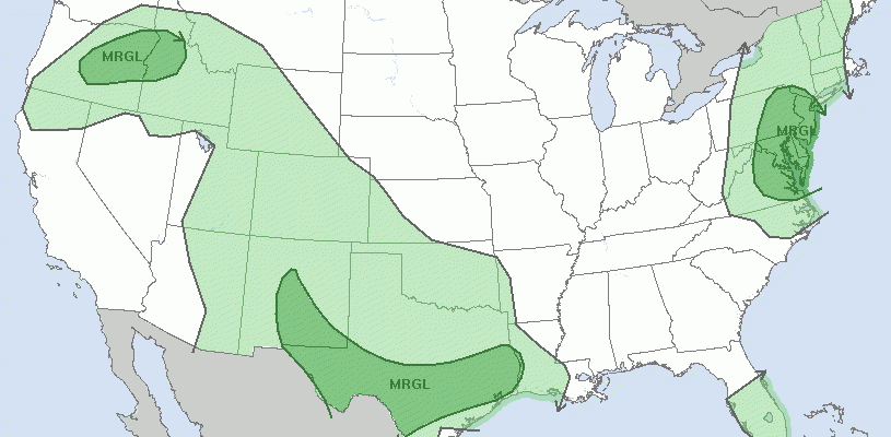
 MARGINAL RISK OF SEVERE WEATHER
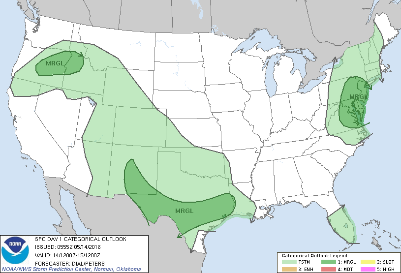

Satellite loops this morning show the first weather front offshore and the second one beginning to swing into action. Skies into mid afternoon should be partly to mostly sunny so if you have outdoor things to do by all means go ahead with them. Nothing should happen before 3pm at the absolute earliest. As of right now showers are only right now getting into Western Pennsylvania and it usually takes about 10 hours to move across to the coast. Temperatures will reach to the low to mid 70s in most places before any thunderstorms arrive.
Severe Weather Risk Late Today Regional Radar Loop

Severe Weather Risk Late Today Local Radar Loops


Once the storms move through and they will move through quick it will turn windy and colder tonight with some partial clearing of skies. Temperatures will fall into the mid to upper 40s. Sunday will be a windy and chilly day (for this time of year) with sunshine and clouds and even a passing shower or two. Highs will only be in the upper 50s to lower 60s. There is no change in my view for temperatures Sunday night into Monday morning. We will be cold but above levels to cause problems with frosts and freezes.
Monday look for sunshine with highs back into the lower 60s. Tuesday through Thursday I mentioned yesterday that I was guardedly optimistic about this week as my thinking was that everything would be supressed south. The overnight weather models seem to be taking this route with rain further south with each passing model series. So for now we will lean toward the idea of clouds and some sunshine for Tuesday and Wednesday and leave rain out of the forecast.
FiOS1 News Weather Forecast For Long Island
FiOS1 News Weather Forecast For New Jersey
FiOS1 News Weather Forecast For Hudson Valley
NATIONAL WEATHER SERVICE SNOW FORECASTS
LATEST JOESTRADAMUS ON THE LONG RANGE
Weather App

Don’t be without Meteorologist Joe Cioffi’s weather app. It is really a meteorologist app because you get my forecasts and my analysis and not some automated computer generated forecast based on the GFS model. This is why your app forecast changes every 6 hours. It is model driven with no human input at all. It gives you an icon, a temperature and no insight whatsoever.
It is a complete weather app to suit your forecast needs. All the weather information you need is right on your phone. Android or I-phone, use it to keep track of all the latest weather information and forecasts. This weather app is also free of advertising so you don’t have to worry about security issues with your device. An accurate forecast and no worries that your device is being compromised.
Use it in conjunction with my website and my facebook and twitter and you have complete weather coverage of all the latest weather and the long range outlook. The website has been redone and upgraded. Its easy to use and everything is archived so you can see how well Joe does or doesn’t do when it comes to forecasts and outlooks.
Just click on the google play button or the apple store button on the sidebar for my app which is on My Weather Concierge. Download the app for free. Subscribe to my forecasts on an ad free environment for just 99 cents a month.
Get my forecasts in the palm of your hand for less than the cost of a cup of Joe!
![]()
![]()

MENTION JOE CIOFFI AND GET A 5% DISCOUNT


