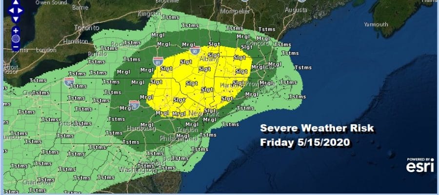
Severe Weather Risk Friday Subtropical Storm Development Likely Off Florida East Coast
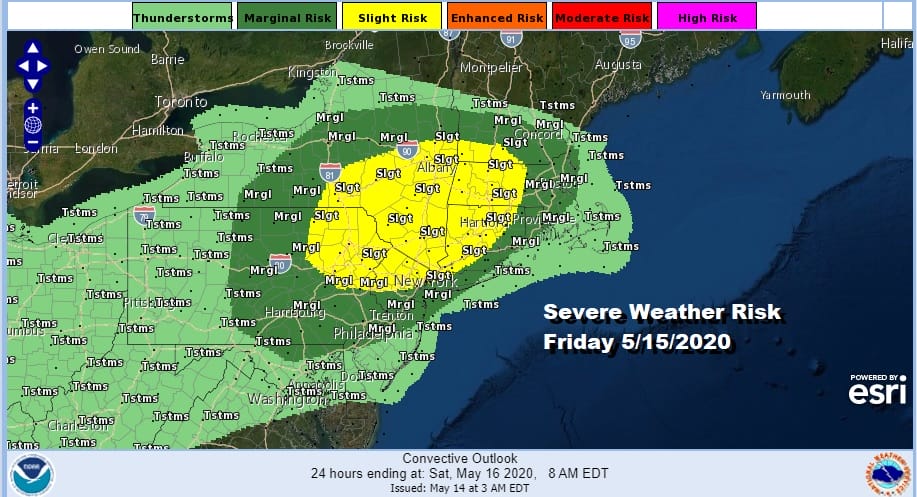
There are two issues that are going to be important in the weather outlook. The one that impacts us in the short term and is more important is Friday’s approaching cold front. We will be warming up into the 80s in some places Friday and the front will set off some late day or evening thunderstorms. The Storm Prediction Center has indicated that we have a slight risk for severe weather.
The second issues is the likely development of a subtropical depression or a subtropical storm over the weekend off the Southeast Coast of the US. While this probably won’t directly impact our weather in the long term, indirectly it is setting up a rather gloomy weather scenario beginning Sunday and probably lasting through much of next week. More on this later.
SATELLITE

REGIONAL RADAR

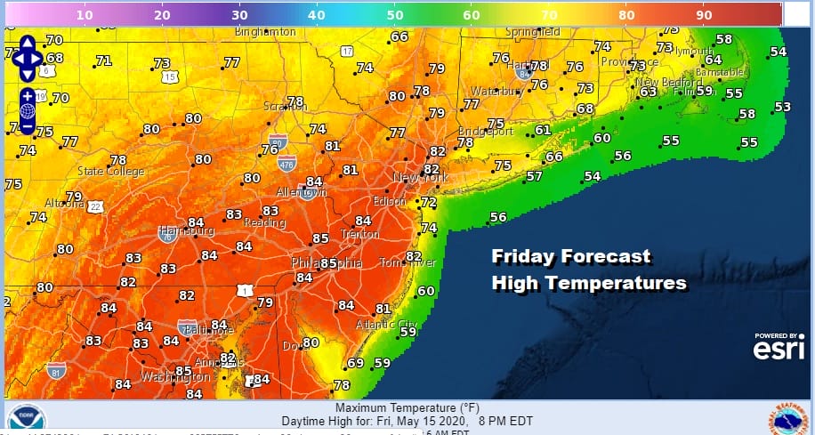
Today starts off with sunshine but clouds will be developing as the day wears on. There is a warm front that is forming across Northern Pennsylvania to about NYC. North and east of the front there could be a few scattered showers tonight but not much is forecast everywhere else other than clouds. Most highs today will be in the 60s to near 70 with the coolest temperatures right along the coast. Then we move on to Friday which will be very warm with a west southwest wind and some sunshine. Highs will reach the upper 70s to middle 80s. Even along the immediate coast temperatures should make it to 70 with a limited sea breeze.
Friday evening brings thunderstorms and the severe weather risk. Once the front passes it will move south and stall over the Delmarva Peninsula back across Virginia and the head back northward as a warm front on Sunday. Saturday should start with some sunshine but clouds are going to be an issue both early and late in the day. That and a developing easterly flow will keep temperatures in check. Highs will be in the 60s along the coast and into the lower 70s inland. The cold front to the south starts to back northward Saturday night and Sunday bringing a chance for showers during the day Sunday. Highs will be just into the 60s inland and 50s to near 60 along the coast.
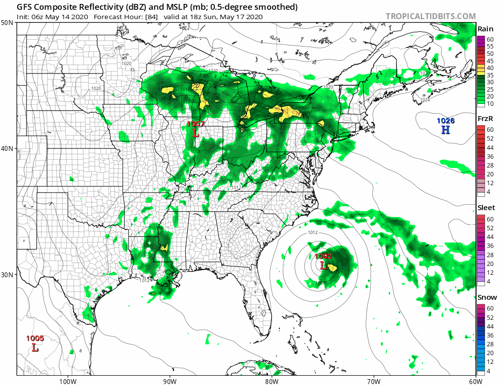
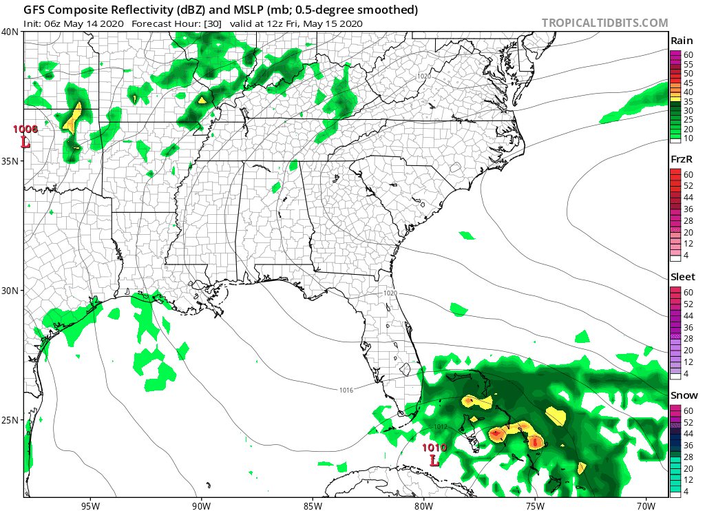
Low pressure moving east across the Ohio Valley and an approaching cold front will bring more numerous showers and thunderstorms Sunday night into Monday. The subtropical storm remains offshore but the problem is that it preventing the low to the west from simply moving along from west to east. Instead the energy from this drops southward into the Middle Atlantic states. The GFS loop above shows weather from Sunday afternoon right through Thursday and you will notice that it doesn’t look good with on and off rain. When it isn’t raining we have clouds to deal with.
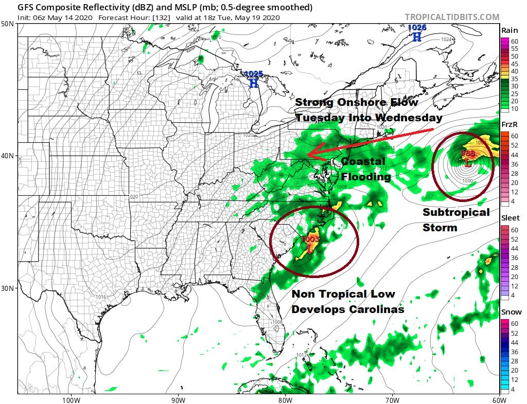
One time frame we are concerned about is Tuesday into Wednesday of next week where we have the subtropical storm well to the east but it is pinning another low back west in the Carolinas. Add to the equation a strong high in Eastern Canada and you have a set up for a strong onshore flow with a long easterly fetch from the Atlantic. That spells coastal flooding issues for the coastline from Virginia to Southern New England. This is something we probably need to pay attention to next week. It will all be part of a miserable weather pattern that may not break until late next week.
BE SURE TO DOWNLOAD THE FREE METEOROLOGIST JOE CIOFFI WEATHER APP &
ANGRY BEN’S FREE WEATHER APP “THE ANGRY WEATHERMAN!
MANY THANKS TO TROPICAL TIDBITS FOR THE USE OF MAPS
Please note that with regards to any severe weather, tropical storms, or hurricanes, should a storm be threatening, please consult your local National Weather Service office or your local government officials about what action you should be taking to protect life and property.


