
Severe Weather Risk Expanded Wednesday Strong Thunderstorms Likely
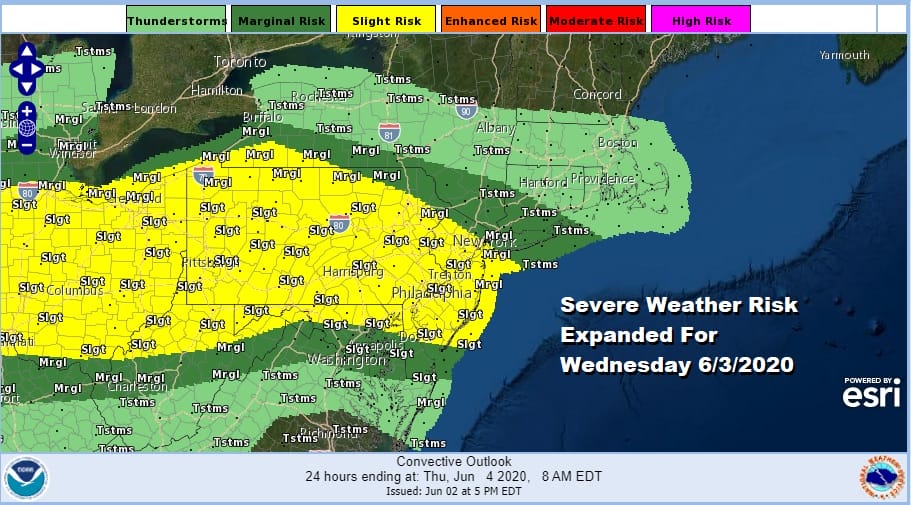
We want to update you on the situation regarding severe weather for Wednesday. It looks like that warm humid air with a warm front will be pushing further north and this has caused the Storm Prediction Center to expand the area of risk for severe weather yet again. Other than a few clouds for tonight there are no issues with most lows in the upper 50s and lower 60s. While we did have a few showers this afternoon they are all gone now and we should have no issues for the rest of the night.
SATELLITE

REGIONAL RADAR

Everything sets up for a round of severe weather on Wednesday with an approaching cold front and very warm and humid conditions ahead of it. Highs will reach the mid to upper 80s and even coastal areas will get to near 80 or so. Thunderstorms will come through in the afternoon. The HRRR model shows a strong mesoscale cluster of thunderstorms racing through the area from Eastern Pennsylvania to the coast between noon and 3pm
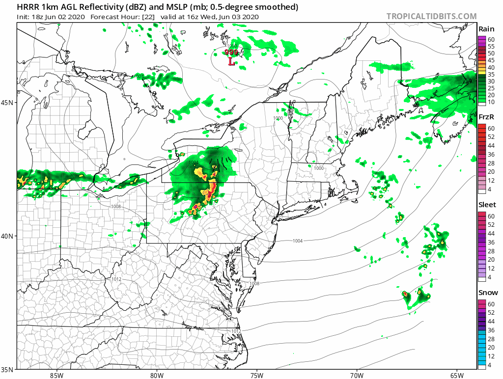
This cluster moves like a rocket ship and if it verifies, whoever gets in it is going to get rocked by some rather strong thunderstorms. It looks like between Route 78 to Route 80 from Pennsylvania through New Jersey has the greatest risk per the HRRR model. However I would not let my guard down in other areas. Keep an eye to the sky for some rough weather Wednesday afternoon.
TROPCIAL STORM CRISTOBAL A LITTLE STRONG IN THE SOUTHWEST GULF OF MEXICO

The latest aircraft flight into the storm found stronger winds of 55 knots or higher so the highest winds on the new advisory are raised to 45 mph. Cristobal is barely moving or drifting south at less than 3 miles per hour and it will continue to hover in the Southwest Gulf into Thursday before moving northward.

The lastest National Hurricane Center forecast remains about the same with a slow drift northward beginning Friday and then heading toward the Central Gulf coast sometime on Sunday. We are still waiting to see if Cristobal moves inland over Mexico first before moving northward. This could impact the strength and forecast down the road. For now models seem to be rather consistent with the idea laid out by the National Hurricane Center.
BE SURE TO DOWNLOAD THE FREE METEOROLOGIST JOE CIOFFI WEATHER APP &
ANGRY BEN’S FREE WEATHER APP “THE ANGRY WEATHERMAN!
MANY THANKS TO TROPICAL TIDBITS FOR THE USE OF MAPS
Please note that with regards to any severe weather, tropical storms, or hurricanes, should a storm be threatening, please consult your local National Weather Service office or your local government officials about what action you should be taking to protect life and property.


