
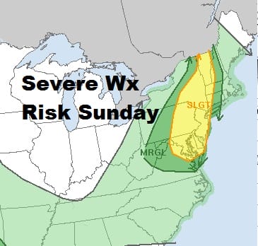
Severe Weather Risk Expanded Sunday NW New England Northeast Virginia
Our friends at the Storm Prediction Center have been busy this severe weather season and we had our fair share of severe weather last week. A strong cold front is forecast to move southeastward on Sunday from the Great Lakes. We are not going to be seeing surging dew points and moisture forcing its way northward so the character of these thunderstorms will be a bit different from last week when we saw clusters of severe thunderstorms develop along with broad lines of storms that followed. This time around it seems we will get one solid line of thunderstorms coming through late in the afternoon and evening. I would think the biggest risk will be from straight line winds though the isolated cell could develop with rotation.
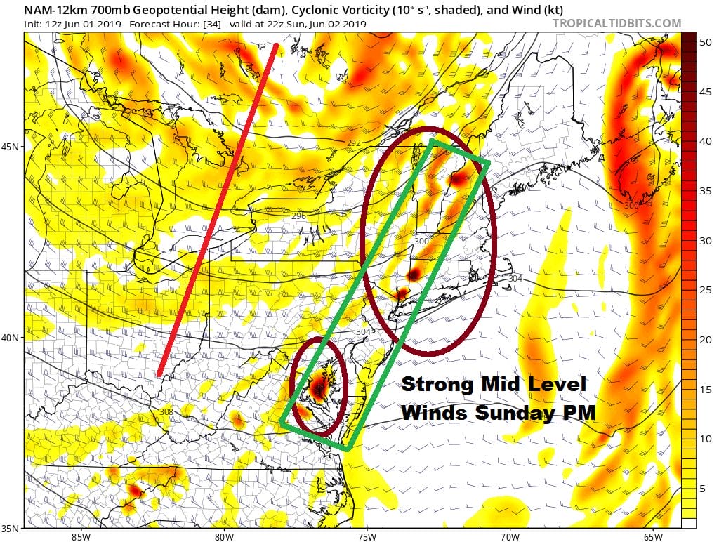
Afternoon weather models are mostly supportive of this idea of a line of thunderstorms moving through late Sunday afternoon or evening. sometime between 3pm and 7pm. The Storm Prediction Center has expanded the risk area slightly covering areas from Northeast Virginia all the way to Northwestern New England.
An offshore low is spinning away to the southeast of Long Island this evening. We have seen some patchy clouds getting thrown back northwestward to the coast. We still have a bit of a hazy sky due to smoke from forest fires in Western Canada. That should go away once the flow in the upper atmosphere strengthens from the north northwest and cleans things up around here. We have no weather issues tonight. There are some showers and thunderstorms that could develop in parts of Northeast Pennsylvania to the Catskills but they should play themselves out in those areas and other than an isolated passing showers overnight I’m not concerned. Most lows will be in the 50s to lower 60s.
SATELLITE

REGIONAL RADAR

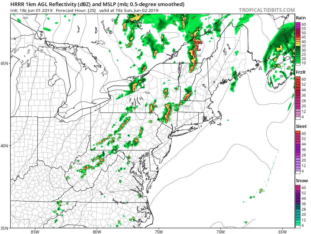
Sunday will be much like today with a mix of sun and clouds with highs in the mid 70s to lower 80s. Late in the day thunderstorms will be moving through. The HRRR model late today has the sequence from 3pm until 11pm and supports the idea of a line of thunderstorms moving through.
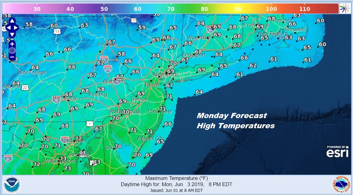
The strengthening jet stream with an upper low in Southeastern Canada will usher in a very cool start to next week. Monday will feature clouds and some sunshine with gusty winds. Temperatures will be hard pressed to get out of the 60s in most areas.
Monday night is going to be quite chilly with lows in the warmer urban centers and along the coast in the lower 50s with everyone else in the 40s. Cold spots will be close to 40 by Tuesday morning. Tuesday will be dry and sunny with less wind. Highs will be in the upper 60s and lower 70s. We will start to warm up Wednesday ahead of the next cold front with some sunshine taking highs back to the upper 70s to lower 80s. Look for a chance for a shower or thunderstorm late Wednesday into Wednesday night.
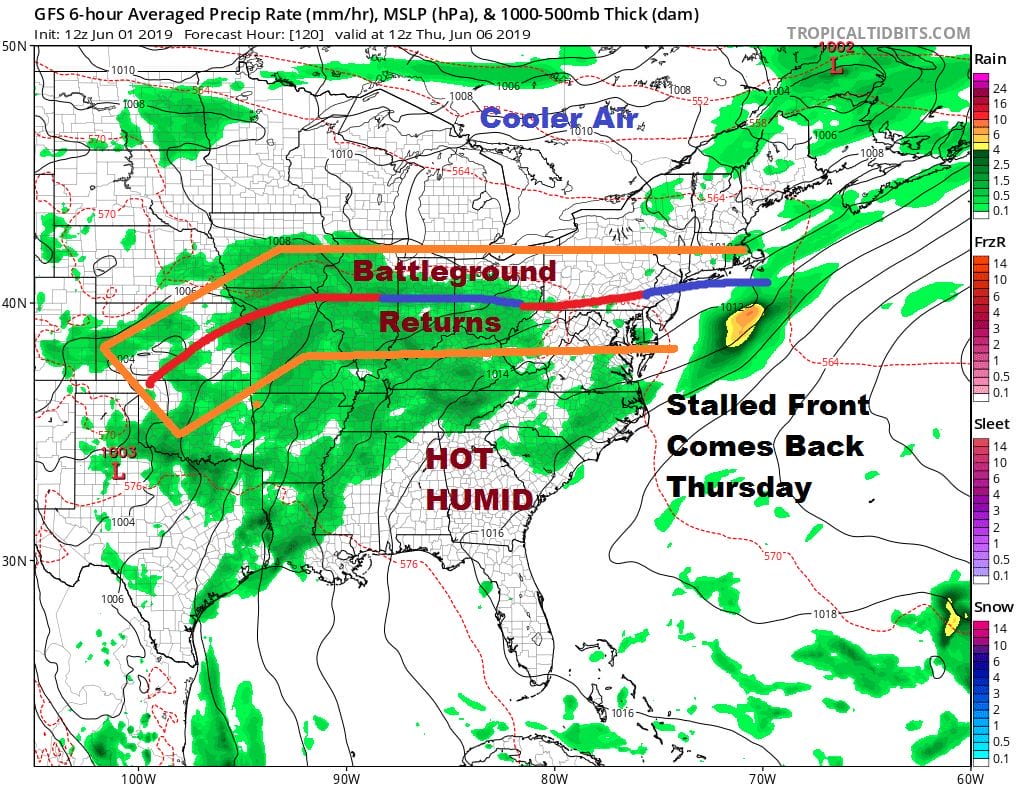
Once the jet stream pulls out of the East it looks like we may be going back to the land of the battleground. Wednesday’s front stalls out. Energy from the Plains starts to shoot eastward. This will likely bring threats for showers and thunderstorms Thursday and Friday of next week. The onshore flow threat will loom as well for areas north of the frontal boundary and the likely hood for thunderstorms and severe weather to the south.
Hurricane Season 2019 has begun and we have disturbed weather in the Southwest Gulf of Mexico that has a chance to develop over the next 2 days or so. Here is the latest on this and a look at what the start of hurricane season usually means in the Atlantic basin.
MANY THANKS TO TROPICAL TIDBITS FOR THE USE OF MAPS
Please note that with regards to any tropical storms or hurricanes, should a storm be threatening, please consult your local National Weather Service office or your local government officials about what action you should be taking to protect life and property.


