
Severe Weather Risk Enhanced Strong Thunderstorms Likely This Afternoon
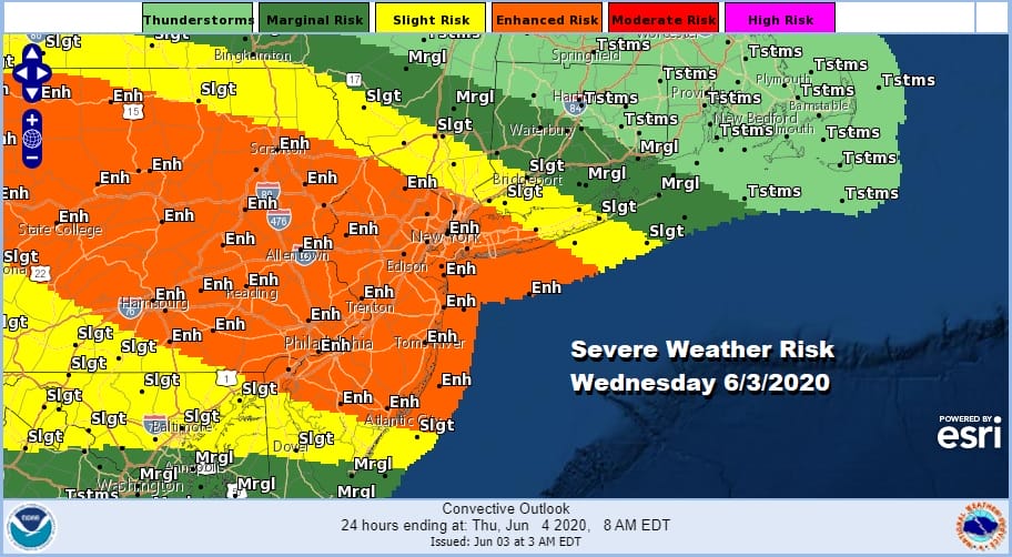
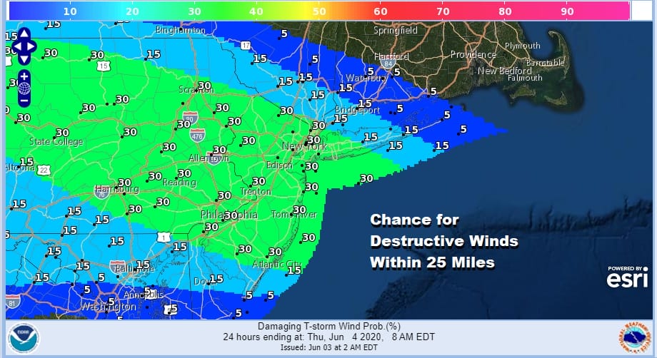
The Storm Prediction Center has gone aggressive with severe weather risk covering much of the area from Eastern Pennsylvania to New Jersey, NYC, the Lower Hudson Valley and Long Island in “enhanced risk” which is rather high for this area. Slight risk extends into SW Connecticut. We don’t see enhanced risk to often. In the enhanced area the chance for a tornado within 25 miles of any point is 2 percent but the chance for destructive winds is much higher at 30%.
The table is set for severe weather as a warm front has gone by to our north and we are going to see sunshine this morning take temperatures quickly up into the 80s. The front is coming down from the northwest which creates a west to southwest wind. This keeps the sea breeze at bay and little influence from any cool marine layer.
SATELLITE

REGIONAL RADAR

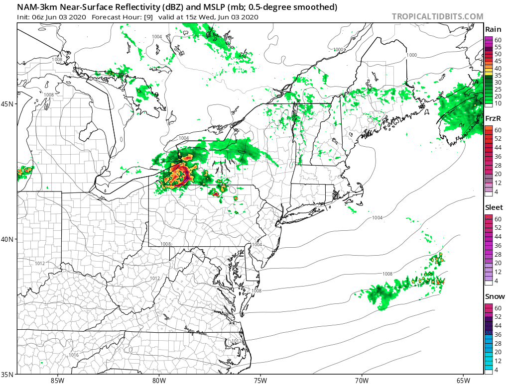
On the regional radar keep an eye on the area moving southeast into Pennsylvania because from this we will see a cluster of severe thunderstorms develop and strengthen as it moves east southeastward. We switched to the Binghamton NY radar so as to give you a better way to follow the cluster along into this afternoon.
LOCAL RADAR BINGHAMTON NY

LOCAL RADAR FORT DIX NJ


These thunderstorms fall into the category of Mesoscale convective complex (MCC)—A particular type of MCS, an MCC is a large, circular, long-lived cluster of showers and thunderstorms identified by satellite. It often emerges out of other storm types during the late-night and early-morning hours. MCCs can cover an entire state. Keep an eye to the sky today as we watch this evolve. The NAM 3km model has the cluster moving across Eastern Pennsylvania, Northern New Jersey, NYC & Long Island.
The loop starts at 11am so you can see how this cluster moves like a rocket ship to the east southeast. The probability of destructive winds is high so bear this in mind. Also notice a line fires up in Central and South Jersey and Southeast Pennsylvania late this afternoon and evening so areas south of NYC should bear this in mind. We will be updating you on this later this morning and this afternoon and likely go live on my youtube channel as thunderstorms get close. Be sure to subscribe to my youtube channel with your gmail account and set notificatons to on so that you will know when we go live. You can also watch the live streams directly from the Meteorologist Joe Cioffi weather app which you can download for free.
BE SURE TO DOWNLOAD THE FREE METEOROLOGIST JOE CIOFFI WEATHER APP &
ANGRY BEN’S FREE WEATHER APP “THE ANGRY WEATHERMAN!
MANY THANKS TO TROPICAL TIDBITS FOR THE USE OF MAPS
Please note that with regards to any severe weather, tropical storms, or hurricanes, should a storm be threatening, please consult your local National Weather Service office or your local government officials about what action you should be taking to protect life and property.