Severe Weather Eastern Pennsylvania This Evening Weakens As It Heads East Tropical Storm Henri And The Weekend

Weather in 5/Joe & Joe Weather Show Latest Podcast
Severe Weather Eastern Pennsylvania This Evening Weakens As It Heads East
Tropical Storm Henri And The Weekend
Severe thunderstorms moved across Pennsylvania coupled with numerous severe thunderstorm warnings and we saw a couple of tornado warnings in the mix. The remnant low of Fred is heading on a steady northeast course across Upstate NY and the area of thunderstorms will lift to the northeast. It should weaken over time so. We expect the showers and thunderstorms to head northeast well west of the coast from Pennsylvania to the Hudson Valley and into New England overnight. We will leave in the chance for showers or a thunderstorm in other areas just in case but there is a fair chance that coastal areas from Eastern New Jersey to Southern New England and Long Island don’t see anything overnight. It will be very warm and humid with lows in the upper 60s and lower 70s.
SATELLITE

WEATHER RADAR

As Fred’s remnant low gets absorbed by a low to the northeast we will see a front and trough approach on Thursday. Look for some sunshine and clouds in what will be another very warm and very humid day. We will throw in the chance for scattered thunderstorms though we are not expecting any severe weather at this time. We will reevaluate this in the morning. Highs Thursday will be in the mid to upper 80s. Behind the front the air is just as warm and just as humid as the air ahead of it so look for some sunshine Friday with the risk for a shower or thunderstorm scattered around. Highs will be in the mid to upper 80s.
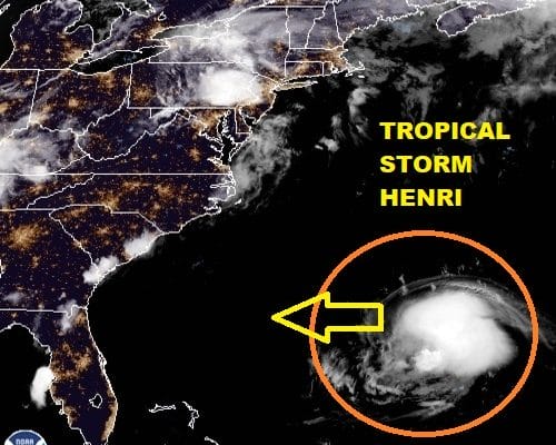
TROPICAL STORM HENRI CONTINUES WESTWARD

The latest forecast from the National Hurricane Center reflects the shifting westward hurricane tracking models and global models with Tropical Storm Henri. Nothing much has changed from earlier regarding the forecast logic. A trough is dropping into the Ohio Valley and a ridge is building in the Northwest Atlantic to New England. How strong these two systems are will determine the ultimate track. The vast majority of hurricanes and tropical storms in situations like this wind up staying just far enough offshore that they produce only minor issues with surfa d tide. However the the needle we are threading here is a fine one and subtle changes in the strength of the Atlantic ridge or the trough in the Ohio Valley could drive Henri further west. I think we are at the point here where models are going to do a little back and forth regarding the track. Earlier today we had models bringing it in to Long Island from the southeast Sunday night. The last GFS run was a little further east near Cape Cod. We will be playing this game for the next few days so sit tight. I think right now that NHC has it right with the cone showing a track between NYC and about 200 miles or so east of Cape Cod. Look for that cone to tighten up in the coming days. Note for coastal residents, we have a full moon next Monday so tides could be running on the high side as it.
BE SURE TO DOWNLOAD THE FREE METEOROLOGIST JOE CIOFFI WEATHER APP &
ANGRY BEN’S FREE WEATHER APP “THE ANGRY WEATHERMAN!

MANY THANKS TO TROPICAL TIDBITS & F5 WEATHER FOR THE USE OF MAPS
Please note that with regards to any severe weather, tropical storms, or hurricanes, should a storm be threatening, please consult your local National Weather Service office or your local government officials about what action you should be taking to protect life and property.


