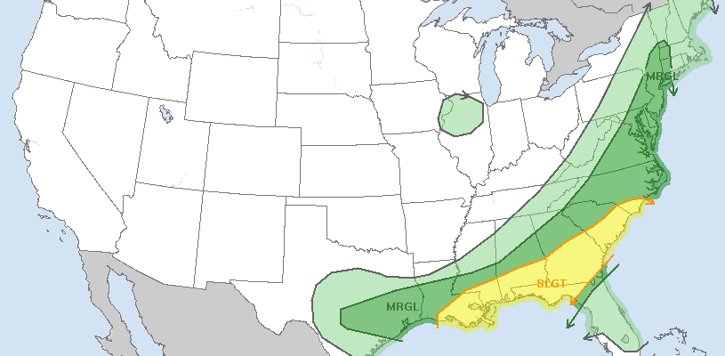
Severe Thunderstorm Risk Into Tonight
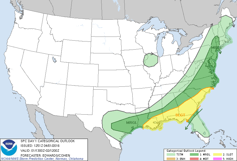
The Storm Prediction Center has our area under a MARGINAL risk for severe thunderstorms into tonight as a cold front approaches. Temperatures are in the 70s across Eastern Pennsylvania, New Jersey and in parts of the Hudson Valley while the marine layer is keeping temperatures in the 60s across Long Island and Coastal Connecticut. In the areas where the marine layer remains it may weaken any thunderstorms as they approach those areas but should the marine layer get dislodged it could create a risk for severe thunderstorms.
Severe Thunderstorm Risk Into Tonight Satellite & Radar Loops


Radars are beginning to show some showers to the west but the first batch is not very impressive. Some showers are beginning to form south and west of us and those have a chance to grow into stronger thunderstorms as we head into the evening hours. The regional radar shows a developing line of thunderstorms across Pennsylvania that is building and moving to the east. We will be watching that line carefully as it moves to the east. It should be approaching our area during the late afternoon and evening in time for the evening rush hour commute.
Once the storm threat ends, there is still the chance for some rain on Saturday as the cold front stalls and a wave develops on the front and moves along it. This could produce a period of rain during Saturday morning and into the early afternoon. Then a large coastal storm will develop east of Long Island Sunday morning which will bring very strong winds of 50 mph or more Sunday morning along with some possible snow squalls. Check the latest links below for all the latest on those issues including the latest snowfall forecast maps and wind gust forecast maps for Sunday.