DOWNLOAD MY NEW FREE JOESTRADAMUS WEATHER APP FOR ANDROID
THE APP IS ABSOLUTELY FREE TO ALL BUT CONSIDERING SUBSCRIBING TO PATREON FOR A WEATHER EXPERIENCE FREE OF ADS, EXCLUSIVE VIDEOS FOR MEMBERS ONLY AND MUCH MORE…STARTS AT $2 A MONTH..MESSAGE ME AT ANY TIME
Seasonal Dry Through Monday Arctic Front Approaches Tuesday
Saturday starts off cold and dry and will finish cold and dry. At least we don’t have any rain or snow this weekend. The only thing to worry about is the extent of cloud cover which will come and go and the fluctuations in temperatures. They will be a little below average today and a little above average Sunday. It means that we are having typical January weather for the last weekend of January! Highs today will reach into the 30s. Highs Sunday will be in the upper 30s and lower 40s. Not much is happening on the radars this morning except for the one strip of snow squalls over Lake Ontario that has been there since yesterday. Areas on I-81 north of Pulaski have been getting hammered overnight in a very narrow east west band. That should wind down today and then more snow is likely in the snow belts upstate on Sunday.
EASTERN SATELLITE

REGIONAL RADAR

Sunday afternoon a cold front comes through with some clouds but nothing more and high pressure builds in from the north for Monday. Sunshine is forecast for Monday with highs in the 30s.
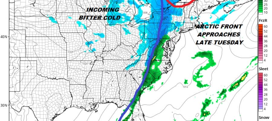
ARCTIC FRONT APPROACHES ON TUESDAY
Weather models overnight didn’t really show too much change with how the arrival of the arctic air plays out. We will likely see arriving clouds with temperatures reaching the upper 30s to middle 40s with some rain showers developing during the afternoon Tuesday. The front will pass in the early evening and the rain will change to snow from west to east. There will likely be about a 6 hour period of snow Tuesday night.
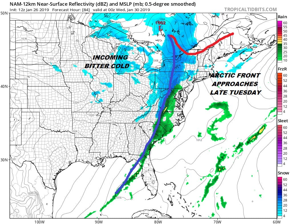
Systems like usually don’t amount to much though snow lovers I think would be content with a coating to an inch and call it a victory. Right now I would think we could see rain changing to snow that leaves a coating to a couple of inches unless something drastic happens. I really didn’t see much in the overnight models or in this morning’s NAM model run to alter that course at the moment. Once the front passes cold air begins to arrive on Wednesday and the coldest temperatures Thursday into Friday.
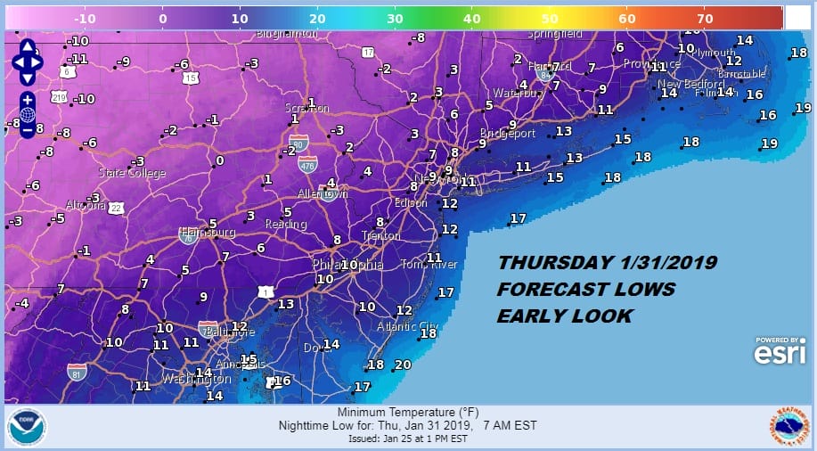
I’m not seeing much here to alter the temperature outlook for later next week either. It looks like single digit lows are a good bet for 2 nights with temperatures to the west getting below zero perhaps. We will update as afternoon weather models come in to see if any altering in the outlook is required.
MANY THANKS TO TROPICAL TIDBITS FOR THE USE OF MAPS
Please note that with regards to any tropical storms or hurricanes, should a storm be threatening, please consult your local National Weather Service office or your local government officials about what action you should be taking to protect life and property.


