Rockies Storm Moving Northeast While Thaw Continues Eastern US

Rockies Storm Moving Northeast Thaw Continues Eastern US
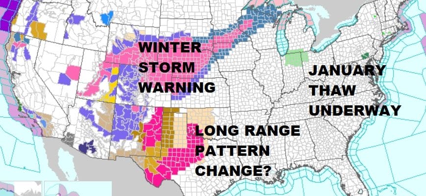
The shift in the upper air pattern is now bringing wintry weather conditions to the Rockies and the Western US with a storm track from there to the Great Lakes. This means that the January thaw is settling into the Eastern US to a certain extent. This will not be a long spell of continuous warmer than average conditions. There will be some shots of cold air along the way. However the air will not be of the extreme arctic nature we have been seeing and the cold shots will be just that. When they come they will last for a couple of days followed by warm ups and some rain. The first such warm up started today with highs reaching the 50s in many areas. We will be dry for Sunday with no serious weather issue to deal with until late Monday when rain could arrive later in the day. In the meantime you can see from the map above that Winter Storm Warnings are posted for much of the Central and Northern Plains and the Upper Midwest which is what you would expect with storms cutting to the Great Lakes.
US SATELLITE

The satellite picture shows some clouds swinging through the Great Lakes tonight. There is going to be a weak front that will ease through here on Sunday which will put us in some cloud cover and also cap the temperatures somewhat.
SUNDAY FORECAST HIGH TEMPERATURES
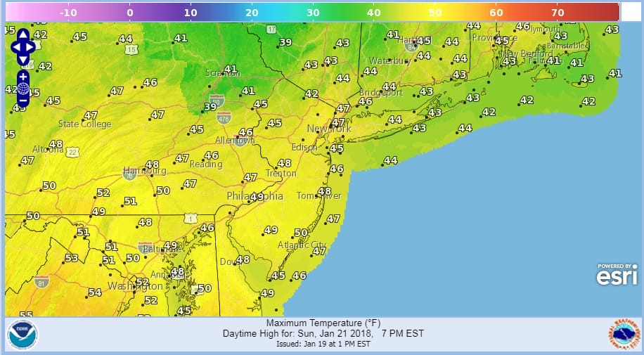
Highs for Sunday should just be in the 40s though we should see some sunshine. Radars are nice and quiet in our area for the time being.
REGIONAL RADAR

Monday we will start to see moisture with clouds as a warm front sets up to the south. We could see some showers with that front later in the day Monday and Monday night with highs in the 40s. Then look for more numerous showers later Monday night into Tuesday as temperatures rise into the 50s Tuesday afternoon. Once the front passes colder air comes in behind it and the rest of next week should be dry and colder with highs back to near or even slightly below average Wednesday through Friday of next week.
The long range would suggest that the thaw pattern could last a couple of weeks and JOESTRADAMUS is already looking for clues regarding if and when the pattern in the Eastern US flips back in early February to something resembling what we just came out of. Read his latest post here.
 GET JOE A CIGAR IF YOU LIKE

FiOS1 News Weather Forecast For Long Island
FiOS1 News Weather Forecast For New Jersey
FiOS1 News Weather Forecast For Hudson Valley