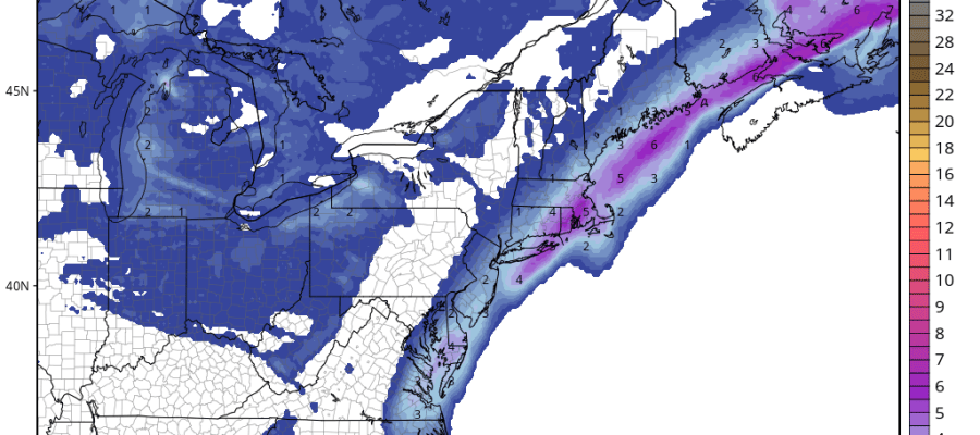
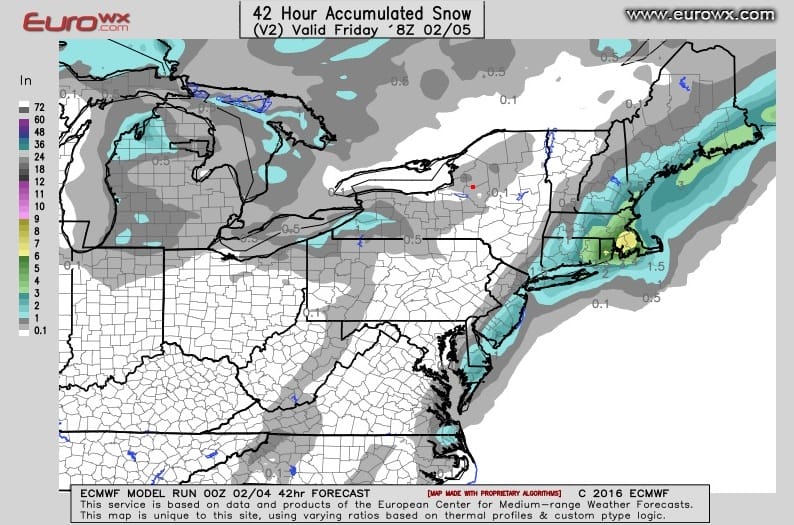
RGEM Model Snowfall Forecast

Tonight’s Canadian RGEM and actually all the models have grown more bullish with regards to the stalled front offshore and a wave developing on that front for Thursday night and Friday. It will be interesting to see how the RGEM performs here. This model has been particularly good in short range situations like this over the past few years. We also have the recent experience of systems offshore being further west than forecast
RGEM Model Snowfall Forecast Surface Maps Friday morning 4am to 10am
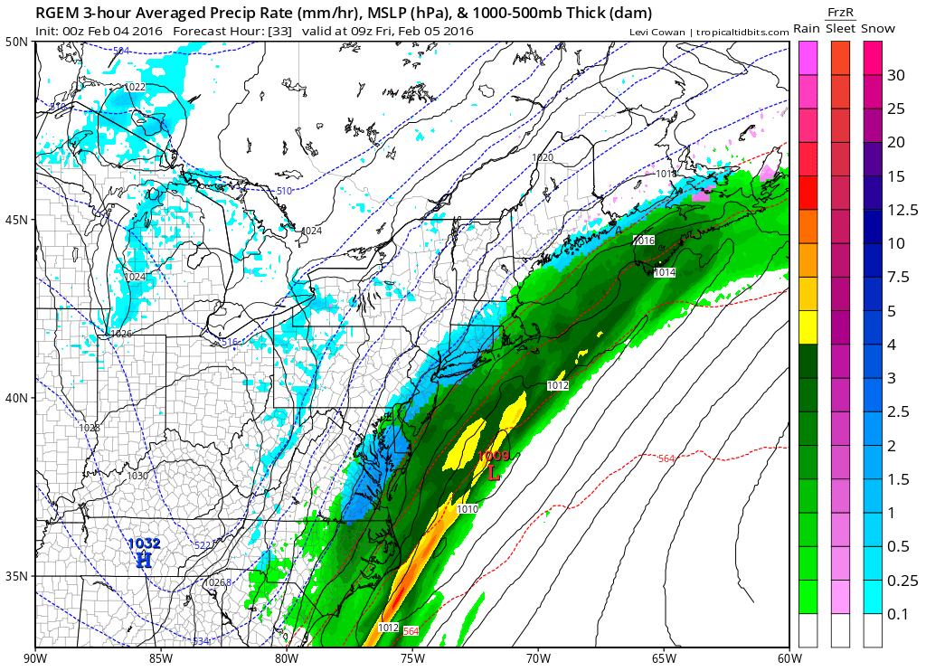
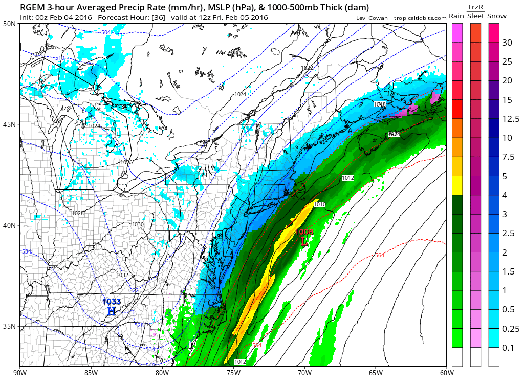
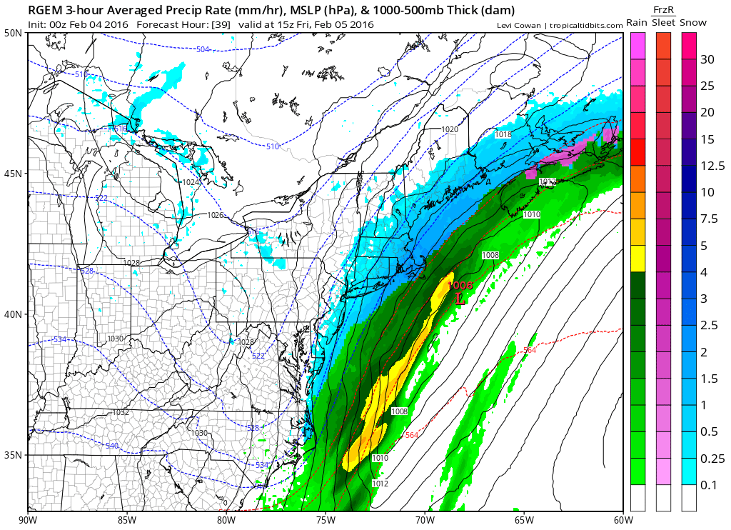
Situations like this can be very tricky. We have two issues. Firstly is whether the RGEM is correct with regards to the second wave. We also have the issue of cold air which the model successfully drains southward from New England in time for the maximum precipitation to arrive. That occurs between 4am and 9am on Friday. We also have to correct the warm low level temperatures through all of this which is an obstacle. All that said what the model does is develops a wave which deepens somewhat as it moves northeast. Through all of this it generates actually a fairly generous amount of snow which is surprising. The model has trended northwest and now even the GFS supports this. The new overnight European is in line with this as well
RGEM Model Snowfall Forecast The European Model View
The light blue area is 1 to 3 inches on the European model and it is also further northwest than the prior run. So it seems the trends on the models remain favorable for this and there is still time for another northwest shift to bring in heavier precipitaion just in time for the Friday morning rush hour.
RGEM Model Snowfall Forecast
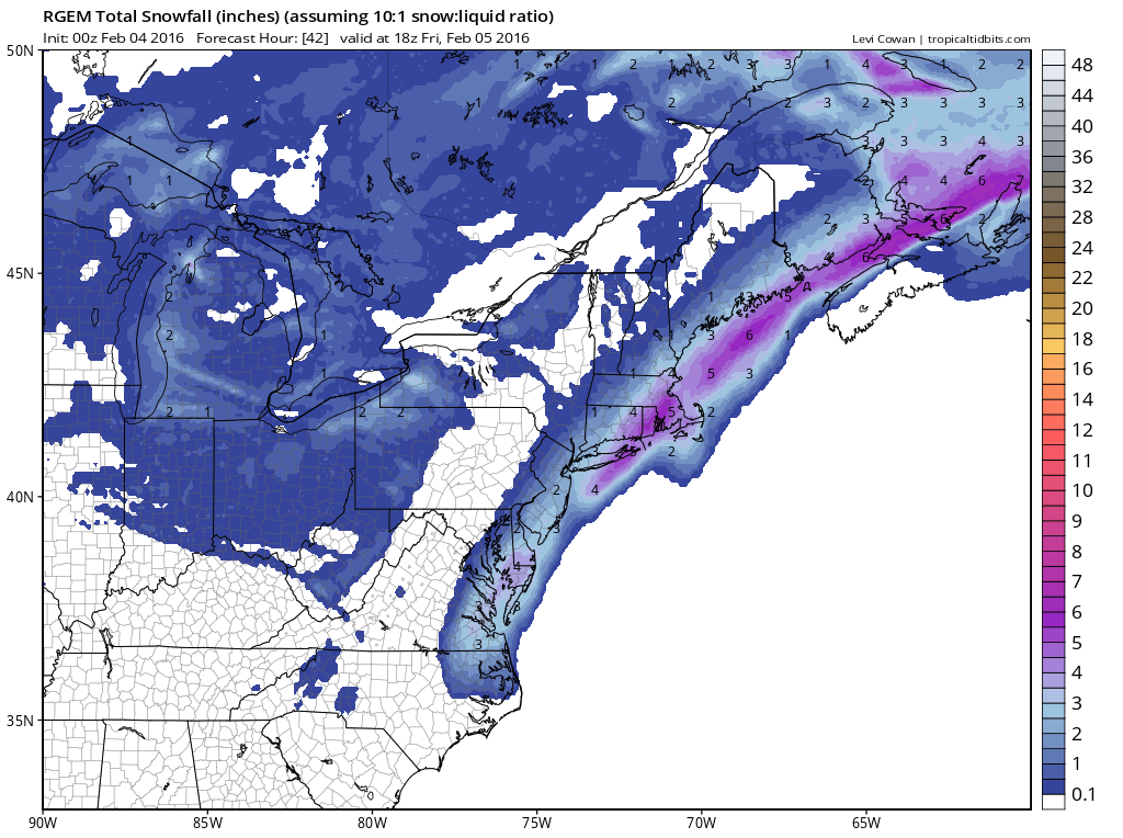
The RGEM Model Snowfall Forecast Map actually has the back edge of 4 inch amounts in Central and Eastern Long Island and through Central and Eastern Connecticut. If you want to be conservative you are left with my forecast snow map which I am leaving unchanged for the moment but my confidence level on this has grown stronger.
I am going to wait until morning to adjust if the mid overnight runs trend further west. At this point its the short range models that will do best. Again we will have to watch how the atmosphere responds to the draining cold air and how cold it gets later Thursday night and Friday morning will be key.
Meanwhile the GFS in the long range is a total mess and trying to figure that out has become an absolute challenge. Here is my latest video regarding the RGEM for late Thursday night Friday morning and the long range GFS model for the early next week storm threat.
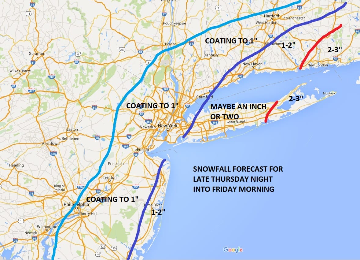
NATIONAL WEATHER SERVICE SNOW FORECASTS
LATEST JOESTRADAMUS ON THE LONG RANGE
Weather App

Winter is here! Don’t be without Meteorologist Joe Cioffi’s weather app. It is a complete weather app to suit your forecast needs. All the weather information you need is right on your phone. Android or I-phone, use it to keep track of all the latest weather information and forecasts. This weather app is also free of advertising so you don’t have to worry about security issues with your device. An accurate forecast and no worries that your device is being compromised.
Use it in conjunction with my website and my facebook and twitterand you have complete weather coverage of all the latest weather and the long range outlook. The website has been redone and upgraded. Its easy to use and everything is archived so you can see how well Joe does or doesn’t do when it comes to forecasts and outlooks.
Just click on the google play button or the apple store button on the sidebar for my app which is onMy Weather Concierge. Download the app for free. Subscribe to my forecasts on an ad free environment for just 99 cents a month.
Get my forecasts in the palm of your hand for less than the cost of a cup of Joe!

![]()


