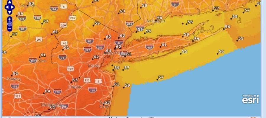
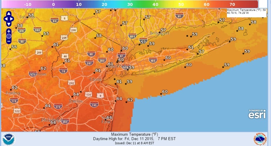
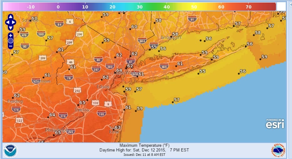
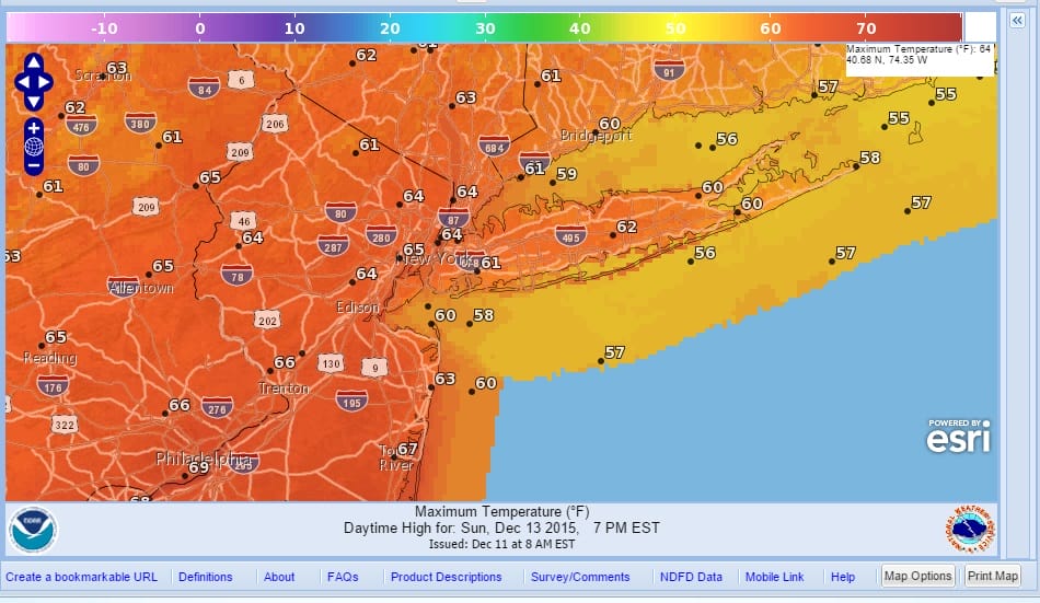
Record Temperatures Through Sunday
More record temperatures will be going by the wayside over the next 3 days from Southeastern Pennsylvania through Southern New England. Low pressure is going by well to the north and west. We have a west to southwest flow through Saturday. Sunday the wind may go more south so that could hold numbers down a bit along coastal areas including Long Island however the bottom line is that we will reach the 60s each day and that will take out records at some places in New Jersey especially central and south Jersey. Here are the forecast high temperature maps for the next 3 days beginning with today.
And of course who better than Meteorologist Brian Fitzgerald to give you your FiOS1 News weather forecast. I will be on tonight beginning at 5pm for Long Island, New Jersey, and Hudson Valley.
No rain is in the forecast through early Monday. The only issue will be nighttime and early morning dense fog that is likely to develop thanks to the long nights and the warm and rather stagnant air mass. Night time temps will drop but probably no lower than the upper 40s to lower 50s. This is certainly a weekend that is about 2 months too late with temperatures running 20 or more degrees above normal.


Radars are quiet this morning and really aren’t a factor until later Sunday when the next storm and cold front begin their approach. This front should bring a decent area of showers and even dare I say it thunderstorms Monday into Monday night before we finally cool off on Tuesday. However by cooling off we are talking about going from 20 degrees above normal to just 10 degrees above normal. We may have to wait later next week on a more substantial cool down to near normal temperatures. Monday should be the last day of record temperatures.
Long range models continue to provide frustration and volatility which I addressed last night in my weather video. Naturally I threw in the towel just before the European came out and the early morning GFS which now put storminess late next week back on the table along with a blocky colder long term look. Prove it to me. You can check my long term video post from last night. It was done in absolute frustration with the day to day model flips. More frustration ahead.
This pattern will not last forever and once it breaks you might want easy access to my weather forecasts and posts. You can get that by downloading my weather app and subscribing to my forecasts for just 99 cents a month. That 99 cents gets you your forecast and your daily Joestradamus long range post without any ads and with no security or tracking issues. Plus that buck goes a long way to paying a few bills for me and that’s a good thing too! This way you can carry me around everywhere! Thank you for making this page a success!
JOESTRADAMUS OVERNIGHT LONG RANGE ANALYSIS