
Record Lows Across The East More Records Today
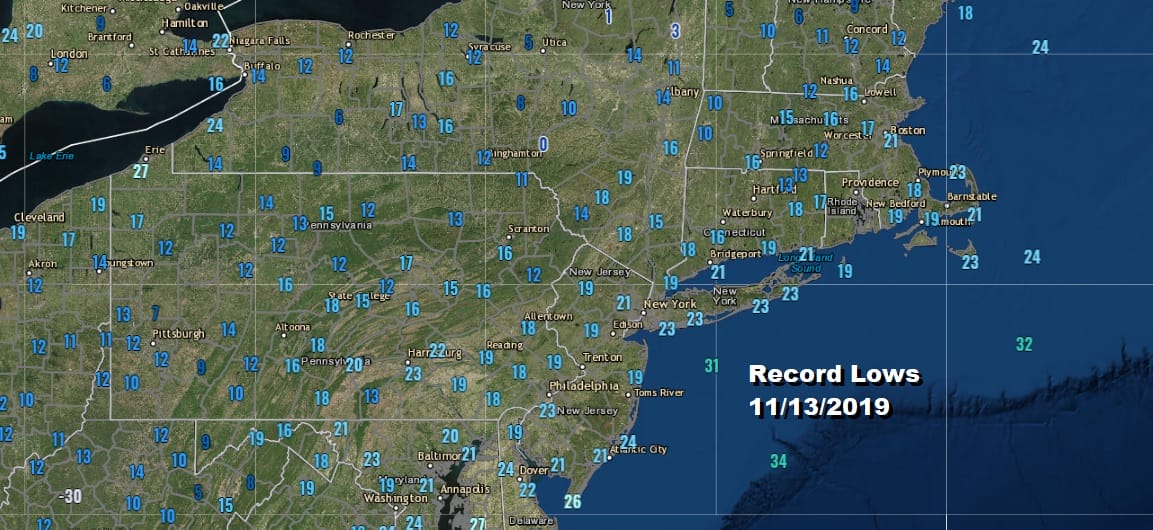
Record lows are the story this morning as we hit bottom in the teens to low 20s across Eastern Pennsylvania to Southern New England. Record lows were also set up and down the East Coast today as the core of this cold air mass moves overhead today. The satellite picture shows us nice and clear and we will enjoy what I call ineffective sunshine today.
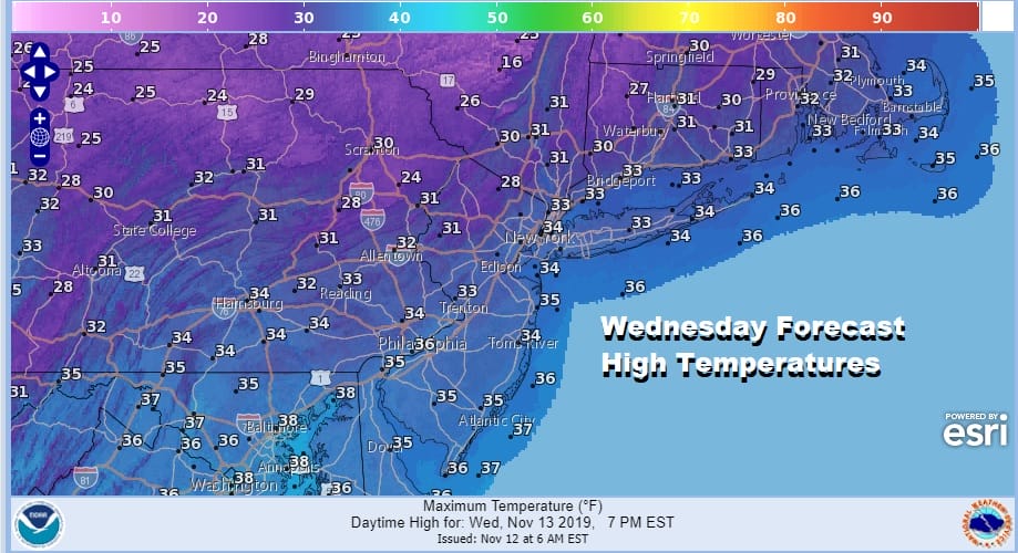
As far as high temperatures are concerned for today, these numbers will also be setting records. Record low high temperatures will be shattered in a number of areas as highs will just barely get back to the low to mid 30s.
SATELLITE

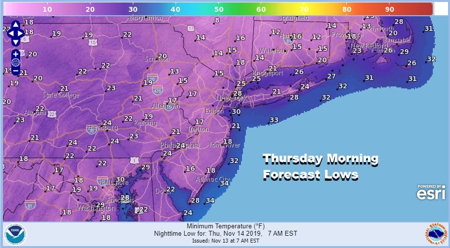
Tonight we could see another round of record lows in our area and over much of the Eastern US though it is a bit trickier tonight. Skies will start clear for the first part of tonight and then we will have to watch and see whether clouds come in during the early morning hours and shuts the cooling down. Urban areas might be a few degrees warmer than what we saw this morning however areas away from warmer urban centers could see lows in the teens. At least winds which are still an issue this morning will be easing a bit as the day wears on and winds will be light overnight.
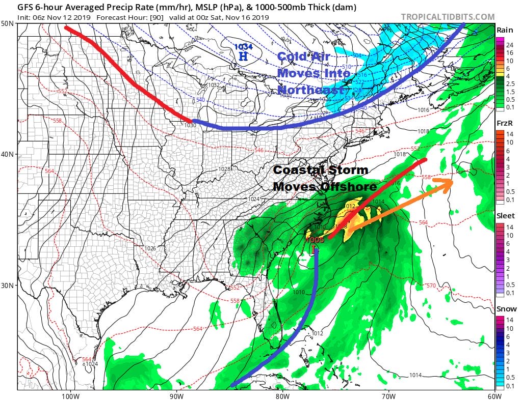
Thursday the high moves offshore and we will have a bit of an onshore flow. Cold air overrunning a warm ocean will likely produce some clouds Thursday though temperatures should bounce back into the 40s. This is still well below normal for this time of year.
Friday we will see a better bounce in temperatures. We will be lying in between a cold front to the north and low pressure off the North Carolina coast. Rains will be occurring along the Southeast coast along with gale force winds. None of that is coming here as the upper flow is split. The northern jet is bringing down that cold front from the north and another high with cold air builds in for the weekend.That air mass is cold but it is not quite as extreme as this one is.

Of the two weekend days I think Saturday is the better one from the standpoint of getting some sunshine but highs Saturday will be hard pressed to get out of the 30s. Sunday we will start to see clouds come on due to the strengthening onshore flow between the high to the north and the gale center developing off the East Coast. So look for cloudy skies Sunday with highs in the 40s. That coastal low could bring rain close to the coast Sunday evening especially from South Jersey southward. The rain could then push northward for later Sunday night and Monday. We will be looking at this system later today along with another one that follows. The answer to the question that you are about to ask is that there is no cold air so this is rain and nothing else.
BE SURE TO DOWNLOAD THE FREE METEOROLOGIST JOE CIOFFI WEATHER APP &
ANGRY BEN’S FREE WEATHER APP “THE ANGRY WEATHERMAN!
MANY THANKS TO TROPICAL TIDBITS FOR THE USE OF MAPS
Please note that with regards to any severe weather, tropical storms, or hurricanes, should a storm be threatening, please consult your local National Weather Service office or your local government officials about what action you should be taking to protect life and property.


