
Rain Warmer Temps Arriving
Rain Warmer Temps Arriving
The latest satellite loop below shows the approaching warm front to the south. This is going to bring even warmer air up the east coast an ahead of it we will see rain overspreading the area tonight. There could be a few heavier downpours before the rain pulls out in the morning.

Radars are loading up to the south of us. It looks like we could get about a half inch of rain in some places. Between the rain and the melting snow today, we continue to make inroads on the long term drought.


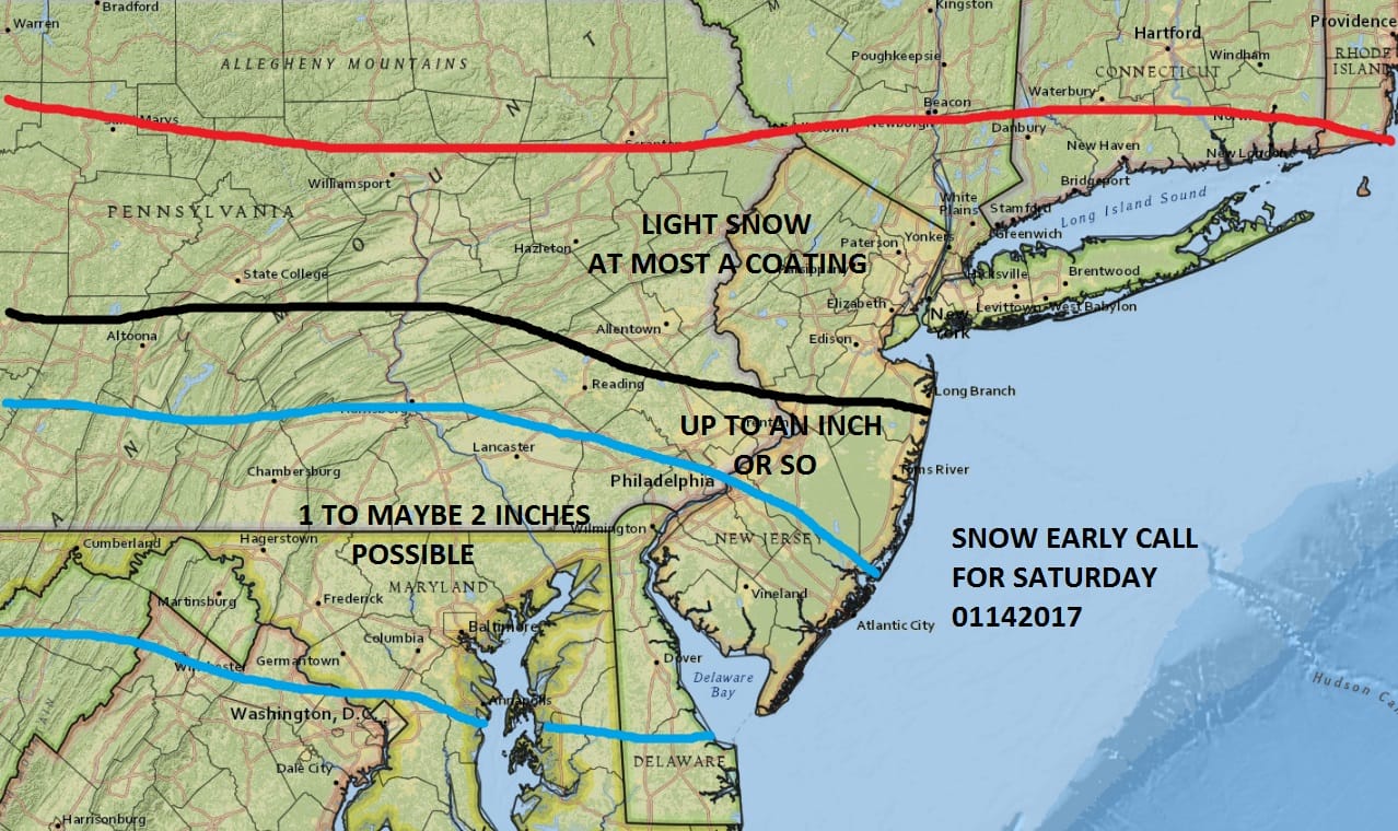
Once the rain leaves before daybreak, we should see some breaks of sunshine develop during the day on Thursday and temperatures could reach 60 or better in many areas. But another front moves through Thursday night and behind it cold air returns for Friday and the weekend. Saturday many areas will probably not get out of the 20s. That hinges on clouds and whether we get any snow. A weak wave will be moving by to our south. Late afternoon weather models seem to be a little more robust again with snow however this will be a MINOR event if it happens.
LATEST NAM MODEL FOR FRIDAY AND SATURDAY CLICK TO ANIMATE
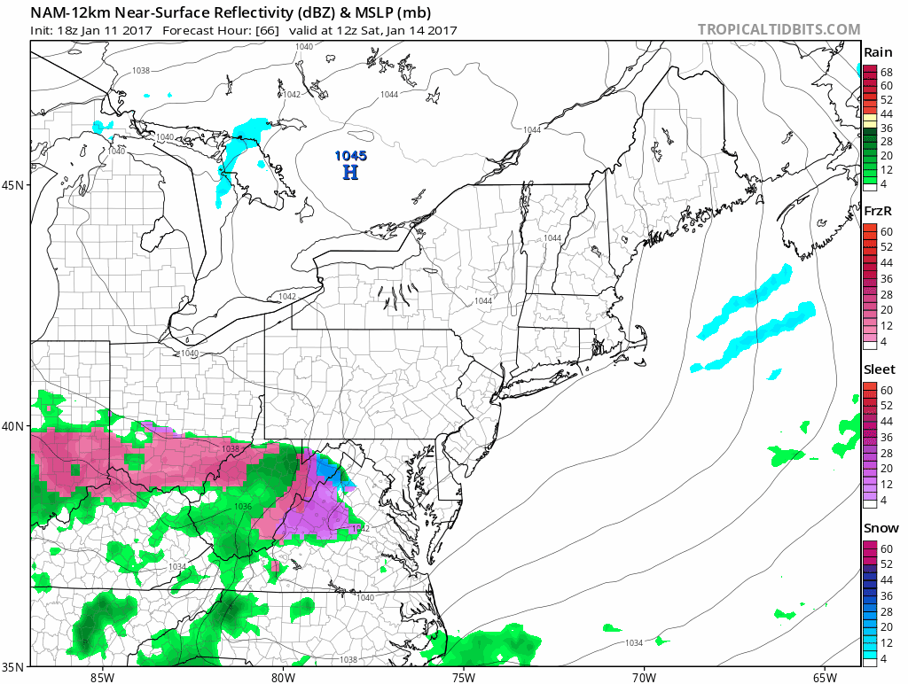
The latest NAM model shows a more intact system moving through and brings snow to New York City and Long Island Saturday evening which is going back to what longer range models were showing for days. Other models seem to be mixed on all this so we will continue to watch and wait. There are no changes at this time to my snow forecast map.
SNOW REMOVAL COMPANIES FOR YOUR WINTER NEEDS
LONG ISLAND ROCKLAND COUNTY Connecticut

![]()

ROCKLAND COUNTY TRI STATE SNOW REMOVAL JOHNSTOWN PA


FiOS1 News Weather Forecast For Long Island
FiOS1 News Weather Forecast For New Jersey
FiOS1 News Weather Forecast For Hudson Valley
NATIONAL WEATHER SERVICE SNOW FORECASTS
LATEST JOESTRADAMUS ON THE LONG RANGE
Weather App

Don’t be without Meteorologist Joe Cioffi’s weather app. It is really a meteorologist app because you get my forecasts and my analysis and not some automated computer generated forecast based on the GFS model. This is why your app forecast changes every 6 hours. It is model driven with no human input at all. It gives you an icon, a temperature and no insight whatsoever.
It is a complete weather app to suit your forecast needs. All the weather information you need is right on your phone. Android or I-phone, use it to keep track of all the latest weather information and forecasts. This weather app is also free of advertising so you don’t have to worry about security issues with your device. An accurate forecast and no worries that your device is being compromised.
Use it in conjunction with my website and my facebook and twitter and you have complete weather coverage of all the latest weather and the long range outlook. The website has been redone and upgraded. Its easy to use and everything is archived so you can see how well Joe does or doesn’t do when it comes to forecasts and outlooks.
Just click on the google play button or the apple store button on the sidebar for my app which is on My Weather Concierge. Download the app for free. Subscribe to my forecasts on an ad free environment for just 99 cents a month.
Get my forecasts in the palm of your hand for less than the cost of a cup of Joe!


