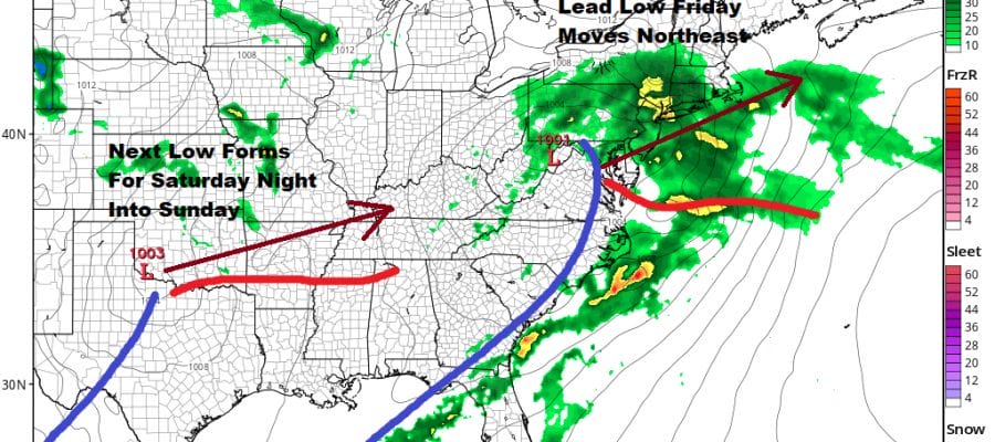
Rain Tonight Into Friday More Rain Saturday Night Into Sunday
We are seeing the first 2 low pressure systems head east with clouds overhead. This has been the case since the get go this morning. Some areas even saw a narrow band of light snow and sleet that broke out giving those who saw it the feeling that maybe locusts are next. This is going to be a wet stretch of weather for sure with only a narrow period of dry weather developing late Friday night and at least lasting through the daytime Saturday.
SATELLITE

REGIONAL RADAR

Radars are starting to load up across the Mid Atlantic states with light to moderate rain showing up on the regional radar and we should see the coverage increase on the local radars later this evening and of course overnight.
LOCAL RADAR NEW YORK CITY

LOCAL RADAR PHILADELPHIA


Temperatures overnight will be in the 40s in most places with a raw northeast to east wind developing. Friday rain should last until late morning Southern Pennsylvania and Southern New Jersey and until early afternoon from NYC north and east. Temperatures might find their way into the 50s once the rain ends.
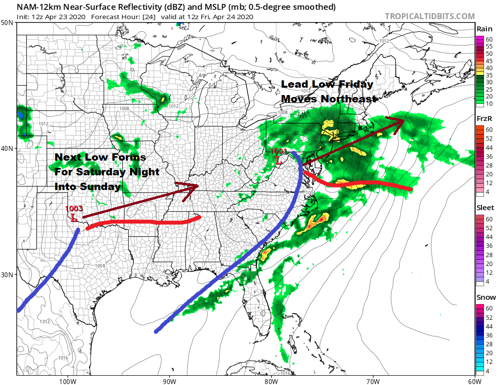
The first low Friday morning will be over West Virginia and redevelop just off the coast of New Jersey and Long Island before heading northeast while the second low starts to develop in the Southern Plains and that heads our way for Saturday night and Sunday. This allows Saturday to be dry so take advantage of that. We should see some sun early before more clouds burst on the scene as the day wears on.

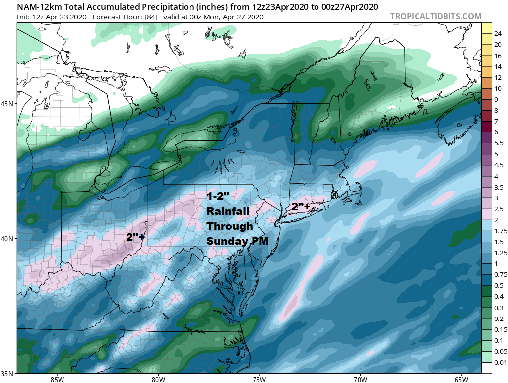
This system is going to take awhile to get out of the way so we will some rain on Sunday and some lingering rain or showers into at least part of Monday. Once it exits we should start to see some improvement and we could actually see dry weather on Tuesday with some sunshine.
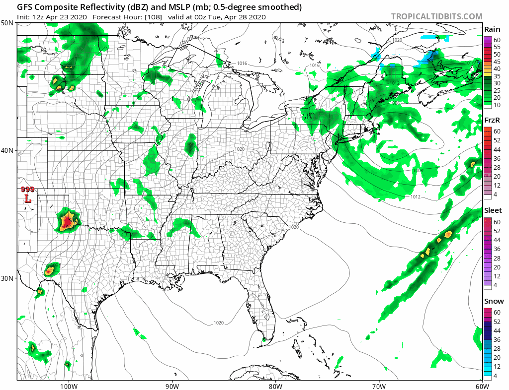
However as is often the case in mid spring, and certainly in this weather pattern the next weather system follows. This one looks to track further north so it will come through like a cold front though there will be a fair amount of moisture ahead of it. Look for showers and maybe even a thunderstorm or two later Wednesday into Wednesday night. As far as temperatures are concerned it will be generally be 50s when it isn’t raining and 40s when it is until we get to Tuesday and Wednesday when we could see 60s both days. Once again the advice is to enjoy the dry weather days (Saturday and Tuesday) as they are only minor interruptions in the primary wet pattern.
BE SURE TO DOWNLOAD THE FREE METEOROLOGIST JOE CIOFFI WEATHER APP &
ANGRY BEN’S FREE WEATHER APP “THE ANGRY WEATHERMAN!
MANY THANKS TO TROPICAL TIDBITS FOR THE USE OF MAPS
Please note that with regards to any severe weather, tropical storms, or hurricanes, should a storm be threatening, please consult your local National Weather Service office or your local government officials about what action you should be taking to protect life and property.


