
Rain Thursday Ushers In Cold Air
We have begun a gradual cool down. Honestly it feels like a warm March day outside with a gusty warm wind and temperatures still hovering close to 60 degrees. Cooler air will begin to slowly work in tonight and on Wednesday as temperatures trend downward for the rest of the week but they are still going to be well above normal through Thursday. To get the “cold” air in we need another cold front to move on through and that will come in the form of a developing wave on that front. All the models show this idea and we could get a decent shot of rain out of this as the wave goes by.

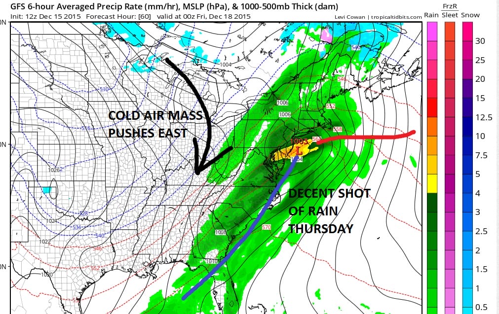
Actually the magnitude of the cold air mass is more impressive aloft than it is on the surface. Snow cover in Canada is lacking and the cold air is not of true arctic origin anyway so it will be enough to bring temperatures down to near normal and not much more. Rainfall forecast from the gfs model is about an inch or so with higher amounts south and east and less as you go north and west. This makes sense given the track of the wave.
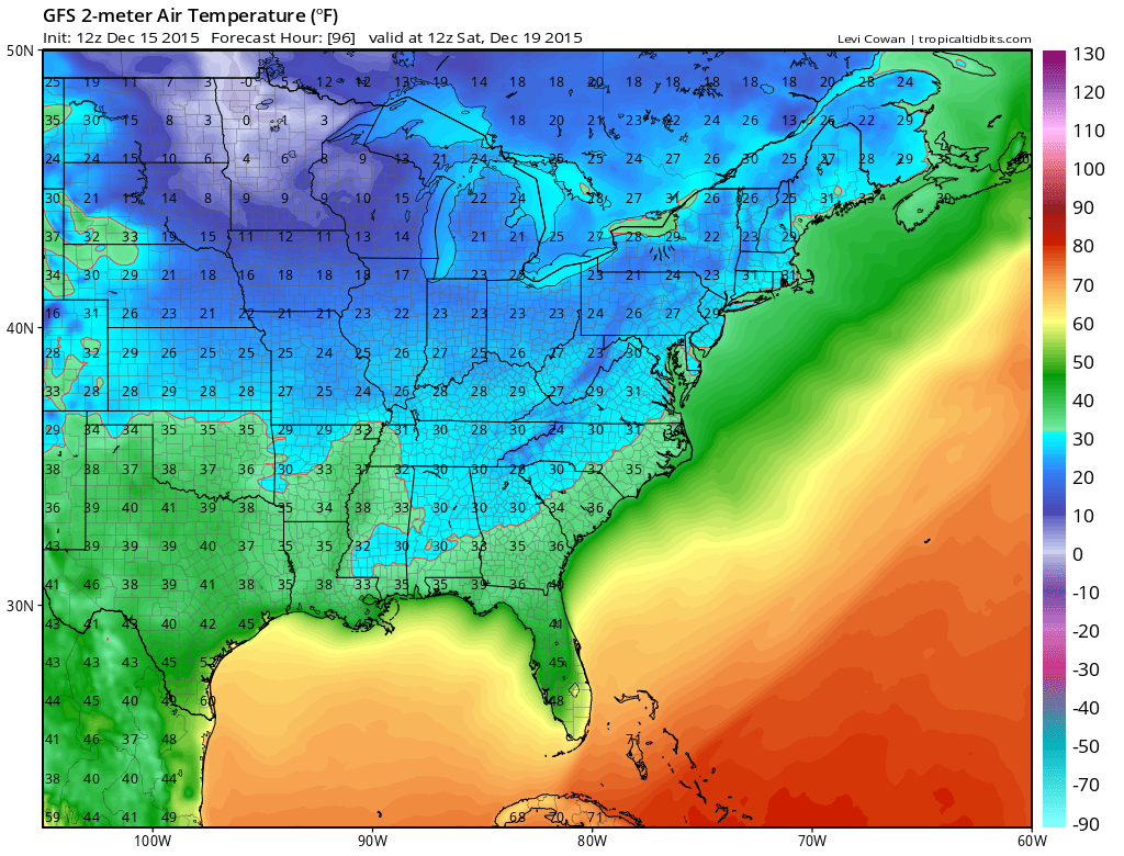
The temperature map is for Saturday morning and it is fairly cold by recent standards. When you go from 70 to 30 you will notice it especially during the daytime hours with a gusty wind on top of that. It is possible that Saturday we might not see temperatures out of the 30s or at best near 40. Saturday night will be cold in most areas but with the upper trough moving out on Sunday temperatures will begin to bounce. The long range forecast from this morning indicates that the blow torch pattern resumes next week and more record highs are not impossible.
One note about December. This is going to be the warmest on record by a mile. It may shatter the record by several degrees. I want to remind everyone that when you look back at the 10 warmest Decembers, in the months that followed NOT A SINGLE WINTER PRODUCED ABOVE NORMAL SNOWFALL! NOT ONE! Remember I’m talking snowfall now. Im not talking temperatures. Also just do the math. December is 1/3 of the winter. If it finshes say +10 or more above normal, then the next 2 months are going to have to finish -10 degrees below normal just to make the numbers come out even. That is going to mean that a monumental pattern change will have to take place in order for that to work out. Any one willing to take a bet on this?
JOESTRADAMUS VIDEO ANALYSIS 12/15/2015


