Rain Thunderstorms & Severe Weather Ahead of the Weekend Tropics Heating Up
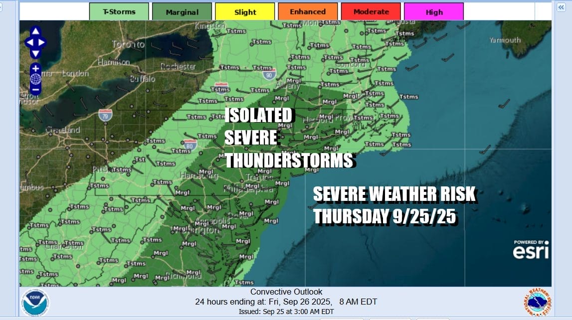
We have a solid soaking rain setting up for today and tonight and it comes with severe weather risk as well. A cold front is heading eastward and the Storm Prediction Center is indicating a marginal risk for isolated severe thunderstorms to be in the mix this afternoon into tonight. We also have tornado risk though it is low. There is the chance for one or two isolated tornadoes to be in the mix as well.
We should be able to get a solid inch or maybe even 2 inches of rain out of this system today as the front nears and low pressure heads northeastward across Lake Ontario and eventually up into Eastern Canada. Showers and thunderstorms this evening will gradually taper off. It is rather warm and humid through all of this and most highs today will be in the muggy 70s. Some warm spots could touch the 80 degree mark in South Jersey and points southward. Everyone else should stay in the 70s.
SATELLITE WITH LIGHTNING STRIKES
WEATHER RADAR
Rain should be long gone by daybreak Friday and we will spend the day slowly improving with decreasing clouds and perhaps some sunshine developing. Temperatures Friday will be in the 70s to around 80 degrees. As we head into the weekend out attention will turn to the south. We will have the frontal boundary stalling out to the south and we also will be watching an area east of Florida and near the Bahamas as weather models are pointing to low pressure developing out of a tropical wave now moving through the Dominican Republic.
This is a very complex situation as we also have Tropical Storm Humberto this morning northeast of the Leeward Islands. Overnight models have changed regarding its track as it heads more west than north. This change is due to a strong ridge that develops in the mid latitudes in the Atlantic north of Bermuda and into the Northeast. This may open the door for the wave in the Bahamas to develop into a tropical storm and move northward. If this shift in the models continues it will be needed to be monitored very closely. As far as the weekend is concerned, Saturday should be okay with some sunshine, an onshore wind and highs in the 70s. Sunday some moisture from the Mid Atlantic could sneak northward with clouds and perhaps some patchy showers pushing into New Jersey or even into Southern New England. There is some uncertainty about this as well. Sunday highs will be in the 70s. We will have more on this and the tropics later today on our subscription platform on Patreon. We will also have complete coverage and analysis tonight on the Joe & Joe Weather Show Podcast at 7:35pm on Youtube.
BE SURE TO DOWNLOAD THE FREE METEOROLOGIST JOE CIOFFI WEATHER APP &
ANGRY BEN’S FREE WEATHER APP “THE ANGRY WEATHERMAN!
MANY THANKS TO TROPICAL TIDBITS FOR THE USE OF MAPS
Please note that with regards to any severe weather, tropical storms, or hurricanes, should a storm be threatening, please consult your local National Weather Service office or your local government officials about what action you should be taking to protect life and property.