Rain Thunder Tuesday Colder Late Week
Rain Thunder Tuesday Colder Late Week
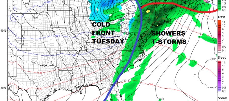
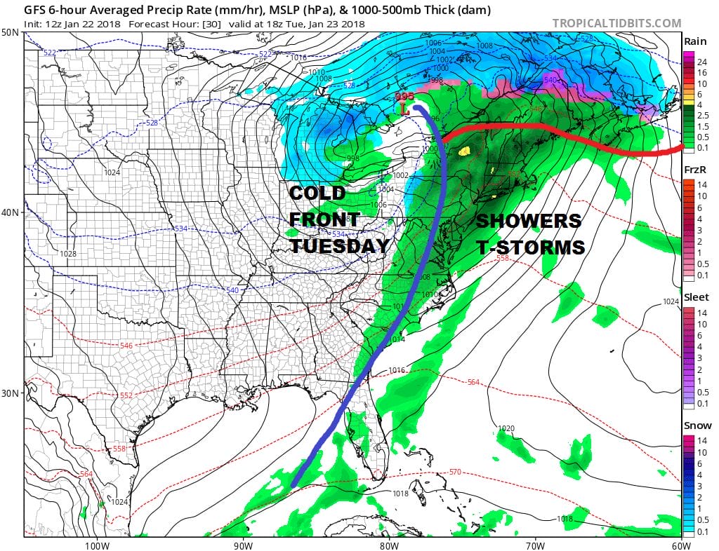
We have a warm front setting up to our south this evening which is keeping temperatures on the damp chilly side (relatively speaking). Some showers continue to dot the radar in a few places and that should remain the case for awhile tonight. However as a storm heads for the Great Lakes and the warm front pushes northward, we are setting up for more numerous showers late tonight and Tuesday along with the chance for a few thunderstorms to get into the mix.
US SATELLITE

REGIONAL RADAR

Radars are showing some scattered showers this evening running around in a few places but not enough to cause any serious issues.
LOCAL RADAR NEW YORK CITY

LOCAL RADAR PHILADELPHIA


Once the front moves through late Tuesday, the rain will end and colder air comes in for the rest of the week with near or below average temperatures into Friday. Since the pattern is transient and the main jet stream remains in the west, another warm up will develop over the weekend followed by another shot of cold air coming in next week for a few days. This up and down pattern continues until we see a major shift in the long range. Regarding that idea, evidence is mounting that such a change will be taking place early next month.
FOR MORE ON WINTER 2017-18 PART 2 CHECK JOESTRADAMUS’S LATEST POST HERE.
 GET JOE A CIGAR IF YOU LIKE

FiOS1 News Weather Forecast For Long Island
FiOS1 News Weather Forecast For New Jersey
FiOS1 News Weather Forecast For Hudson Valley