Rain Into Thursday Morning Strong Wind Gusts Thursday Into Early Friday
As Hurricane Erin Passes Offshore
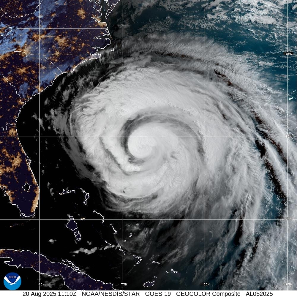
Hurricane Erin is gaining latitude now as it moves northward and eventually will make a turn to the northeast later tonight and Thursday. Nothing has changed in the overall forecast outlook regarding Erin. Yes the hurricane will pass about 400 miles to the southeast of New Jersey and Long Island Thursday night. The main issue is going to be gusty winds above gale force threshold (at least 39 mph) for coastal areas from New Jersey to Long Island and coastal Southern and Southeastern New England Thursday into Friday morning.
SATELLITE WITH LIGHTNING STRIKES
WEATHER RADAR
Ahead of Erin today we have an upper trough that is moving eastward across the Northeast and thankfully so. This upper trough is the reason why Erin will turn northeastward and track out into the Atlantic rather than move all the way up the East Coast. We are going to see some showery rains from the upper trough later today and overnight into Thursday morning. There might be a few heavier downpours in the mix. Highs today will be mostly in the 70s thanks to the onshore flow from the east and southeast.
It will likely turn a little breezy along coastal locations today and then winds will pick up tonight from the east and then gradually turn northeast and then eventually northerly during Thursday. Winds inland will likely gust 20 to 30 mph at times and along the immediate coast we will see winds gusting 35 to 50 mph during the day Thursday. Much of the rain from the upper trough will be done by daybreak and then we will see leftover clouds and maybe some sunshine developing during the afternoon. Temperatures at best will be in the upper 60s to lower 70s for highs Thursday which is unusually cool for this time of year.
We will see improvement Friday along with higher temperatures with sunshine taking highs back into the 80s away from the ocean. As far as the weekend is concerned we have another cold front that will be headed our way and this front marks the leading edge of rather cool air. Saturday and Sunday highs will reach the 80s each day away from the ocean. We see the risk for some showers or a thunderstorm Sunday as the front passes.
BE SURE TO DOWNLOAD THE FREE METEOROLOGIST JOE CIOFFI WEATHER APP \&
ANGRY BEN’S FREE WEATHER APP “THE ANGRY WEATHERMAN!
MANY THANKS TO TROPICAL TIDBITS FOR THE USE OF MAPS
Please note that with regards to any severe weather, tropical storms, or hurricanes, should a storm be threatening, please consult your local National Weather Service office or your local government officials about what action you should be taking to protect life and property.