Friday Night Saturday AM Rain
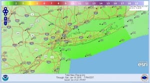
Friday night Saturday AM Rain is in the forecast. However the noreaster conditions that models were depicting earlier will be minimized as the storm center moves further south and it will not be as intense as previously indicated. There will be no serious snow issues from this anywhere in my view as the precipitation shield is not impressive and there is no cold air around to support a big snow even in normally colder areas to the north. Such is the winter of 2015-2016. You can have a hurricane in the Atlantic for the first time since 1955 but you can’t get a winter storm in the east. You can’t even get a few inches!
Friday Night Saturday AM Rain
Satellite loop shows us still fighting some clouds that are streaming across the Great Lakes. That cloud cover should diminish some tonight to allow for some partial clearing of skies. Temperatures overnight will drop in the mid 20s to lower 30s. With the core of the cold air moving out temperatures will continue to moderate on Friday. We will see more arriving clouds from the south. You can see them building in the Gulf States as low pressure there begins to organize and eventually head for the Carolinas Friday night.
Radar is showing lake effect snows pounding parts of upstate NY on the Eastern shores of Lake Ontario. That too should diminish as winds begin to shift from the west to the south and cut off the moisture source. Amounts up there continue to be measured in feet.


Friday night Saturday AM rain will be on the order of about half an inch to aninch. We will see some rain with gusty winds along the coast. The threat for coastal however is diminished some as the northeast wind will be minimal. The storm further south and east prevents any serious issues. Saturday afternoon weather conditions should begin to improve.
Long Range Analysis regarding Hurricane Alex
Friday Night Saturday AM Rain Forecast
Long range for Sunday and Monday will see the arrival of much colder air. The arrival may come with some snow Sunday night and Monday as an upper air disturbance moves through. The GFS weather model was trying to make a more serious storm along the coast however this idea is not going to happen as the upper air support for an east coast storm simply isn’t there. Still there could be a cheap thrill Sunday night into Monday for some area snow lovers as the cold air arrives.
NATIONAL WEATHER SERVICE SNOW FORECASTS
LATEST JOESTRADAMUS ON THE LONG RANGE
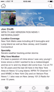
Weather App
Winter is here! Don’t be without Meteorologist Joe Cioffi’s weather app. It is a complete weather app to suit your forecast needs. All the weather information you need is right on your phone. Android or I-phone, use it to keep track of all the latest weather information and forecasts. This weather app is also free of advertising so you don’t have to worry about security issues with your device. An accurate forecast and no worries that your device is being compromised.
Use it in conjunction with my website and my facebook and twitterand you have complete weather coverage of all the latest weather and the long range outlook. The website has been redone and upgraded. Its easy to use and everything is archived so you can see how well Joe does or doesn’t do when it comes to forecasts and outlooks.
Just click on the google play button or the apple store button on the sidebar for my app which is onMy Weather Concierge. Download the app for free. Subscribe to my forecasts on an ad free environment for just 99 cents a month.
Get my forecasts in the palm of your hand for less than the cost of a cup of Joe!


