
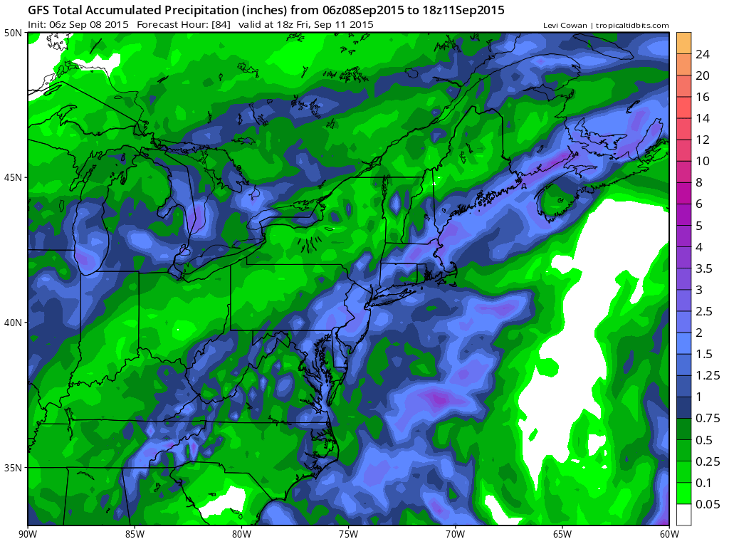
The pattern at least temporarily has opened up to allow for some rain and there are potentially 2 event over the next 7 days which is more than we have seen over the last 3 months. The map above is the forecast rainfall from the first weather system which is coming through for Wednesday night through Thursday night. The latest on this is at the Joe’s forecast page. This map updates the rainfalls which on the GFS and other models remain rather generous in the 1 to 3 inch rain. I think it is probably wise to forecast underneath the models as they have under performed throughout this entire dry spell. 1 to 2 inches appears to be in order at least and will gladly bust on the low side.
Now as far as the weekend goes this is the system we have been struggling with over the last week or so as models come and go and have it there one minute and then gone on the next. The three models have seemed to have settled on the idea that a deep trough will attempt to set up in the eastern states. The European and the Canadian models are the most vigorous with this.
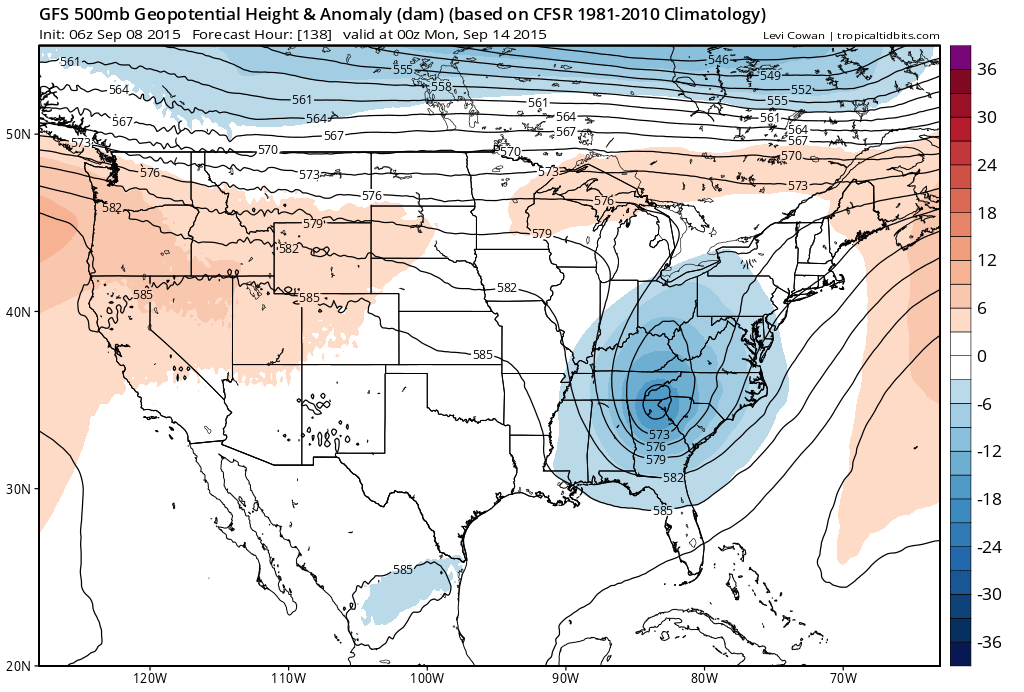
The gfs model is above and the other 2 models are below. The gfs drops the upper support well south and separates it from the stronger flow to the north. This would not produce much rain here and is the least aggressive of all the models. Both the Canadian and the European would argue for a big area of heavy rain to develop under the upper support. The European would probably keep the heaviest rains from New York City westward but it would be a substantial rainfall for much of the area. The Euro holds the upper low as it moves it northeast. Heavy rain could fall late Saturday into early Sunday morning.
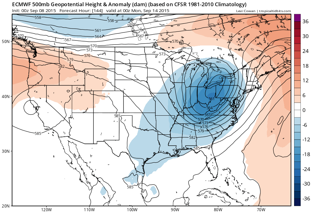
The Canadian is the slowest of the three and takes the upper low right over New York City. That option could be quite the rain maker for the coast and highly desirable given how dry things are.
 In fact the 7 day rainfall forecast on the Canadian is really on the high end of anyone’s expectations with 6 inch plus rainfalls. This is cumulative over the next 7 days.
 The Canadian solution which would be great from the standpoint of rain and making up the rain deficit in a hurry is at this point way overdone but even if you cut it in half to say 3 to 4 inches cumulative, it looks possible. The keys to all this lie in which model has the better idea on how to handle the next weather system. The european has been more consistent with this lately which is probably a good compromise between the over deep Canadian and the weaker overly south GFS. Let’s see where the models take us later today.