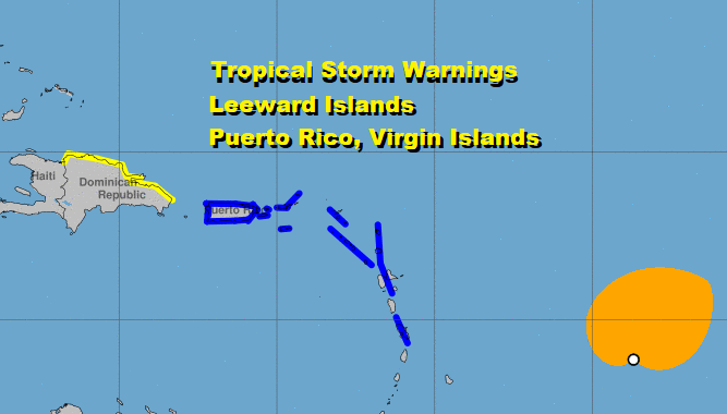
Potential Tropical Cyclone 9 Tropical Storm Warnings Leeward Islands
Latest satellite loops show disturbed weather with the low pressure system east of the Leeward Islands continues to become better organized. The low center remains broad and convection is beginning to form around the circulation center. If this trend continues we could have the seasons 9th tropical storm late today or tonight and this will set another record as the earliest 9th storm on record. There are entire seasons that don’t see 9 storms in total.
POTENTIAL TROPICAL CYCLONE 9

LOCATION…13.8N 53.7W
ABOUT 585 MI…940 KM ESE OF THE LEEWARD ISLANDS
MAXIMUM SUSTAINED WINDS…40 MPH…65 KM/H
PRESENT MOVEMENT…W OR 280 DEGREES AT 23 MPH…37 KM/H
MINIMUM CENTRAL PRESSURE…1007 MB…29.74 INCHES
A Tropical Storm Warning is in effect for Puerto Rico, Vieques, Culebra, U.S. Virgin Islands, British Virgin Islands, Antigua, Barbuda, Montserrat, St. Kitts, Nevis, Guadeloupe, Martinique, St. Martin, Saba, and St. Eustatius, & St Maartin. I’m going to pull out a few sentences in the National Hurricane Center’s discussion.
It cannot be stressed enough that since the system is still in the formative stage, greater than average uncertainty exists regarding both the short-term and longer-term track and intensity forecasts.
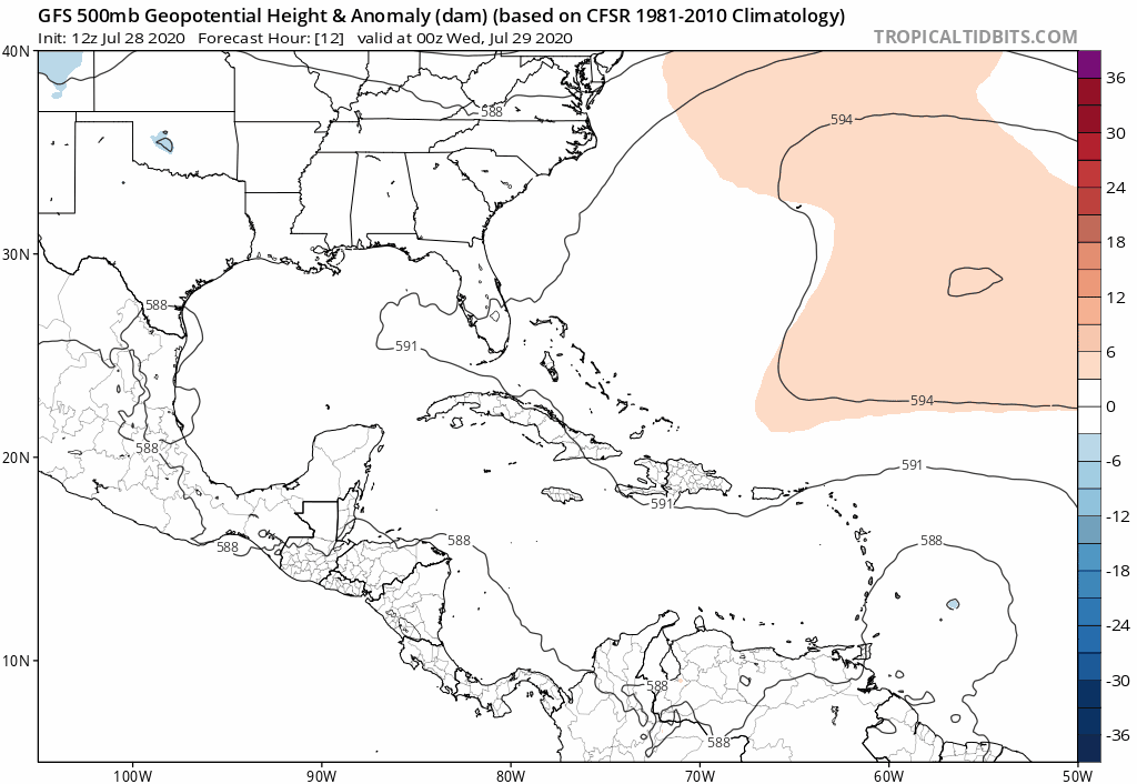
A subtropical ridge that extends westward from the central Atlantic is expected to be the dominant steering mechanism over the next several days, and the flow around this ridge should steer the low
pressure area generally west-northwestward. However, the details in the track forecast could change depending on exactly where within elongated circulation the center forms.
We discussed the players in our Patreon post yesterday with regards to the upper ridge in the Atlantic and the shortwave dropping down from the Plains into the lower Mississippi Valley. Follow the low or closed circle over the islands and its move northwestward. The upper ridge weakening and the short wave trough that drops down into the lower Mississippi Valley open up a rather wide alley way for this system to travel.
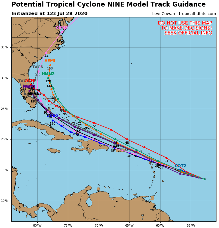
Most of the hurricane tracking models take this over the Leeward Islands or just to the north of them and then northwestward to the Florida Straits and the Bahamas late this week and into the weekend. All of this depends on whether this system develops a closed center and into a tropical storm. A weaker less developed system would likely respond to the stronger low level easterlies and head more to the west rather than to the north. The big key is that this system develops in a tropical storm and then we can start to resolve the track.

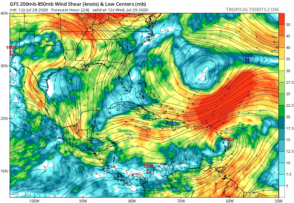
Another issue here is wind shear which lies to the north of the track and this will be a player here. It is likely the reason why the GFS weakens this system as it heads toward Florida.
We will be watching for the development of a closed center with convection near the center late today and get that rectified. Then we can speculate with a bit more confidence going forward.
BE SURE TO DOWNLOAD THE FREE METEOROLOGIST JOE CIOFFI WEATHER APP &
ANGRY BEN’S FREE WEATHER APP “THE ANGRY WEATHERMAN!
MANY THANKS TO TROPICAL TIDBITS FOR THE USE OF MAPS
Please note that with regards to any severe weather, tropical storms, or hurricanes, should a storm be threatening, please consult your local National Weather Service office or your local government officials about what action you should be taking to protect life and property.