Perfect Summer Sunday
Spectacular Weekend Continues
Perfect Summer Sunday
Thunderstorms Late Monday Night & Tuesday
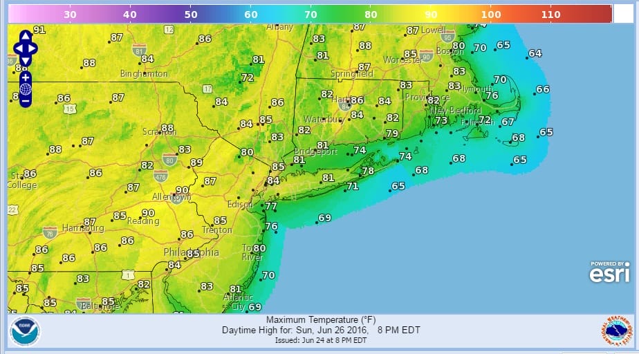
The first full weekend of summer continues with another beautiful day setting up for a perfect summer Sunday with lots of sunshine, comfortable humidity for the most part and temperatures in the reasonable 80s..cooler along the shore. The satellite loop shows the extent of the dry air that covers all of the Northeast, Middle Atlantic States and Midwest. The next cold front is still 2 days away and will not arrive until late Monday night early Tuesday morning. Monday will be mostly sunny. The real heat remains in the Central Gulf States westward and if you look on the loop you can see strong thunderstorms that develop from St Louis southeastward to Western Georgia. This is really where the borderline is between the very hot air and the much more pleasant air mass. There are no signs of any of that heat coming here anytime soon if at all.


Perfect Summer Sunday
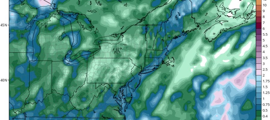
The next front on Tuesday will get hung up overhead so this at least affords the opportunity for some much needed rain for some areas. Northern New Jersey northeasward to Southern New England is in a moderate drought situation with rainfall deficits of 5 to 7 inches over most areas. However it should be noted that many upstate water sources are running at 85% of capacity which is actually quite good so while there is a moderate drought it has not impacted water supply.
GFS RAINFALL FORECAST TUESDAY
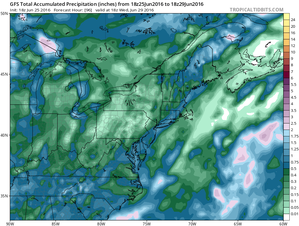
Looking at the GFS precipitation forecast through Tuesday, it does show a band of 1 inch plus rains however it should be noted that models have overproduced on almost every event in the last few months and this should be viewed with skepticism.
FiOS1 News Weather Forecast For Long Island
FiOS1 News Weather Forecast For New Jersey
FiOS1 News Weather Forecast For Hudson Valley
NATIONAL WEATHER SERVICE SNOW FORECASTS
LATEST JOESTRADAMUS ON THE LONG RANGE
Weather App

Don’t be without Meteorologist Joe Cioffi’s weather app. It is really a meteorologist app because you get my forecasts and my analysis and not some automated computer generated forecast based on the GFS model. This is why your app forecast changes every 6 hours. It is model driven with no human input at all. It gives you an icon, a temperature and no insight whatsoever.
It is a complete weather app to suit your forecast needs. All the weather information you need is right on your phone. Android or I-phone, use it to keep track of all the latest weather information and forecasts. This weather app is also free of advertising so you don’t have to worry about security issues with your device. An accurate forecast and no worries that your device is being compromised.
Use it in conjunction with my website and my facebook and twitter and you have complete weather coverage of all the latest weather and the long range outlook. The website has been redone and upgraded. Its easy to use and everything is archived so you can see how well Joe does or doesn’t do when it comes to forecasts and outlooks.
Just click on the google play button or the apple store button on the sidebar for my app which is on My Weather Concierge. Download the app for free. Subscribe to my forecasts on an ad free environment for just 99 cents a month.
Get my forecasts in the palm of your hand for less than the cost of a cup of Joe!

MENTION JOE CIOFFI AND GET A 5% DISCOUNT


