Paulette Rene Tropical Storm Development Continues 4 Names Left Before Greek Alphabet

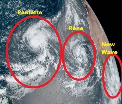
The tropics remain on fire and the Tropical Atlantic is front and center at the moment with two tropical storms way out to the east. Tropical Storm Paulette stands out on the satellite in the Central Atlantic. It has gotten a bit stronger overnight and the satellite signature actually looks rather impressive. Feeder bands sweep in from off the coast of South America northeastward into Paulette’s circulation.
5AM LOCATION…18.1N 42.8W
ABOUT 1250 MI…2010 KM W OF THE CABO VERDE ISLANDS
ABOUT 1330 MI…2140 KM E OF THE NORTHERN LEEWARD ISLANDS
MAXIMUM SUSTAINED WINDS…50 MPH…85 KM/H
PRESENT MOVEMENT…NW OR 325 DEGREES AT 6 MPH…9 KM/H
MINIMUM CENTRAL PRESSURE…1000 MB…29.53 INCHES

The National Hurricane Center forecast remains unchanged from yesterday. Southwest shear may get involved and keep Paulette from getting much stronger. A gradual turn to the west should occur and then back to northwest later in the forecast. Obviously here there is no threat to land and there is a lot of uncertainty in the future of any of the storms that form out here over the next 2 weeks. With so many systems spinning around weather models are having an extremely difficult time with these and we have see all sorts of radical changes from run to run. You can expect that to continue going forward. There are simply too many storms and too much noise to take anything very seriously at this stage.
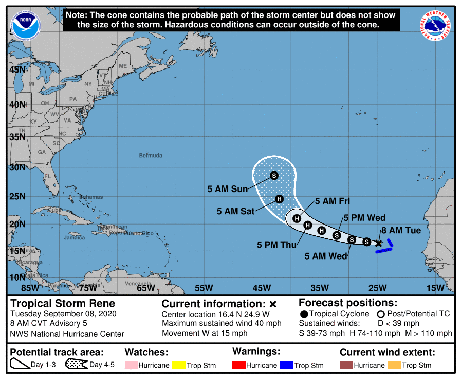
Tropical Storm Rene is right behind Paulette and it moving right over the Cabo Verde Islands today as it heads westward. Heavy rains and tropical storm force winds are occurring there. Once it clears the islands it should move west or west northwest and it is likely to recurve east of 45 degrees west.
5AM LOCATION…16.4N 24.9W
ABOUT 40 MI…65 KM SSE OF SANTO ANTAO CABO VERDE ISLANDS
MAXIMUM SUSTAINED WINDS…40 MPH…65 KM/H
PRESENT MOVEMENT…W OR 280 DEGREES AT 15 MPH…24 KM/H
MINIMUM CENTRAL PRESSURE…1001 MB…29.56 INCHES
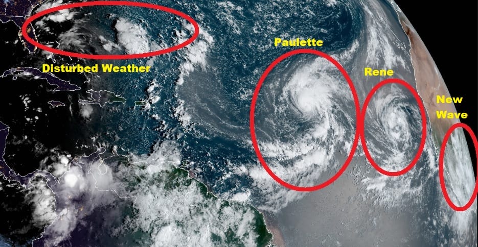
There are two more waves behind Rene and you can make out the lead one on the far right of the satellite picture above as it is moving westward across Africa. It will emerge south of the Cabo Verde Islands late Wednesday night or early Thursday. Conditions are favorable for this system to become a tropical depression or tropical storm as it moves westward.
SATELLITE

Meanwhile much closer to home we have disturbed weather off the Southeast coast of the US that extends eastward out into the Atlantic. High pressure is sitting east of New England and we have lower pressures and an onshore flow up and down the East Coast.
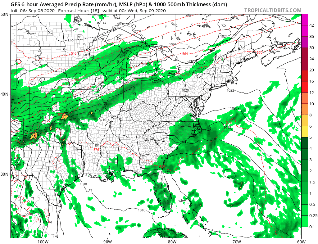
Hints of a developing low show up on various models overnight and the National Hurricance Center has a 40% chance of this developing into a tropical cyclone. Conditions are actually somewhat favorable for development with upper air winds diminishing along and off the Southeast coast over the next 48 hours so this is worth keeping an eye on.
WHAT HAPPENS WHEN WE RUN OUT OF NAMES?
Sally,Teddy,Vicky, Wilfred
These are the 4 remaining names before we run out. In 2005 we ran out of names and that is the only time that has happened (at least so far). When that occurs the National Hurricane Center switches to the Greek Alphabet and we start with Alpha, Beta, Gamma, Delta, Epsilon, Zeta, Eta, Theta, Iota, and so on. Brush up on it because there is a chance given how active things are that we could get there before September is done!
BE SURE TO DOWNLOAD THE FREE METEOROLOGIST JOE CIOFFI WEATHER APP &
ANGRY BEN’S FREE WEATHER APP “THE ANGRY WEATHERMAN!
MANY THANKS TO TROPICAL TIDBITS FOR THE USE OF MAPS
Please note that with regards to any severe weather, tropical storms, or hurricanes, should a storm be threatening, please consult your local National Weather Service office or your local government officials about what action you should be taking to protect life and property.


