Passover Easter Sunday Weekend Outlook
Passover Easter Sunday Weekend Outlook
With the weekend coming and the Passover/Easter Sunday holy days fast approaching, we seem to be on an up and down road as far as the weather is concerned. Right now we are basically fighting the battle of the warm front against the colder marine air that is covering the Northeast. Its always a struggle to bring those fronts northward so we can at least taste the 60s for a day or so. Offshore we have a gale center which sits in the upper right corner of the picture with its classic circular signature and broad center of low pressure. To the west lies a frontal boundary with heavy rains and some thunderstorms. We sit in between in lots of clouds with some patchy light rain drizzle and fog today.
US SATELLITE

REGIONAL RADAR

There isn’t too much going on from the standpoint of rain on the regional and local radars so far today. Observing stations are reporting some light rain or drizzle but most are just reporting overcast skies.
LOCAL RADAR NEW YORK CITY

LOCAL RADAR PHILADELPHIA


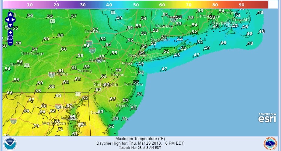
Temperatures today should reach the 50s..it may get closer to 60 in Southern New Jersey & Southeastern Pennsylvania while coastal areas that are impacted by an onshore wind will see their temperatures hold in the 40s to near 50. Some shower activity is possible tonight and then Thursday we watch to see how far north the warm front gets. Hiighs should reach the 50s everywhere and into the 60s Central & South Jersey southward.
THURSDAY’S FORECAST HIGH TEMPERATURES
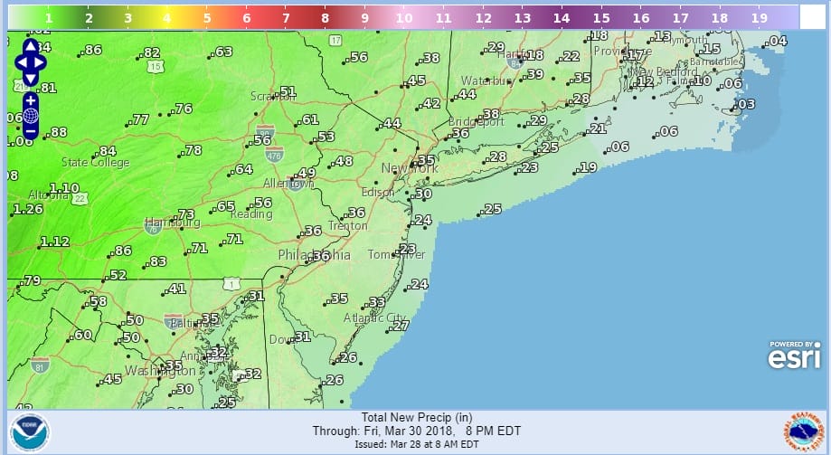
Thursday night into Friday morning a cold front comes through with some showers. While heavy rain is falling to the west of us today and Thursday, most of that will be going west and north so our rainfall amounts should be generally a half inch or less.
RAIN FORECAST THROUGH FRIDAY
Passover begins Friday night and we should see weather conditions improving Friday afternoon with some sun and temperatures in the 60s. Then comes the weekend which looks dry overall. Saturday we will see some sunshine with highs in the 50s.
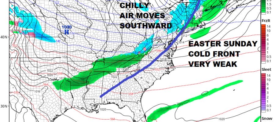
GFS EASTER SUNDAY 8AM FORECAST
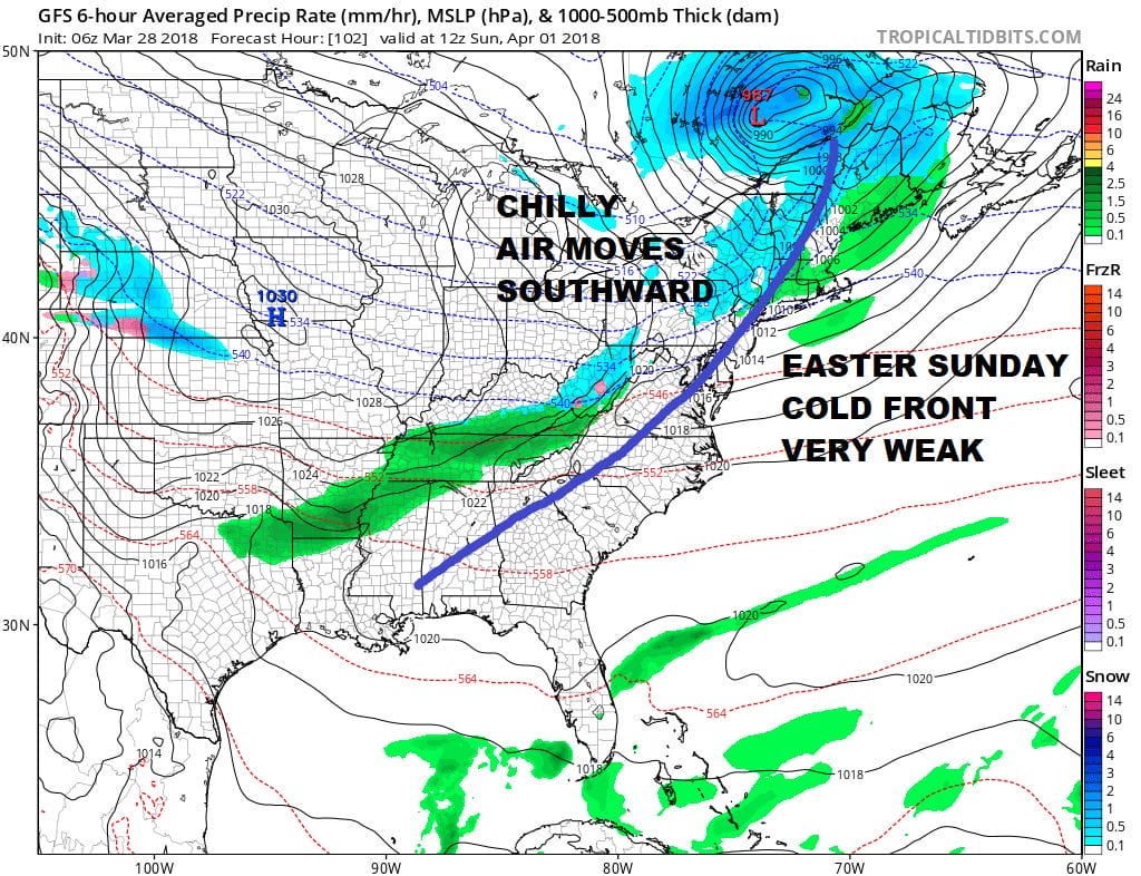
Another cold front arrives Easter Sunday morning but it should be weak with nothing more than clouds and maybe a passing shower. Otherwise Easter Sunday looks dry with some sunshine and highs in the 50s. No major storms are on the horizon as we head into next week.
 GET JOE A CIGAR IF YOU LIKE

FiOS1 News Weather Forecast For Long Island
FiOS1 News Weather Forecast For New Jersey
FiOS1 News Weather Forecast For Hudson Valley


