Onshore Flow Today Wednesday Showers Thunderstorms Late Friday

Onshore Flow Today Wednesday Showers Thunderstorms Late Friday
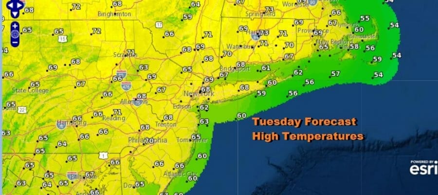
We are looking mostly good for the next several days. High pressure in New England is sliding to Nova Scotia. We are going to see the high sit there for a day or two before rebuilding to the south on Thursday. Until then we will likely see partly sunny skies over most of the area today. Temperatures are going to be a few degrees lower than yesterday with highs in the 60s along the immediate coast and mostly upper 60s and lower 70s inland. This is not an onshore flow set up that calls for doom and gloom weather here thankfully though there will be some clouds that developing tonight into Wednesday morning. Most lows will be in the 50s. The satellite shows clouds leftover from tropical moisture that moved up the East Coast yesterday. It did bring some rain overnight to parts of Southern New Jersey and points south but everyone else saw very little or nothing at all.
SATELLITE

WEATHER RADAR

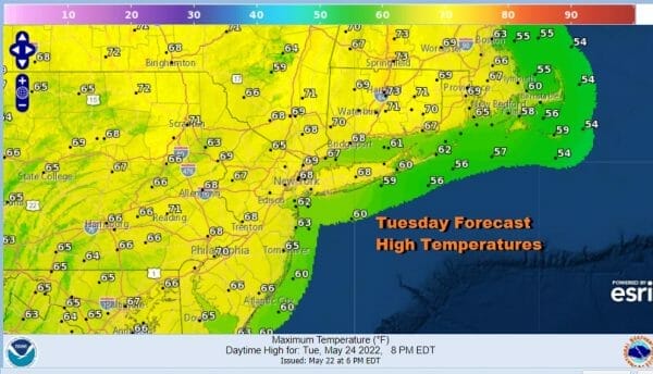
Moving on to Wednesday we are going to have clouds in the morning especially along the coast but then the sun should cut through them and we go to partly sunny skies in most places. The wind will still be off the ocean so highs will once again will be in the 60s along the coast and lower 70s inland.
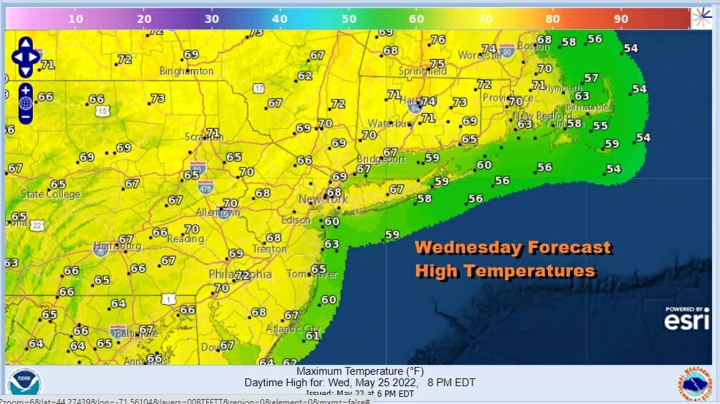
Thursday begins the change where the winds turn from east to south. That will bring in more moisture but not enough to cause big issues. I’m thinking we will see changeable skies with some breaks of sunshine. The south wind will allow things to warm up especially inland. Highs will be in the upper 60s and lower 70s coast and mostly 70s
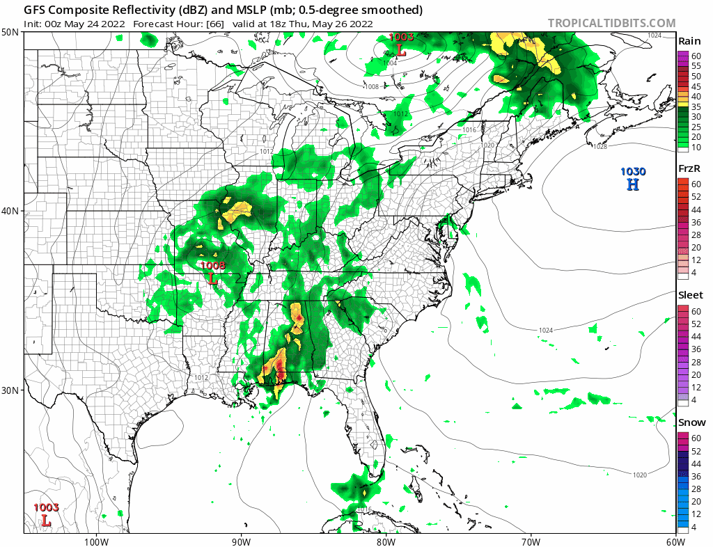
Friday we see a cold front approaching out of low pressure in the Ohio Valley. Models have been struggling on extremes with the European showing a straight forward cold front Friday followed by a nice warm mostly dry Memorial Day holiday weekend. The GFS implies that we will have showers and thunderstorms Friday, like the European and then the low tracks to the coast Saturday keeping us in clouds and occasional showers. The shower risk diminishes but not completely for Sunday and Monday. It seems that the two models overnight sort of split the difference where Saturday might be somewhat lost to some showers though not a whole day washout by any means with better weather Sunday. We will give it another day or so to settle out these differences before laying the final verdict on the holiday weekend. I’ve been optimistic about warm mainly sunny idea and right now that seems to be hanging by a thread.
BE SURE TO DOWNLOAD THE FREE METEOROLOGIST JOE CIOFFI WEATHER APP &
ANGRY BEN’S FREE WEATHER APP “THE ANGRY WEATHERMAN!
MANY THANKS TO TROPICAL TIDBITS & F5 WEATHER FOR THE USE OF MAPS
Please note that with regards to any severe weather, tropical storms, or hurricanes, should a storm be threatening, please consult your local National Weather Service office or your local government officials about what action you should be taking to protect life and property.


