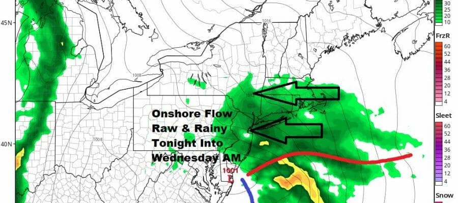
Onshore Flow Rain Tonight Into Wednesday Morning
Showers Thunderstorms Thursday

Onshore Flow Rain Tonight Into Wednesday Morning
Showers Thunderstorms Thursday
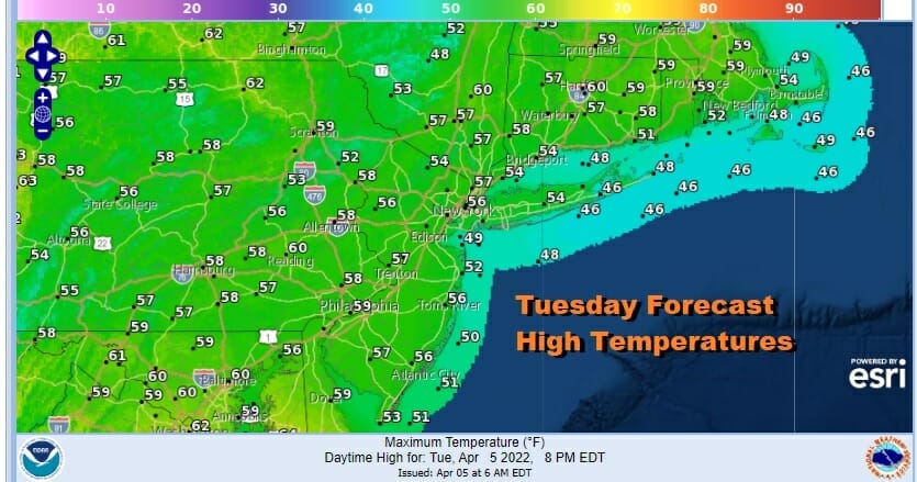
Our weather begins to slowly go down hill as high pressure moves offshore and low pressure in the Southern Plains moves east to the Carolinas. This low will cause severe weather across the South and Southeast today and Wednesday while north from the Mid Atlantic to Southern New England, it is the curse of the onshore flow and rain. Clouds are rolling in from the west on the satellite and we will throw in a developing southeast to east wind late today and tonight to provide an additional moisture feed. Temperatures today will be in the mid to upper 50s but once the rain develops and spreads northward, temperatures will fall into the 40s.
SATELLITE

WEATHER RADAR

Rain is still to the south only now developing across Northern Virginia and West Virginia. That rain area slowly spreads northward this afternoon and doesn’t reach Southern New Jersey until around 4 or 5 pm and NYC and Southern New England get into it late this evening between 7 and 10pm.
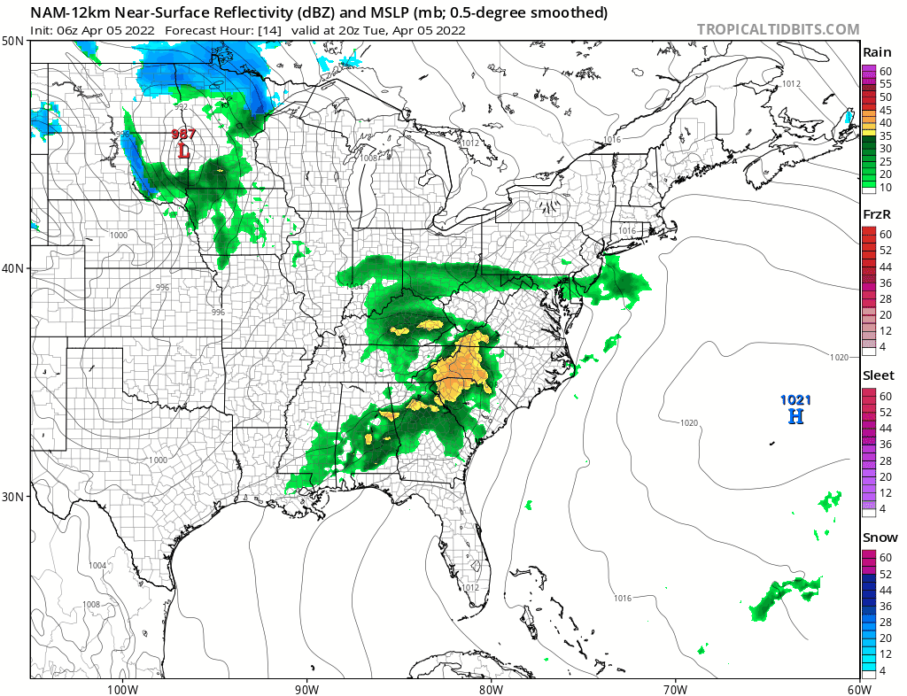
Wednesday morning the rain starts to pull away to the northeast and that will leave us in leftover clouds. Once the rain ends, we could see temperatures edge back to the 50s and some areas from Southern New Jersey and Southern Pennsylvania southward could reach the 60s. Note that right behind the coastal low is another storm heading for the Great Lakes and an approaching cold front for Thursday.
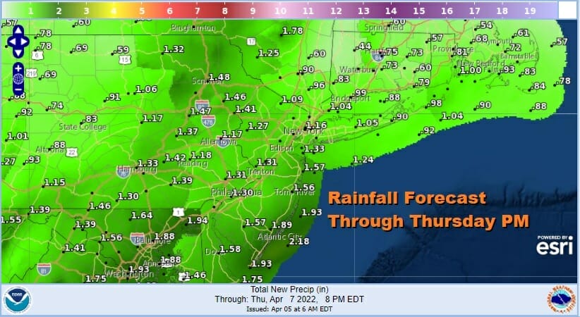
We will see some showers Thursday and the chance for a thunderstorm or two. For now the risk for severe weather is well to the south of our zone but the Storm Prediction Center might nudge up the marginal risk further north over the next day or two. The wind will have a bit of an ocean component to it being mostly southeast or south Thursday. That holds temperatures down somewhat. Highs will be in the 50s to near 60. Rainfall amounts over the next 3 days will total 1.25 to 1.75 inches spread out over 3 days.
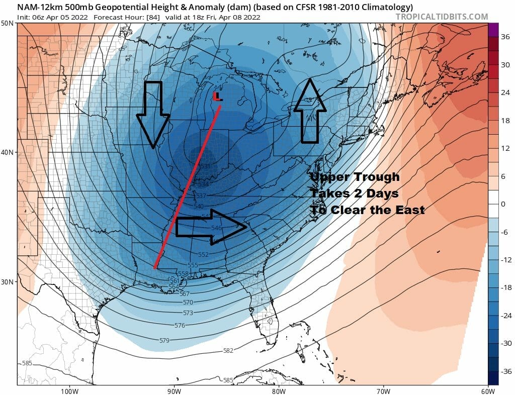
Normally we would see improving weather conditions after the cold front passes but unfortunately, the upper trough is strong and lags behind. It will take another 2 days to move out of the Eastern US which leaves us in cold unstable conditions aloft. Friday and Saturday we will see clouds with limited sunshine and the risk for scattered showers especailly in the afternoon and evening. Friday’s highs will be in the 60s and weekend highs will be in the 50s to near 60 degrees. Signs are pointing to a warm up for a few days next week.
BE SURE TO DOWNLOAD THE FREE METEOROLOGIST JOE CIOFFI WEATHER APP &
ANGRY BEN’S FREE WEATHER APP “THE ANGRY WEATHERMAN!
MANY THANKS TO TROPICAL TIDBITS & F5 WEATHER FOR THE USE OF MAPS
Please note that with regards to any severe weather, tropical storms, or hurricanes, should a storm be threatening, please consult your local National Weather Service office or your local government officials about what action you should be taking to protect life and property.


