Onshore Flow Brings Showers Late Wednesday Warm Thursday More Showers Friday

Weather in 5/Joe & Joe Weather Show Latest Podcast
Onshore Flow Brings Showers Late Wednesday Warm Thursday More Showers Friday
Look carefully on the satellite picture this morning and you can see the issue of a high to the east and even a weak onshore flow. Low clouds and fog developed in some areas overnight and those low clouds are hugging the coast. This is a thin layer of low clouds and it will burn off quickly to sunshine. Temperatures today should make the low to mid 60s. Along the coast temperatures will likely be 10 degrees cooler.
SATELLITE

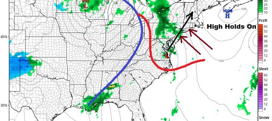
The high is going nowhere. In fact the onshore flow strengthens tonight so it will be back to low clouds and fog. Most lows will be in the 40s. Wednesday clouds are going be here all day. Along with the low clouds on the satellite this morning there is a swirl of clouds off the North Carolina coast.
To the west we have low pressure moving out of the Central Rockies today and heading into the Western Lakes with its own cold front. The swirl of clouds will move northward as does the dying occluded front and that could produce a few showers later Wednesday. Most highs will be in the 50s.
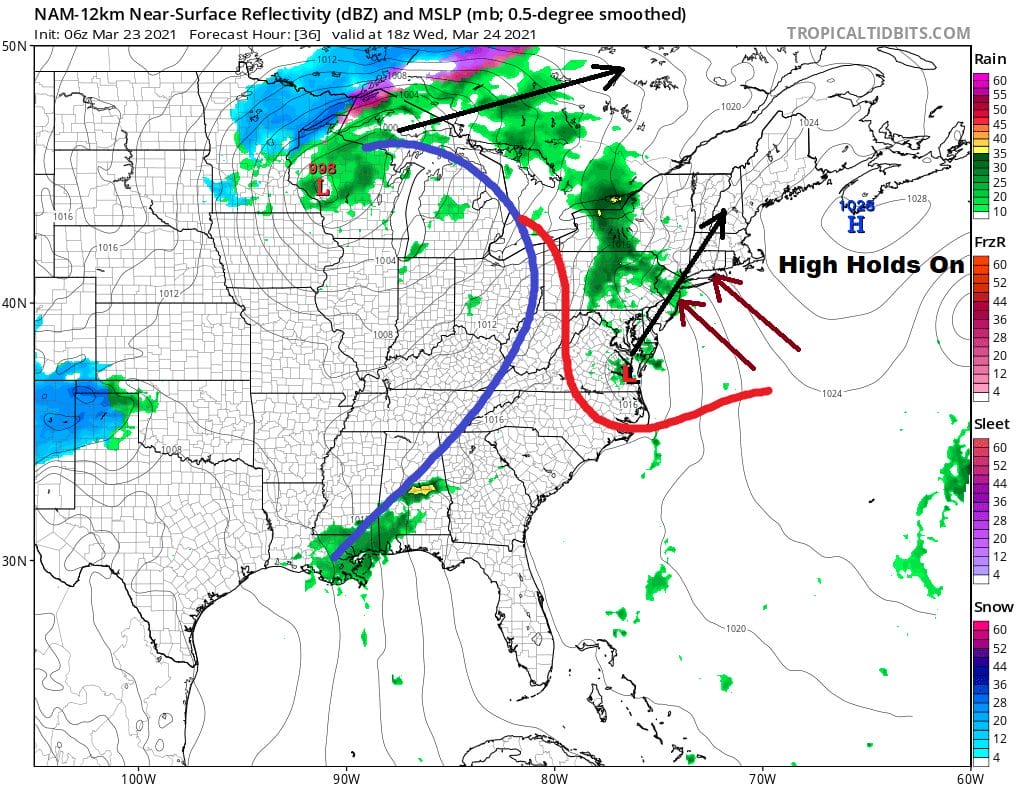
There is some upside to this and that comes Thursday. The high pulls away and the onshore flow shifts to a southwest flow. Clouds will give way to sunshine Thursday. A southwest wind means we will warm up nicely with highs reaching the low to mid 70s away from the ocean! A cold front will arrive late Thursday night or early Friday morning with a few showers.
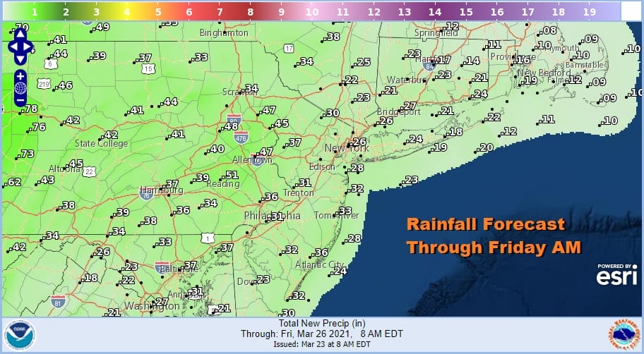
Wednesday and Friday’s system won’t produce much rain. Between the two we are looking at a quarter to half inch combined from both. It is enough to be annoying but not enough to be useful to keep soil moisture levels high.
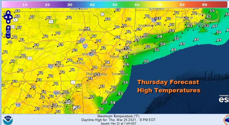
Weather conditions will improve on Friday with clouds giving way to sunshine. Initially there will be leftover warm air around Friday so highs will certainly be in the 70s. Then we see temperatures lowering on Saturday with some sunshine. Highs Saturday will be in the 60s.
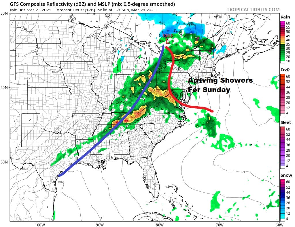
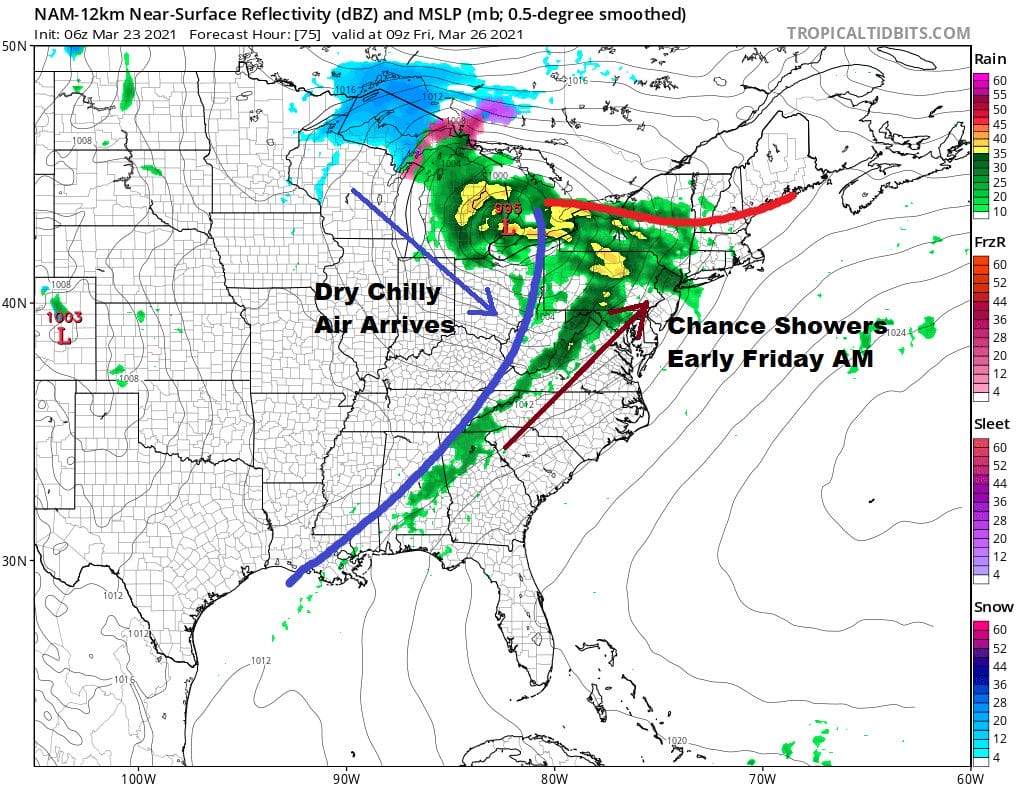
The next weather system which is low pressure heading across the Great Lakes and Northeast will bring showers Sunday/ This front will have a little punch to it so there could be some heavier downpours and maybe even a thunderstorm late Sunday into Sunday night. Dry weather follows next Monday.
BE SURE TO DOWNLOAD THE FREE METEOROLOGIST JOE CIOFFI WEATHER APP &
ANGRY BEN’S FREE WEATHER APP “THE ANGRY WEATHERMAN!
MANY THANKS TO TROPICAL TIDBITS FOR THE USE OF MAPS
Please note that with regards to any severe weather, tropical storms, or hurricanes, should a storm be threatening, please consult your local National Weather Service office or your local government officials about what action you should be taking to protect life and property.


