Ocean Effect Snow As Coastal Carolina Storm Moves Northward
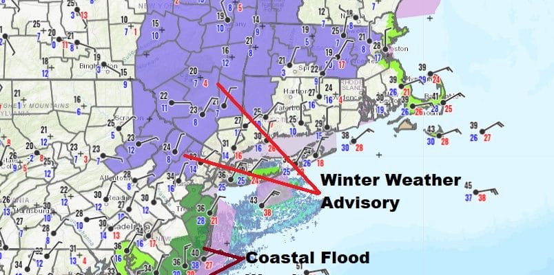
Winter Weather Advisory Northwest New Jersey,
Hudson Valley Orange Sullivan Counties Northward
It was a rather nice surprise to wake up to some ocean effect snow going on this morning over parts of Long Island and Coastal New jersey. That was a bit unexpected but the cold high to the north is strong and so is the northerly wind. Temperatures across NY State and New England are in the single digits and teens. Add a little bit of an easterly component to the wind over the relatively warm ocean waters and you get some nice flakes flying around on a cold Sunday morning.
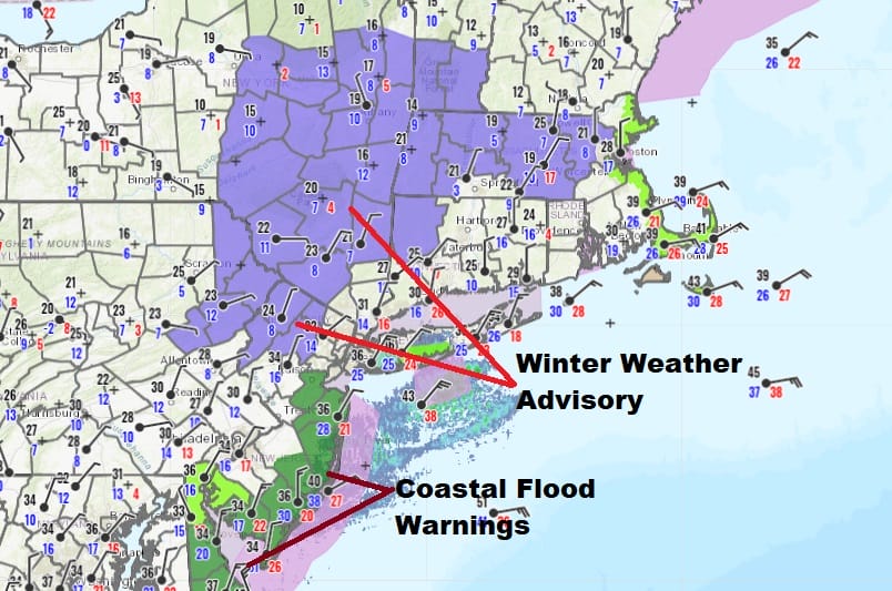
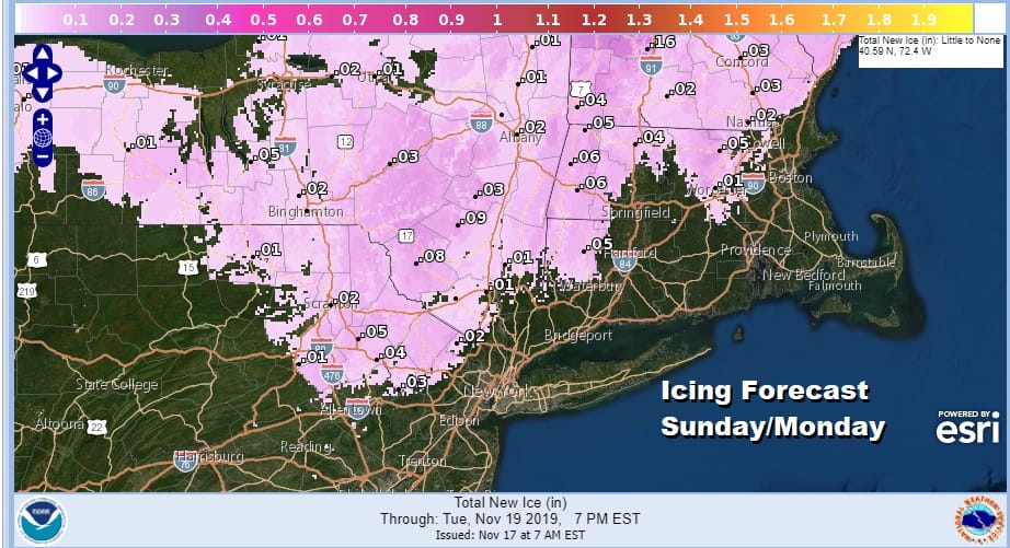
Winter Weather Advisory is now posted for tonight for Northeast Pennsylvania, North West New Jersey mainly north of Route 80, Catskills and Lower Hudson Valley west of the Hudson northward to north of I-90. All this cold air inland is going to be rather difficult to scour out especially with the low tracking well offshore. This could create some icing issues tonight and on Monday in some areas due to freezing rain or freezing drizzle. .01 to ,05 inches of ice is being forecast for most.
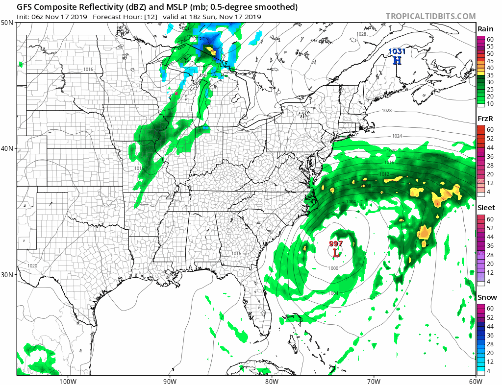
Meanwhile this morning clouds from the coastal storm area pushing northward and you can see the well defined signature of the storm offshore the North Carolina coast. To the north skies are still either clear or some high clouds are starting to arrive. Clouds will be increasing as the day wears on.
SATELLITE

REGIONAL RADAR

There is no steady precipitation on the regional radar at the moment however on the local NYC/Long Island & Phliadelphia/NJ radar you can actually see the ocean effect snow on it moving west or northwestward inland. It is like Buffalo in reverse though clearly on a much smaller scale.
LOCAL RADAR NEW YORK CITY

LOCAL RADAR PHILADELPHIA


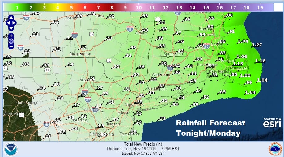
The rest of the day will be cloudy raw and cold as temperatures will be holding in the 30s to some lower 40s. Inland highs especially in valleys may not get above freezing today. Watch for the possibility of a little drizzle or freezing drizzle to develop later today. Tonight as the low moves northward we throw in the chance for some rain developing along the coast to Southern and Southeastern New England. North and west of the coast in the Winter Weather Advisory zone some freezing rain is possible though it is forecast to be on the light side since forecast liquid amounts of rain remain low.
Our storm is also creating issues with tidal flooding and Coastal Flood Warnings are posted for New jersey and a Coastal Flood Watch later today for Long Island. This storm will track offshore and pass east of New Jersey and Long Island later Monday but it has a rather large circulation to it that is actually going to grow in size in the next 24 hours or so.
The back edge of the rain sharply cuts off just inland of the coast. This will continue into Monday and Monday evening with some on and off mostly light rain possible with highs just barely into the 40s and areas in the Hudson Valley where we have Winter Weather Advisories up will have a tough time struggling out of the 30s or even above freezing in some areas. We should see genuine improvement here on Tuesday with some returning sun but it will be cold with most highs just in the 40s at best.
BE SURE TO DOWNLOAD THE FREE METEOROLOGIST JOE CIOFFI WEATHER APP &
ANGRY BEN’S FREE WEATHER APP “THE ANGRY WEATHERMAN!
MANY THANKS TO TROPICAL TIDBITS FOR THE USE OF MAPS
Please note that with regards to any severe weather, tropical storms, or hurricanes, should a storm be threatening, please consult your local National Weather Service office or your local government officials about what action you should be taking to protect life and property.


