WEATHER MODELS SHOW NOREASTER NEXT WEEKEND BUT STILL LONG ON DETAILS
The probability of a noreaster, or a strong coastal storm, or what every you want to call it, is growing on weather models. In fact it is pretty safe to say at this point that while we are still long on the specific details, the idea of some sort of important storm development is growing more likely. The origins of the low that is forecast to develop in the Gulf of Mexico will stem from the remnants of Hurricane Willa which is headed for the Mexican coast in the next several days. You can actually trace the remnants into the Gulf of Mexico where a non tropical wave will absorb the moisture and begin its march eastwast late this week and then up the coast next weekend.

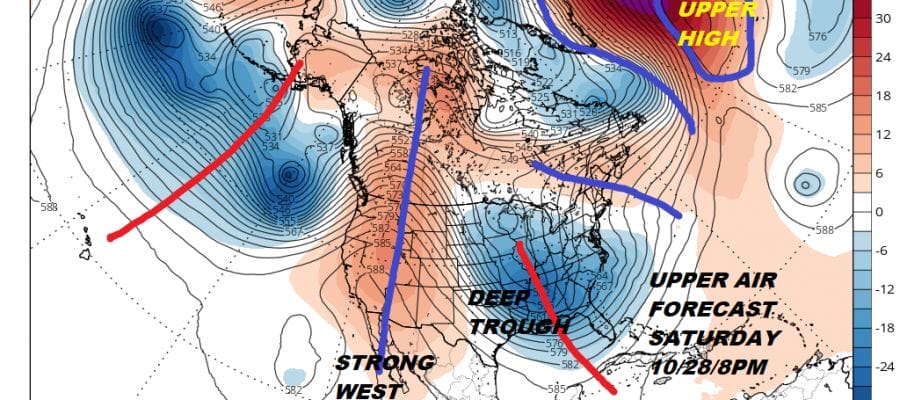
All of this is in response to a complex deep trough comprised of two piece. The short wave trough in the Southeast and a diving system into the Ohio Valley which lifts the southern trough northward energizing a surface low in the process. All the models have it and we have been watching shifts east and west from run to run.
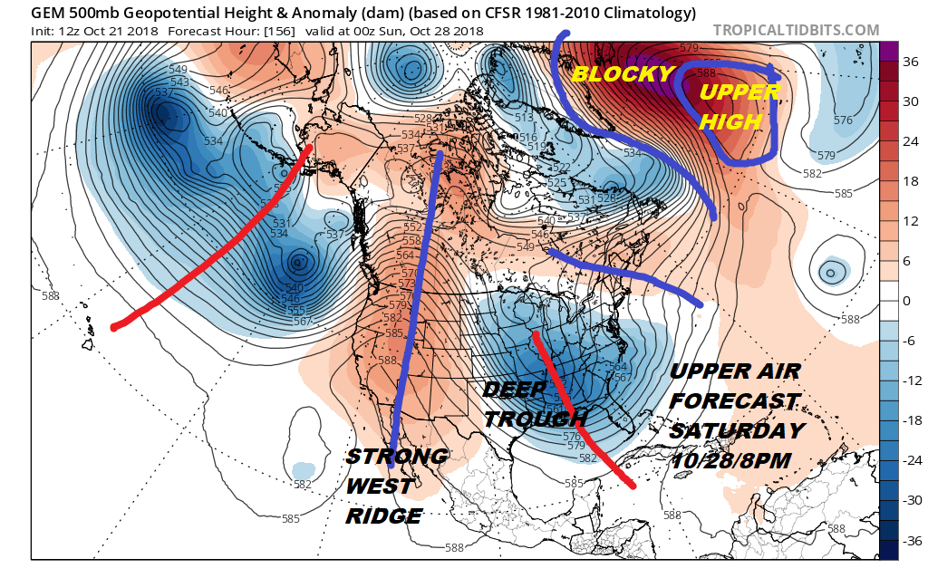
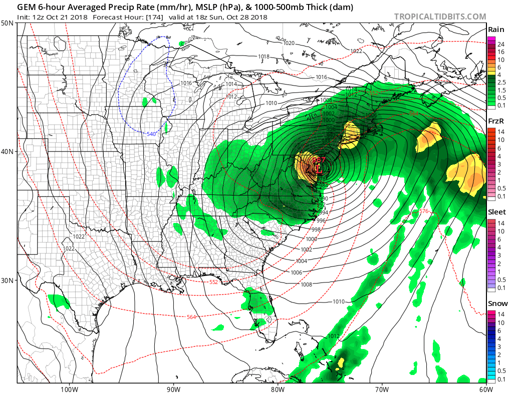
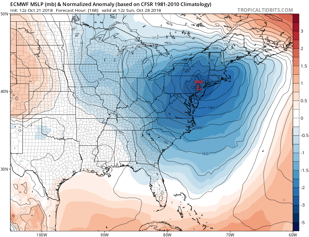
Today’s Canadian model has made the most radical change in the last 12 hours and has come in closer to the GFS model idea. In fact the Canadian is ultra aggressive with an intense coastal low moving northward into Chesapeake Bay a week from today.
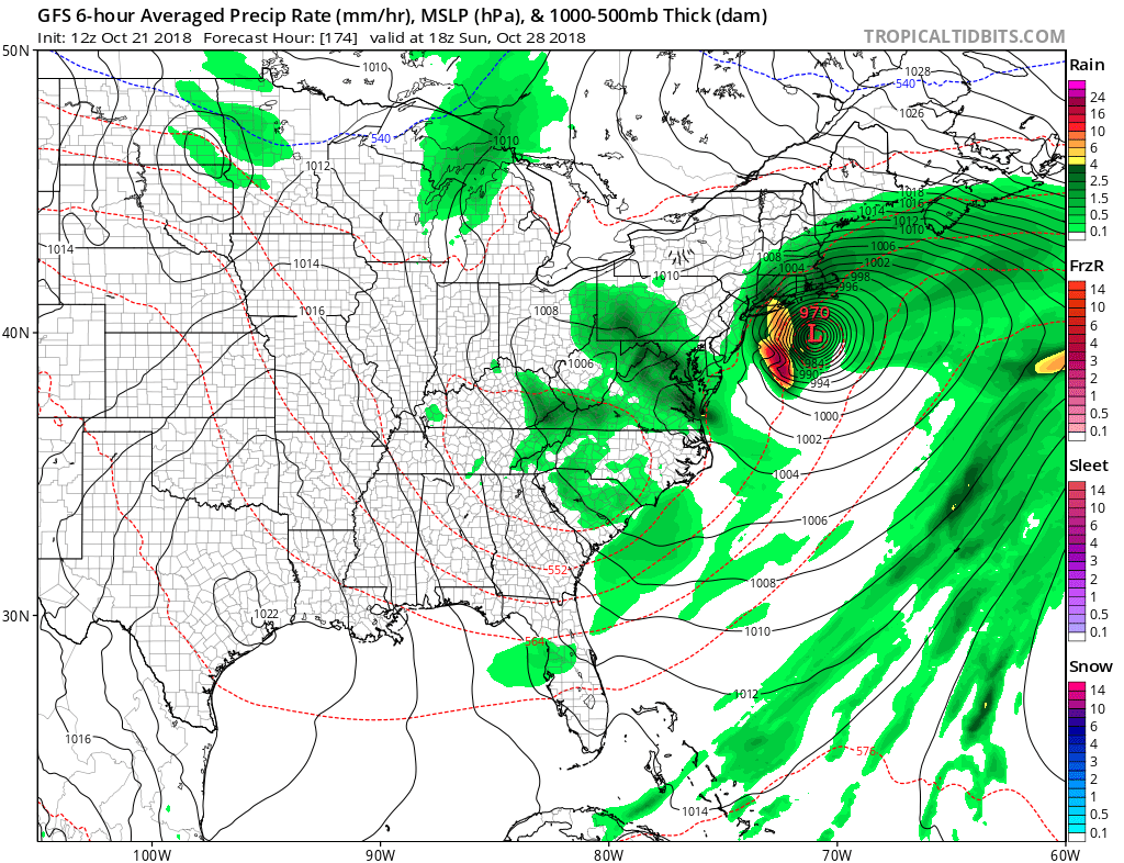
The GFS is deep with its surface low but because of timing differences with the upper air has it further to the east. Anytime you have a strong blocking or in this case “blocky” pattern, weather models struggle with the details even more so than usual. We seem to be trending now toward the stormier noreaster solution for next weekend as models continue to consolidate closer to each other.
The European has a much weaker solution as it keeps everything separate and rather squashed. It suggests that while it will be wet with rain, it doesn’t have the system developing into anything out of the ordinary. It seems to be still out there regarding development.
Overall some models seem to be growing in confidence of a major storm developing next weekend along the east coast for next weekend and we support this idea. By the way for you snow lovers looking at this and thinking snow…think again. It ain’t happening.
SUBSCRIBE TO PATREON FOR A WEATHER EXPERIENCE FREE OF ADS, EXCLUSIVE VIDEOS FOR MEMBERS ONLY AND MUCH MORE…STARTS AT $2 A MONTH..MESSAGE ME AT ANY TIME

MANY THANKS TO TROPICAL TIDBITS FOR THE USE OF MAPS
Please note that with regards to any tropical storms or hurricanes, should a storm be threatening, please consult your local National Weather Service office or your local government officials about what action you should be taking to protect life and property.
LATEST JOESTRADAMUS ON THE LONG RANGE