
Regardless of track We will experience very strong noreaster conditions here that will mean gale warnings, coastal flooding possibilites, beach erosion and at least some rain though how much will depend on where this ultimately winds up. We discussed last night the GFS and Canadian models and their tracks taking the storm inland in coastal Virginia north to Chesapeake Bay. The early morning GFS model update was actually a little further south with the landfall and further west with the ultimate track. Let me lay out a scenario for what happens between now and Saturday
 This is going to happen no matter what happens to Hurricane Joaquin and is probably the best case scenario assuming any track that either takes the hurricane offshore (which seems to be the less likely road right now) to a track with landfall well south of Southern New Jersey. At least this will give you an idea of what to expect relative to any possible landfall position along the east coast. If we adjust landfalls further north than these conditions are likely to be worse..If the track is further east and offshore it won’t matter because we still will experience noreaster conditions. First off beginning late Thursday as the map shows above the pressure gradient ( difference between high pressure to the north and low pressure to the south relative to distance) tightens. This means wind and there will be gales along the coast beginning Thursday night and continuing into the weekend.

You can see through Saturday afternoon the gradient is still tight. 3 days of a northeast to east fetch means piling of water through at least 6 high tide cycles which means we are going to see tides running at least a couple of feet above normal. Please check my marine forecast page and the tide widgets. The will tell you the tide height and they are interactive so you can check for your own local area.
Next issue through Saturday will be rainfall. This is a bit trickier because there will be a fine line between where the northern extent of the rain is. The models may go back and forth on this. Also as the hurricane begins its northward push, at least intially there could be some drying on Saturday from the north as everything in the atmosphere gets drawn southward toward the hurricane. Ultimately it comes back northward and this is just to point out that it is not going to be raining all the time during the next 3 days.

This is Sunday morning on the GFS. Again the emphasis here for our area right now should be on Noreaster conditions regardless of track..and models are likely to continue changing over the next couple of days though I believe the spread of what we are seeing will narrow.
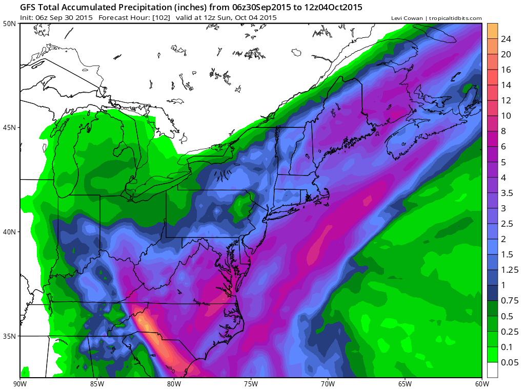
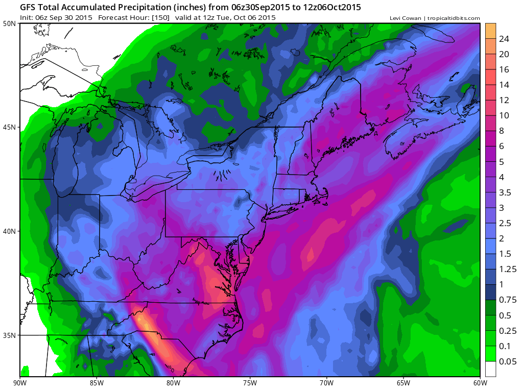
Rainfall maps. The top one is from Today into Sunday morning. The second is from today through Tuesday. The shift southward of the heaviest rain reflects the track shift to the west and south of this model run.
More changes and adjustments are coming ahead. It is important to pay close attention to forecasts from here on in. For specific forecasts download my weather app and subscribe to my forecasts. The app is free and the subscription is just 99 cents a month. The app is free from web ads and there are no security or tracking issues.


