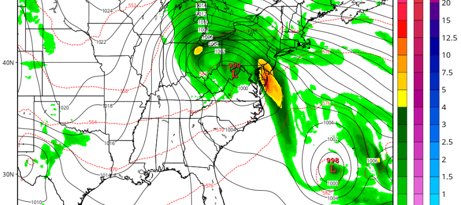
Regardless of what Tropical Storm Joaquim does or doesn’t do, the set up of huge high pressure to the north and low pressure to the south off the Carolinas will mean a tight pressure gradient, a strong easterly fetch of moisture, heavy rains, and gale force winds along the coast with coastal flooding which would be typical noreaster conditions. This is given regardless of whether there is a tropical system in the equation or not. If there is a tropical system, the equation changes and we are no closer today then we were yesterday with models literally all over the place with this.
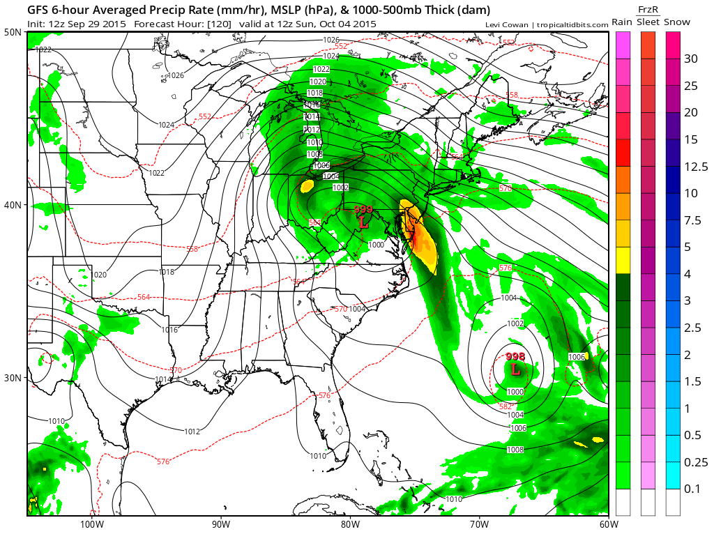
Take the GFS for instance which really has Tropical Storm Joaquim out well to the east by Sunday morning. A separate low forms along the coast in response to the upper dynamics and brings rain and wind into Sunday morning for much of the Mid-Atlantic and Southern New England. The tropical storm never really becomes a factor as it stays basically offshore. To me the model looks utterly lost.
On the other extreme this afternoon we have that fabulous Canadian run which has a Category 3 hurricane going into Delaware Bay from the southeast which would obviously be a really serious hurricane hit if this were right. It intensifies Tropical Storm Joaquim rapidly into a hurricane and moves it north and then northwest.
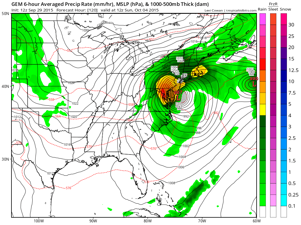
The problem with this solution is something we spoke about earlier and that is that up until now every tropical storm has fallen apart thanks to shear. Could this happen? Sure it could. Is it a definite bet against at this point. Absolutely until proven otherwise. Now of course we have the European which takes Tropical Storm Joaquim west southwestward into the Bahamas and it is further southwest than any other model by Friday. In fact the block on the European is so strong that the rain gets suppressed to the south on Sunday!!!!
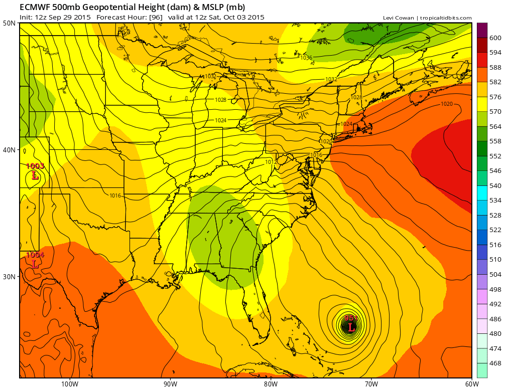
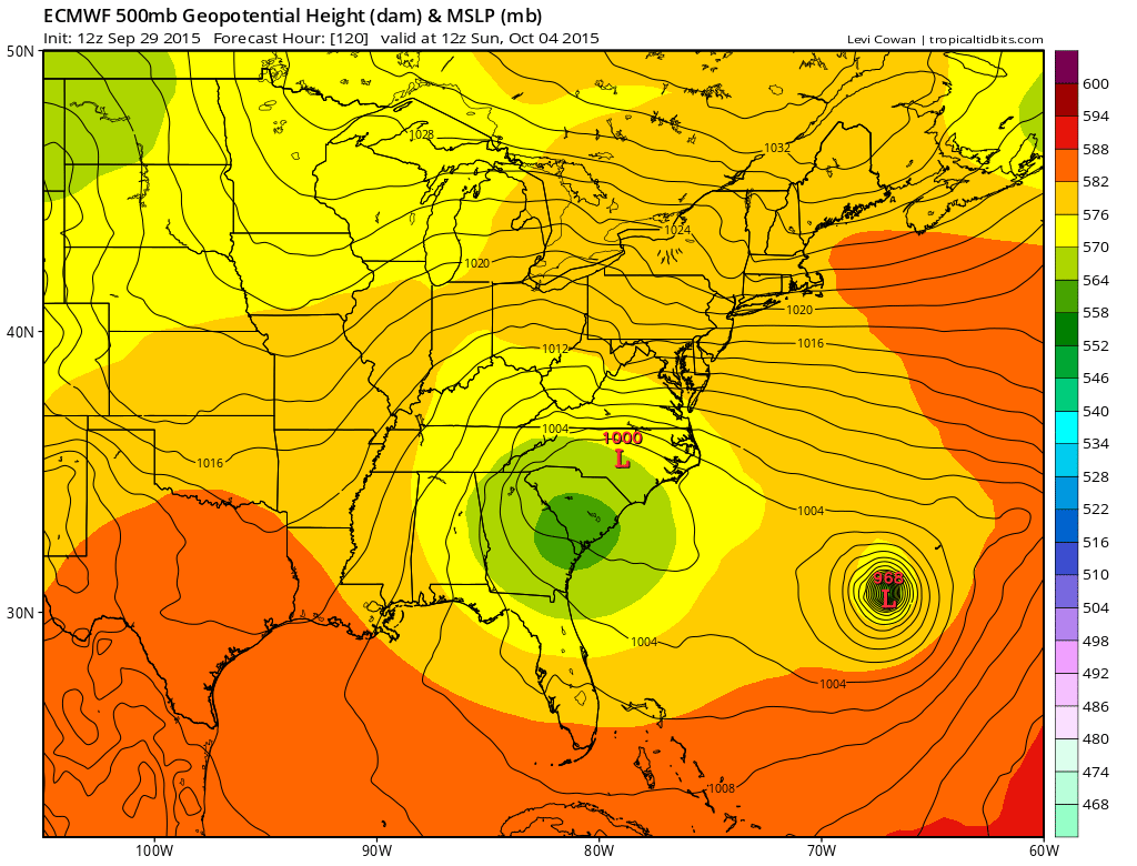
Of course if you want to accept the European you have to accept the idea that there will be a Category 3 or 4 hurricane in the Bahamas! In a year where you cant even get a tropical storm to hold for a day or so???
Here are my thoughts. I continue to believe that this will remain a weaker system until proven otherwise. Until we see a significant strengthening trend established it is very hard for me to buy the notion of a major hurricane. I also believe that the shallow weaker solution would mean noreaster conditions and rain here for Friday into Sunday. The bottom line is that we are absolutely no closer to figuring this out as this is about as challenging a forecast problem I have seen in a long long time.
Be sure to download my weather app and subscribe to my forecasts. The download is free and the subscription is 99 cents a month for an advertiser free environment with no security issues and no tracking issues.


