No Major Changes Heat Goes On Sunday Through Tuesday
Looking at the weather maps today we see no major changes in the weather going forward. The humidity is up. We will be adding heat to it on Sunday. Throw in the chance for a pop up shower or thunderstorm and you have those long August days of heat and humidity. Nights will be warm and humid. Some patchy fog will develop in cool spots and along coastal areas. It is a rather straight forward outlook heading into next week. We are going to throw in some 90 degree plus days beginning on Sunday.
SATELLITE

REGIONAL RADAR

Regional and local radars are showing some scattered downpours and thunderstorms popping up and there will be a few around going into the evening. Then after sunset they die off. The vast majority of you won’t see any. There is always the outside chance for an isolated severe thunderstorm popping up but for the most part they should come and go rather quickly.
LOCAL RADAR NEW YORK CITY

LOCAL RADAR PHILADELPHIA 

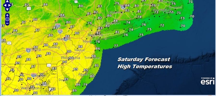
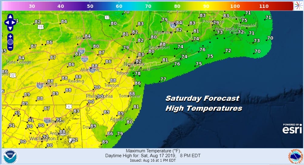
Saturday will be a very warm humid day. Winds have been from the east which have helped hold the temperatures down but we will start to lose that as winds go to the south and eventually to the southwest. Highs will be a bit higher on Saturday than today with low to mid 80s from Southern New England into Northern New Jersey and Long Island but from Southern New Jersey and Southeastern Pennsylvania southward it will reach the upper 80s to near 90.
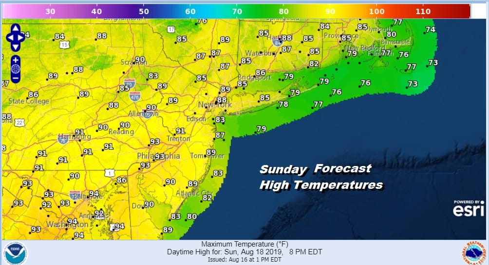
Sunday we add some more 90s to the mix and bring the cooler areas from NYC North and East into the upper 80s to near 90 degrees. Again there is the chance for a pop up scattered thunderstorm but no widespread activity is forecast. The rest of the time it is a mix of sun and clouds followed by a very warm humid night.
Monday we take up another notch for everyone with most highs reaching the upper 80s to lower 90s with high humidity and the chance for a pop up downpour or a thunderstorm. Otherwise it will be sunshine and clouds for the rest of the day with very high humidity.

Two weak fronts approach with the first one late Tuesday. It will be another hot humid day ahead of it with some sunshine but we will watch for some late day thunderstorms. Another front follows on Wednesday with another shower or thunderstorm. Some humidity relief should follow the second front for late next week. The tropics remain quiet and we don’t see much happening in the next 5 days.
MANY THANKS TO TROPICAL TIDBITS FOR THE USE OF MAPS
Please note that with regards to any tropical storms or hurricanes, should a storm be threatening, please consult your local National Weather Service office or your local government officials about what action you should be taking to protect life and property.


