Nice Quiet Chilly Friday Saturday Western Major Storm Heads East Sunday Monday
The day after Thanksgiving Day and the big holiday shopping day is here and with it comes sunshine with fewer clouds than yesterday. it is still a bit on the breezy side today and there is a chill in the air with highs just in the low to mid 40s but it is a decent day of weather with nothing to worry about radar wise. Tonight will be a little colder and clear with still a bit of a breeze. That should keep temperatures uniform with lows in the 20s to near 30. The satellite is showing the western edge of the blocking storm to the east while we some clouds are streaming southeast across the Great Lakes but nothing is showing up in lake effect land upstate.
SATELLITE

REGIONAL RADAR

Let’s get the weekend underway. Saturday is obviously the better of the two weekend days. Sunshine will give way to arriving late day clouds. Highs will be in the upper 30s to lower 40s. Then clouds thicken up Saturday night setting us up for round one of this major winter storm which is currently creating havoc everywhere west of the Mississippi River.
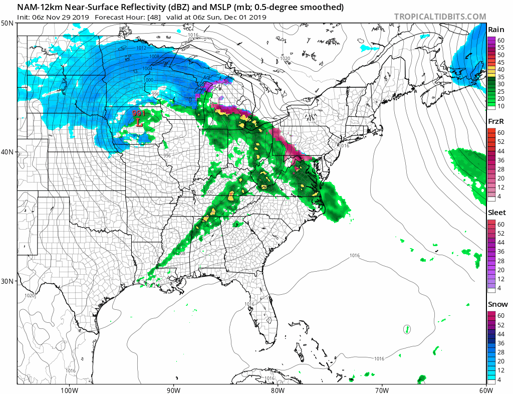
This storm is going to play out in 2 parts. The first part is Sunday and it hinges on how cold the lower atmosphere is. We have the primary low moving the across the Southern Great Lakes Sunday and weakening rapidly with a secondary low developing along the New Jersey coast. This brings an arm of precipitation eastward that develops quickly Sunday morning around or just after daybreak. The atmosphere will be cold enough to support snow/sleet/freezing rain and then we see a change to sleet and rain that gets to just north and west of NYC by Sunday evening. Sunday night we will see snow in the Hudson Valley north of 287 and Connecticut north and west if I-95 and it may actually come to an end during the early morning hours. Then we wait for round 2 that arrives during the day on Monday.
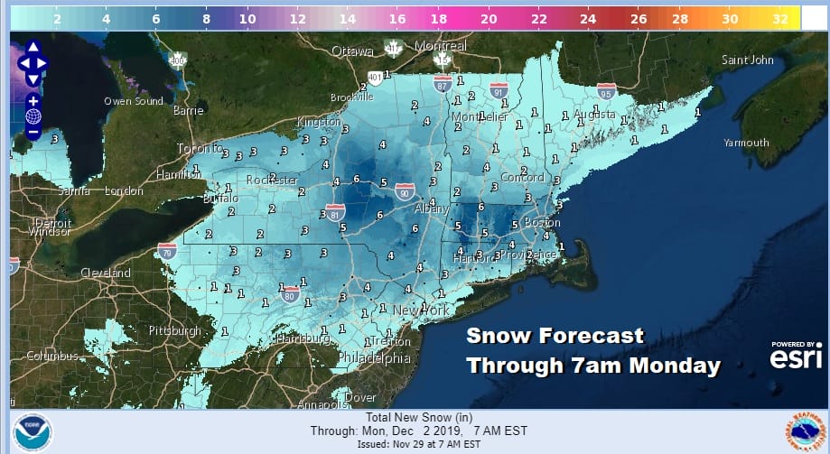
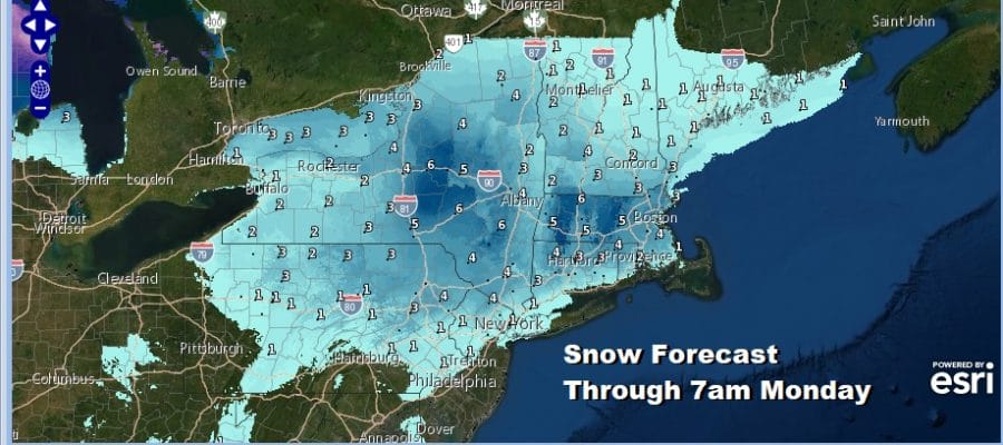
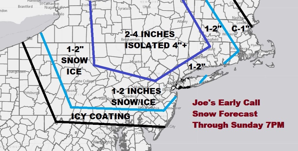
This is the National Weather Service snow forecast map THROUGH MONDAY MORNING 7AM which takes into account round 1 but DOES NOT INCLUDE ROUND 2. My early call snow forecast map issued yesterday shows numbers slightly beefier as i am counting on a colder atmosphere at least initially. However it does match up fairly well to consensus out there at the moment.
Precipitation will start up again Monday morning as round 2 gets underway and the coastal storm intensifies some and also slows down to a crawl offshore. Cold air should collapse southeastward and rain changes to snow everywhere by midday and lasts into Monday night. The amount of uncertainty here is large as you are looking for a lot of things to happen here as the low sits offshore.
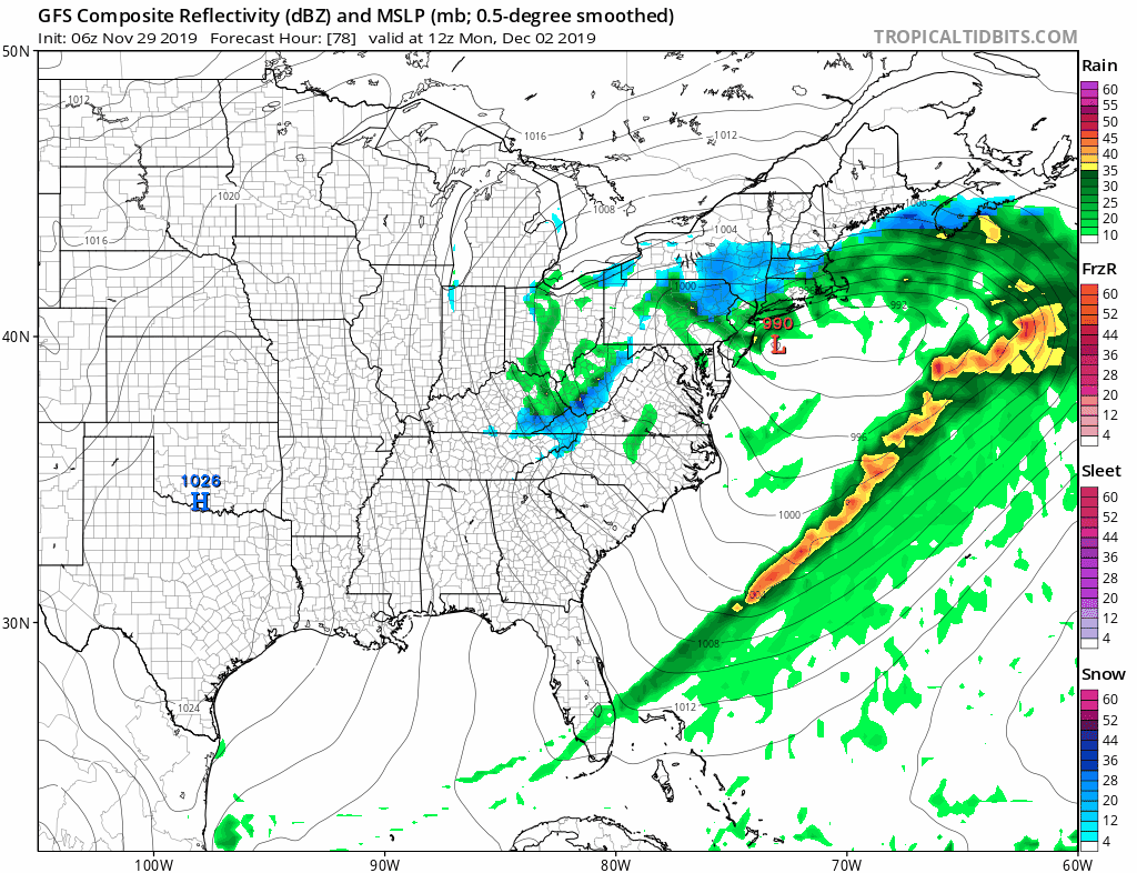
Round 2 could at least produce the same amounts as round 1 and in some cases higher amounts. The southern edge of Round to could make it as far south as Route 195 in New Jersey judging from the way models are tracking this low which is basically from Atlantic City east northeastward. We are going to wait until later today to attempt an early call on the second round for Monday. The low to the southeast does finally move away and everything comes to an end Monday night. Weather conditions should improve on Tuesday.
BE SURE TO DOWNLOAD THE FREE METEOROLOGIST JOE CIOFFI WEATHER APP &
ANGRY BEN’S FREE WEATHER APP “THE ANGRY WEATHERMAN!
MANY THANKS TO TROPICAL TIDBITS FOR THE USE OF MAPS
Please note that with regards to any severe weather, tropical storms, or hurricanes, should a storm be threatening, please consult your local National Weather Service office or your local government officials about what action you should be taking to protect life and property.


