
New York Weather: Rain For Tuesday
We are enjoying a nice dry day today with sunshine but there are high clouds to the south as we are beginning to see moisture from a system in the south creeping northward. This is a non tropical low pressure system that is developing and it is not related to Tropical Storm Kate which is sitting east of the Bahamas

You can see the 2 features separately on the satellite loop. Tropical Storm Kate which has become better organized this morning and is skimming the eastern islands of the Bahamas. The non tropical low is spreading moisture northward and the moition on the loop shows the tropical storm is being drawn northward into what will be the warm sector of the developing low to the west.

Radar is quiet right now here but a solid area of rain is pushing northward into the Middle Atlantic States. No rain should get here until the early morning hours; first in Southern New Jersey and probably around daybreak in northern areas. Rain should be with us for Tuesday though weather forecasting models greatly differ on the how much part of this equation. The coastal low that forms will move northeast but the support aloft for this is not all that impressive so there is an argument that could be made where the rain area decreases in coverage as it moves northeast. The Nam weather forecasting model this morning holds together a pretty solid area of rain for the area.
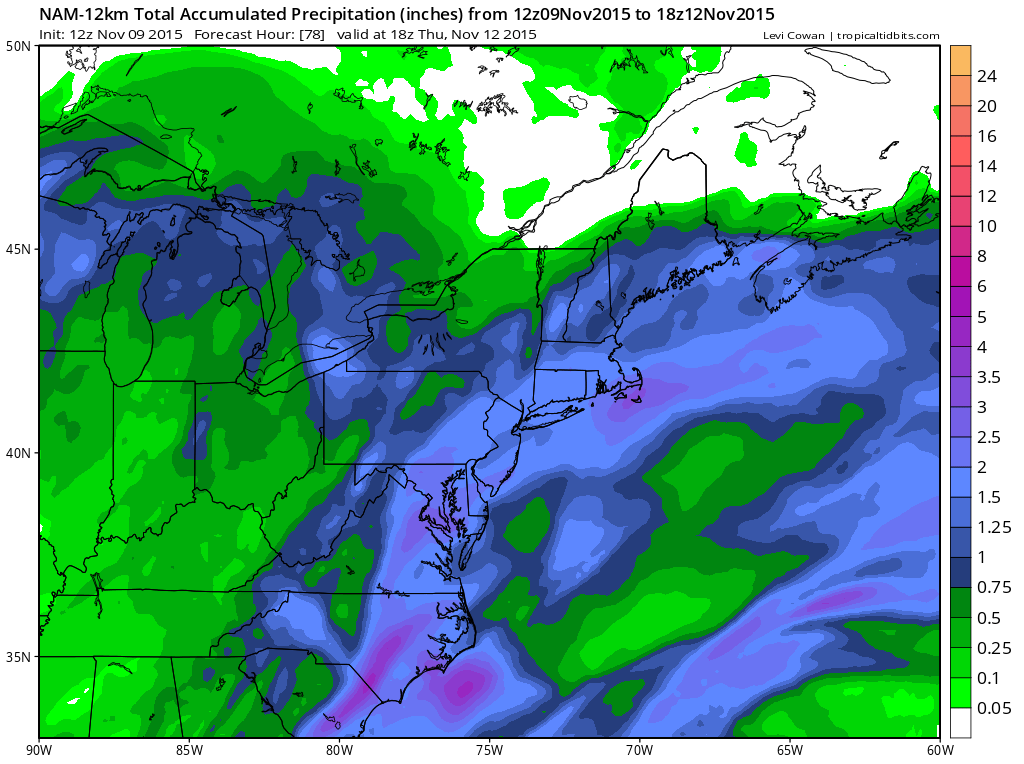
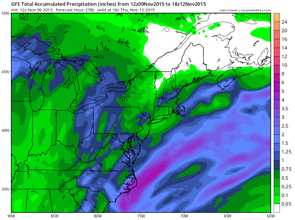
The main difference in the weather forecasting models is that the GFS creates a bit of a hole over New York and New Jersey with higher amounts inland and this could be due to the gfs putting more emphasis on an offshore coastal low that is further east while the nam weather forecasting model has a low much further west.

In either case it looks like some rain is going to occur Tuesday and it should be on the order of around a half inch to some amounts up to an inch. The moisture from Tropical Storm Kate will not get involved with this until the storm eventually gets absorbed by the non tropical system somewhere east of Cape Cod on Wednesday.
Wednesday we should dry out with some sunshine. Then another cold front approaches later Thursday with some some showers and temperatures back into the 60s before it turns a little colder again on Friday.
THE LATEST ON TROPICAL STORM KATE


